12/22/2025, 12:43 pm EST

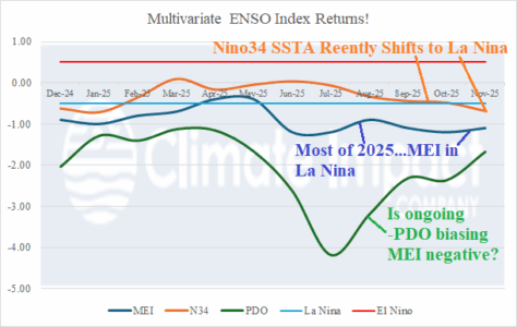
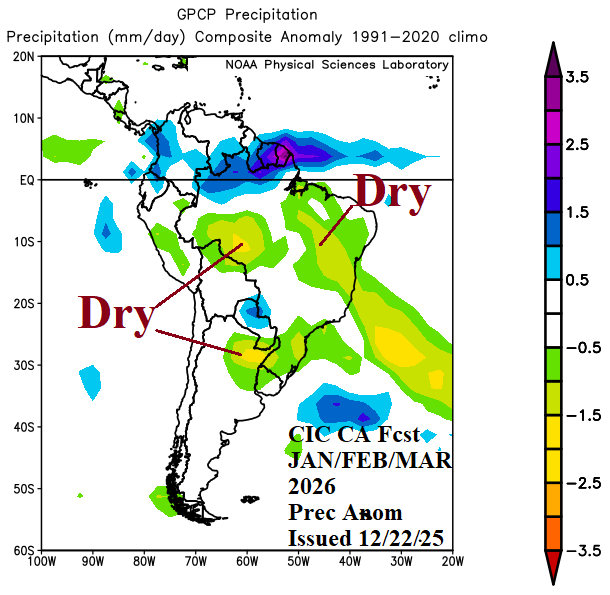
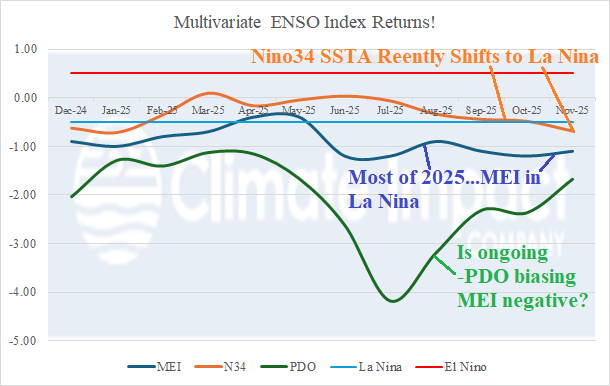
The Climate Impact Company month 1-4 climate outlook for South America valid for January through April is updated. The constructed analog forecast is based primarily on lingering La Nina climate through Q1/2026 coupled with unusually warm SSTA off the West Coast. A trend toward El Nino could initiate as early as April.