02/22/2026, 1:26 pm EST
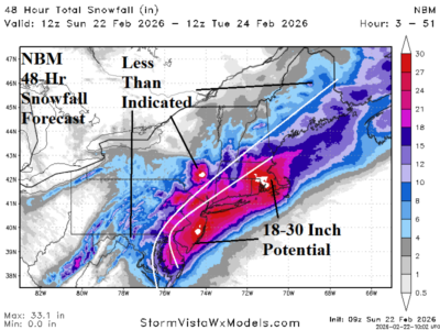
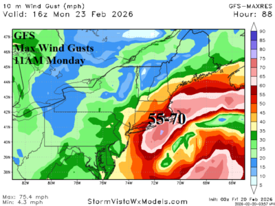
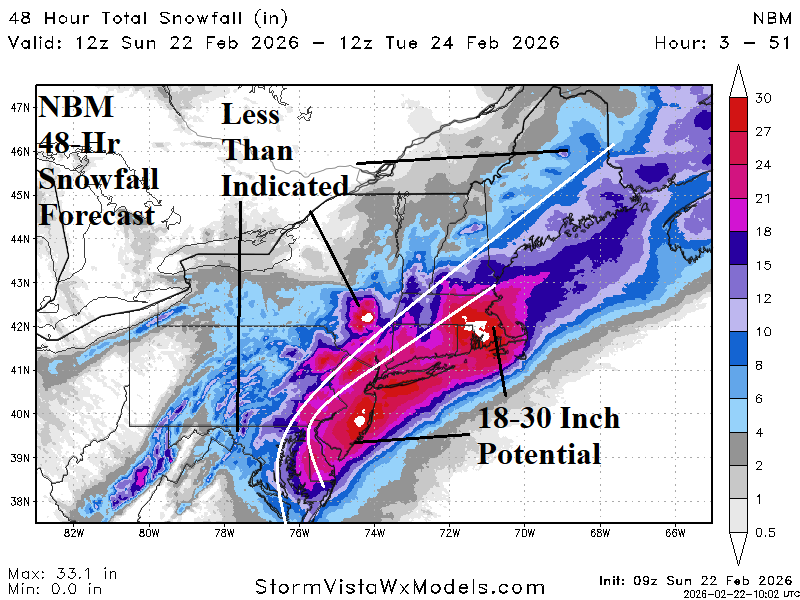
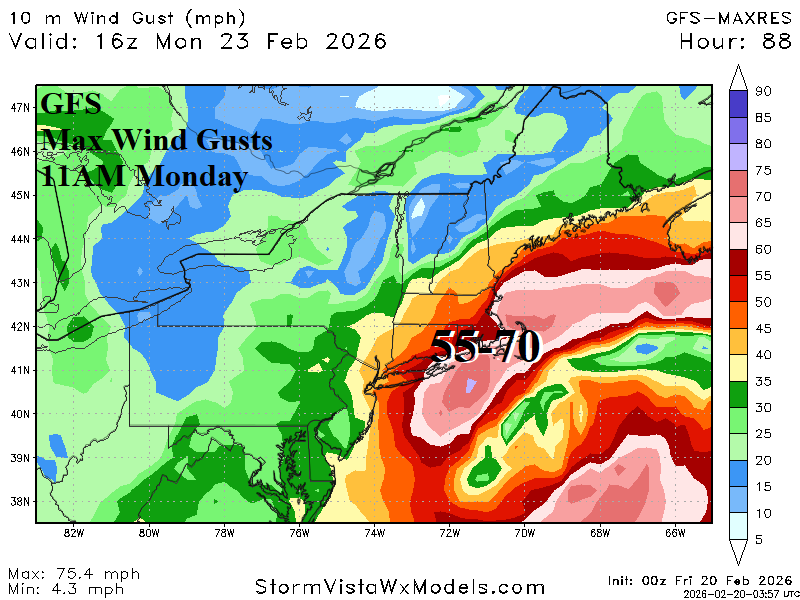
Focus is on the Northeast Corridor blizzard, the first widespread blizzard since January 2022. Blizzard Warnings extend from the Mid-Atlantic Coast to east and south portions of New England. The culprit is a coastal storm developing east-southeast of Norfolk, VA early this afternoon drifting slowly northeastward as a “bomb cyclone” with a central pressure near 970 MB south of Nantucket tomorrow at dawn.
