03/15/2026, 9:39 am EDT
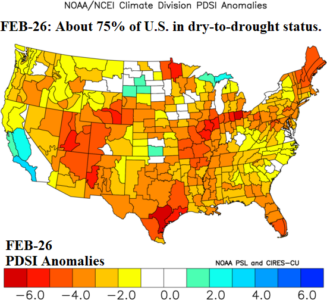
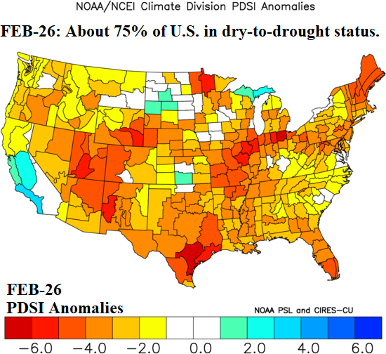
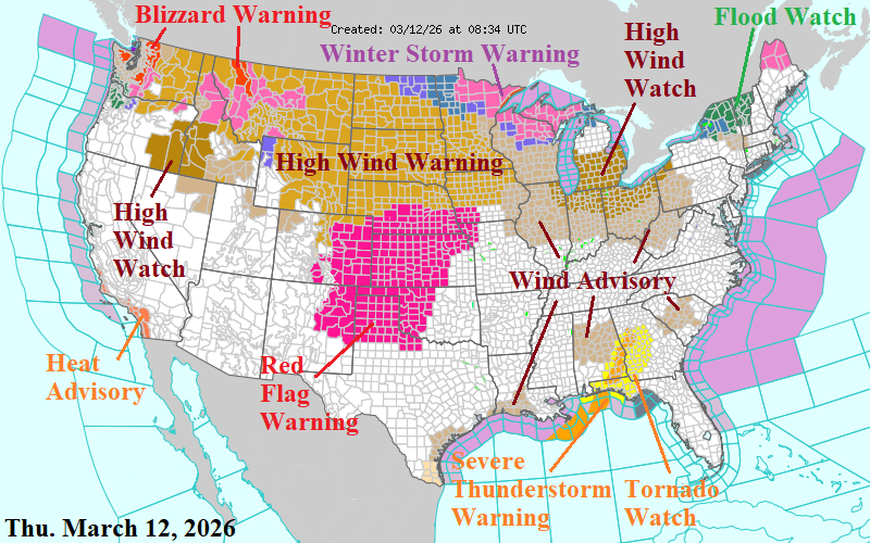
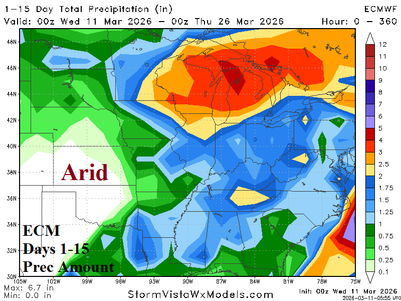
About 75% of the U.S. is in a dry-to-drought soil moisture condition as meteorological spring arrives. Combining the month of February during 2000, 2012, and 2025 yields a similar Palmer drought severity index (PDSI) regime to FEB-26.

