07/31/2025, 6:36 am EDT
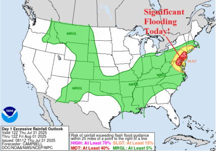
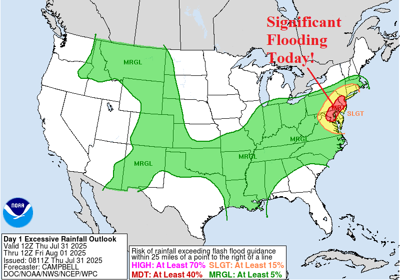
In the Mid-Atlantic region, a Flood Watch is issued for excessive rainfall and severe storm threat for today. In high population centers of Washington, Baltimore, and Philadelphia dangerous flash flooding is possible late today/tonight!
