06/07/2026, 9:42 am EDT
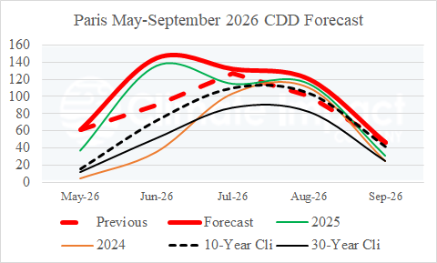
The May 2026 CDD at Heathrow and Paris were prohibitively warm! A whopping 61 CDD was observed in Paris due to a record (May) heat spike compared to 12 and 15 30-year/10-year climatology. The June 2026 CDD forecast for both Heathrow and Paris remain hot with strong increases in CDD count from the previous (May) forecast. Note that May, June, and July (Paris) are hotter (CDD) forecasts than last year’s totals.

