09/04/2025, 5:03 am EDT

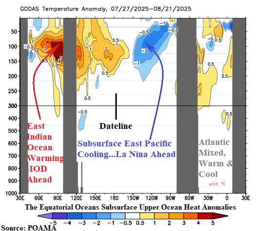
The subsurface equatorial upper ocean heat profile foreshadows phase change of various modes of climate variability. In the Indian Ocean, the eastern portion of the equatorial region has warmed significantly (Fig. 1). Implied is evolution of a potentially strong negative phase of the Indian Ocean dipole (-IOD). The daily IOD index is robust -1.04. The -IOD regime has arrived. In the equatorial Pacific, the eastern portion has cooled significantly. Implied is an approaching La Nina episode.
