01/08/2026, 3:48 pm EST
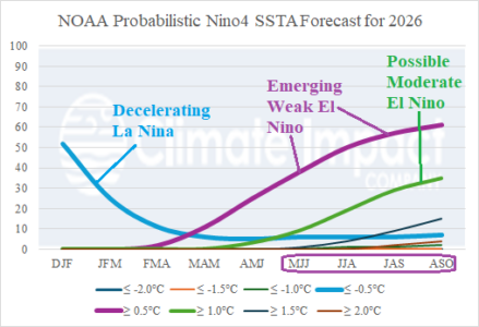
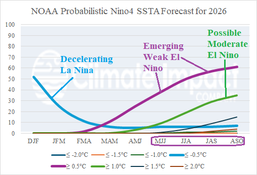
The equatorial subsurface East Pacific has warmed significantly and oceanic La Nina demise is ahead for late winter. La Nina climate is likely to last longer, lasting until mid-to-late spring. We’re entering the “springtime prediction barrier” for ENSO forecasts. Recent research has revealed that already low skill of ENSO forecasts made at this time of year has worsened.