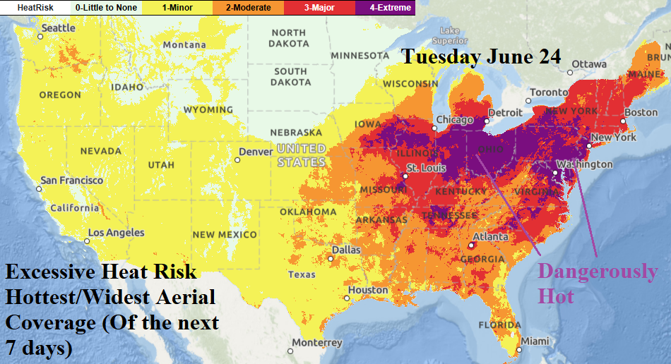
The hottest day in the 7-day NOAA/NWS excessive heat forecast is next Tuesday when the Ohio Valley, including the Chicago area, eastward through the Mid-Atlantic encounters widespread dangerously hot conditions.
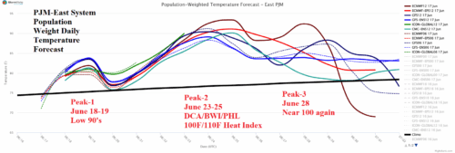
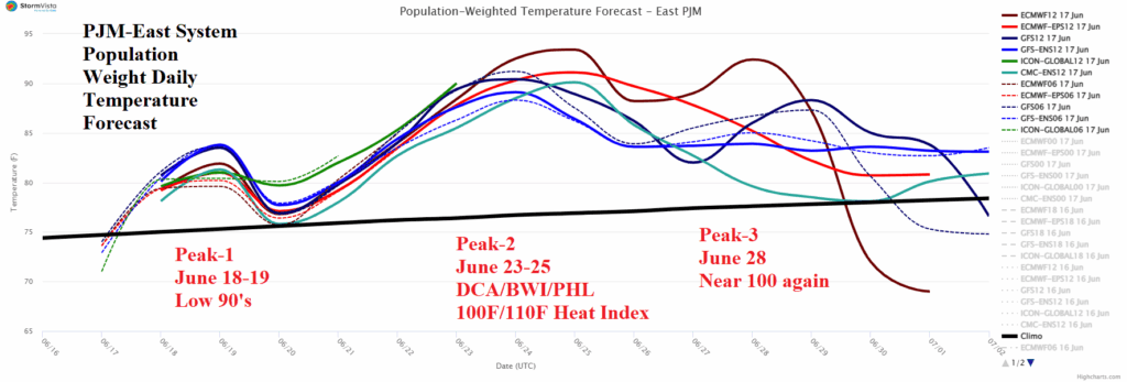
Incoming excessive heat event for PJM misses ERCOT. In the PJM-East sector the primary peak is June 23-25. During this time, forecast models agree on near the 100F risk for the DCA/BWI/PHL stretch and NYC/BDL/BOS will be close. Making this heatwave unique is the extreme humidity and therefore heat index. Heat indices routinely flirt with 110F in this type of heat.
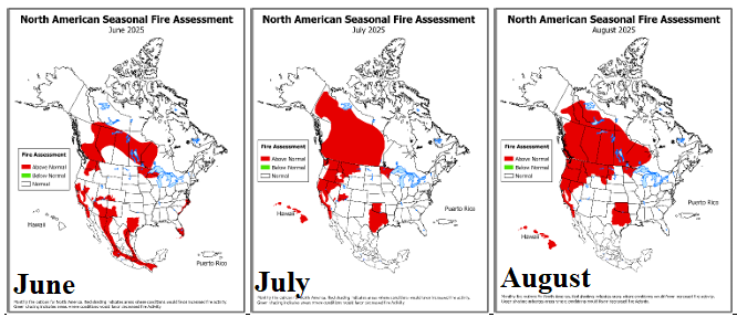
NOAA/CPC has updated their monthly fire risk outlook for Canada, the U.S., and Mexico. The outlook continues to indicate a major westward expansion of fire risk in Canada for mid-to-late summer, steadily widening risk in the Northwest U.S. gradually reaching California while diminishing in Mexico and increasing in Texas.
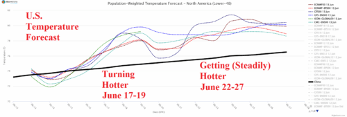
The U.S. national temperature is suppressed near normal for a few days primarily due to East U.S. rains. However, as the wet belt lifts northward during the medium range, hotter weather emerges, especially in high population areas of the East causing the national temperature surge somewhat warmer than normal.

