01/13/2026, 4:07 am EST
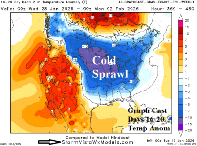
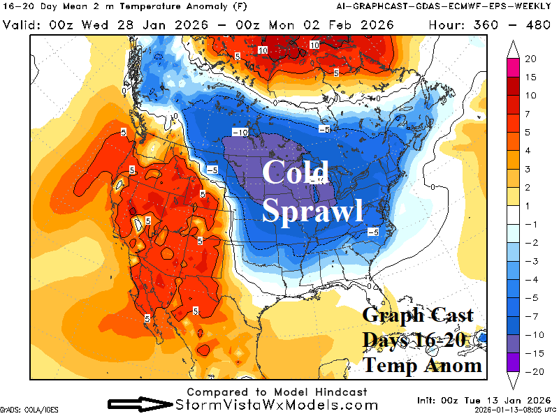
The 15-day AO outlook strengthens the negative phase. The projected JAN-26 value is near -2.0 rivaled most recently by JAN-21 (-2.4) and JAN-10 (-2.6). Right now, arctic air mass stretches across Eurasia. During the 6-10-day period, the 500 MB anomaly outlook projects a “ridge bridge” over Alaska. The upper ridge causes a cross-polar low-level air mass trajectory taking arctic air from Russia into North America.

