01/24/2026, 10:02 am EST
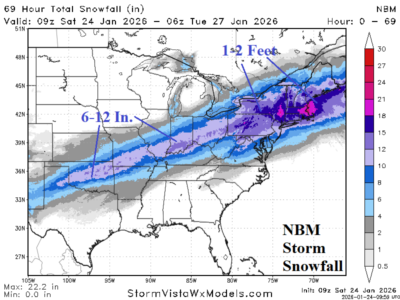
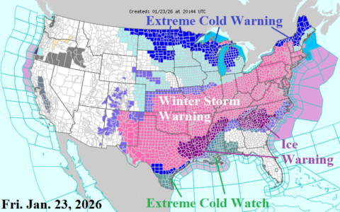
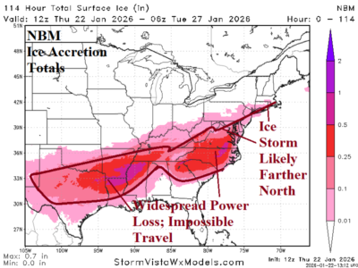
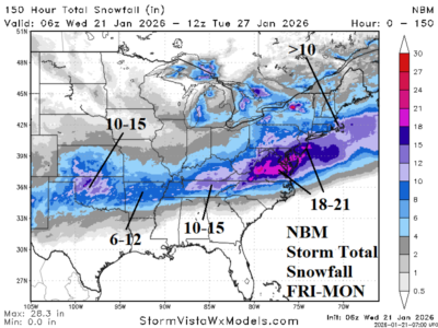
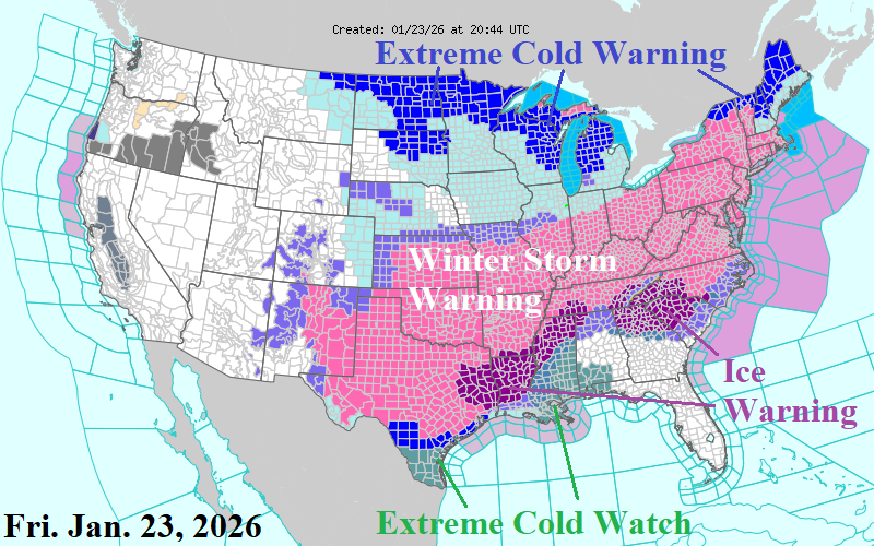
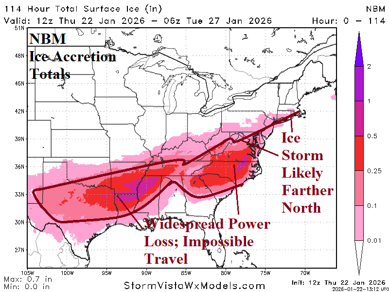
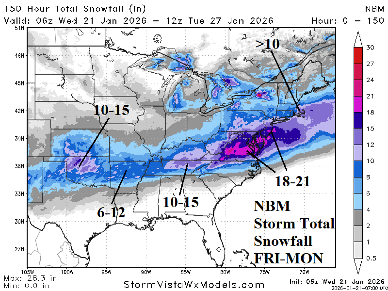
Winter Storm Warnings have reached the Atlantic Coast and extend westward across Texas and the Southern Great Plains. Ice Storm Warnings remain in effect from East Texas to Tennessee and Northern Georgia across the western half of South Carolina and Southwestern North Carolina.