Significant Ice Accretion Forecast Edging Northward for Weekend Storm Especially Mid-Atlantic
01/22/2026, 9:56 am EST
Massive U.S. Storm Developing, Widespread Hazards Central and East U.S. Ahead!
01/24/2026, 10:02 am EST![]()
Climate Impact Company Daily Feature
Issued: Friday, January 23, 2026
Highlight: Storm update and long-duration cold.
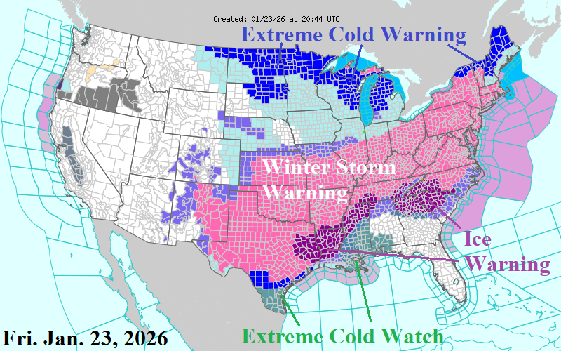
Fig. 1: The NOAA/NWS weather watch, warning, and advisory areas.
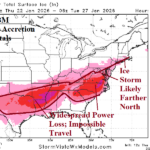
Discussion: By late Friday afternoon, Winter Storm Warnings expanded south to the Houston area and eastward to the Atlantic Seaboard (Fig. 1). Initial focus zones for severe icing are East Texas, the northern 2/3 of Louisiana, southern Arkansas, and northern Mississippi plus northern Georgia and the western half of South Carolina. The latest NBM snowfall total for the weekend storm indicates 8-15 inches of snow across the southern Great Plains northeastward to the Ohio Valley and 10-20 inches well inland the coast of the northern Mid-Atlantic and New England States (Fig. 2). In these zones, high wind will cause fluffy snow character to create large drifts. Additionally, Blizzard Warnings are likely to generate in some locations due to near zero visibility. The heavy snow across the southern Winter Storm Warning areas has a snow/sleet consistency with higher water content. Power outages due to “weighty” snow on power lines and tree limbs is likely in these areas. The NBM ice accretion totals indicate 4 areas of major ice accretion. Amounts >0.5 inches for each area indicate widespread power loss and impossible travel (Fig. 3). The widespread heavy snow will hold the cold most impressively across PJM-East and SERC in the latest 15-day forecasts (Fig. 4-5). ERCOT chill eases with a possible second cold event later next week (Fig. 6). Earlier, the Climate Impact Company week 2-4 outlook regenerated cold in the East possibly backing westward to the Central U.S. by week-4. NOAA/CPC agrees with sustaining the East U.S. cold bias with NO warm-up (Fig. 7).
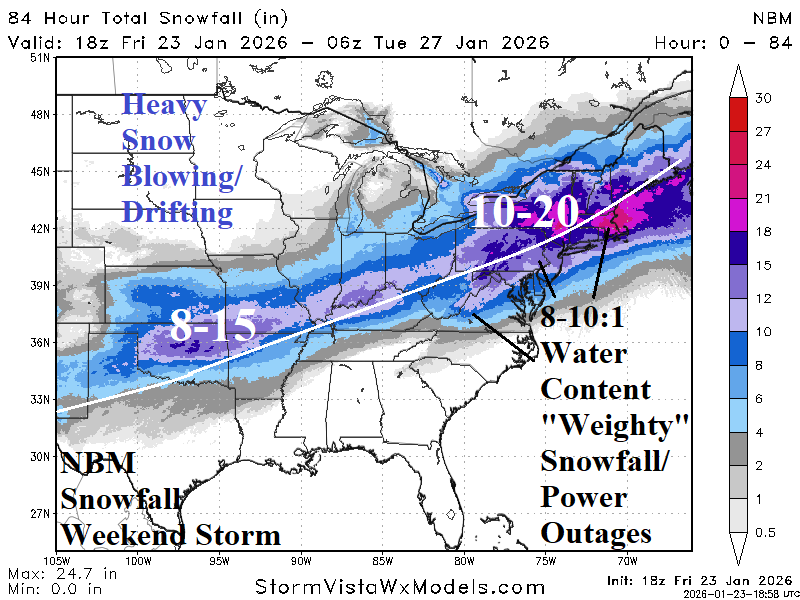
Fig. 2: The latest NBM snowfall storm total.
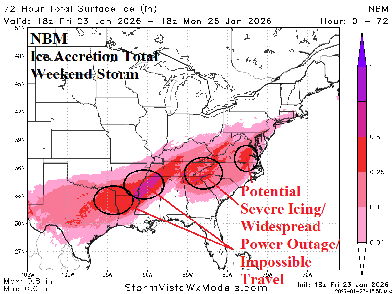
Fig. 3: The latest NBM ice accretion storm total.
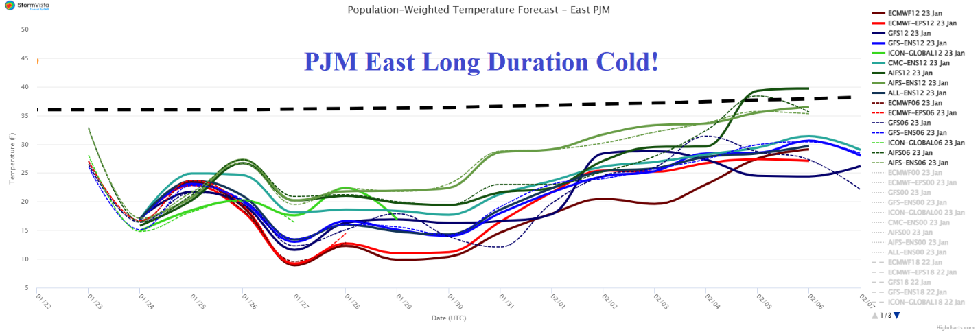

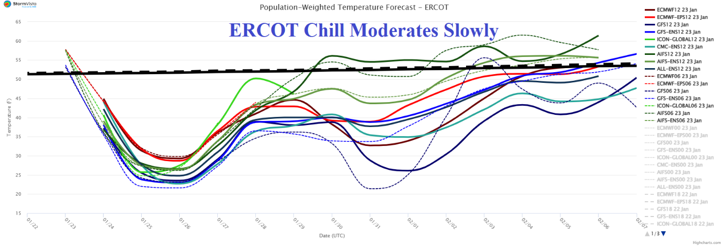
Fig. 4-6: PJM-East, SERC, and ERCOT 15-day system temperature forecasts.
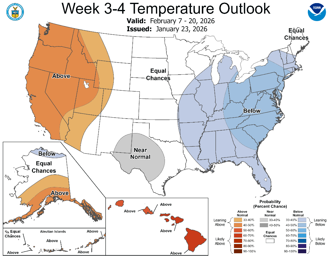
Fig. 7: NOAA agrees with maintaining cold bias in the East during the 16-30-day period similar with the previously issued Climate Impact Company week 2-4 outlook.