09/30/2025, 2:01 pm EDT
A graph showing the results of a forecast AI-generated content may be incorrect.

North and South America 16-30-day 500 MB Verification

Surprising is overall success of the GFS ENS skill score of forecasting the upper air pattern (using 500 MB anomalies) during the 16-30-day period across both North and South America for the past 30-day, 14-day, and 7-day intervals. Traditionally, the ECM “weeklies” are used to make a “first guess” at the expected weather during this timeframe. ECM rivaled GFS ENS for North America forecasts and finished second to GFS ENS in South America.
09/29/2025, 6:16 am EDT
A map of a storm AI-generated content may be incorrect.

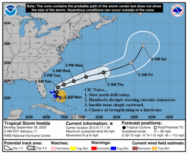
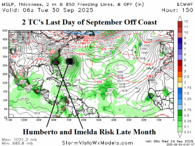
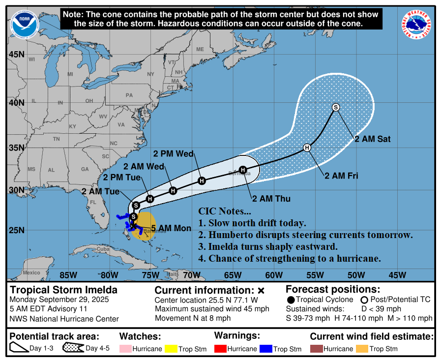
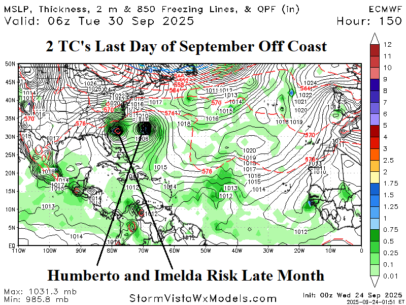
Direct Effects from Imelda and Humberto Stay Offshore the East U.S.

Major Hurricane Humberto disrupts steering currents associated with the North Atlantic subtropical ridge tomorrow enabling westerly flow aloft to turn both Humberto and Imelda northeastward away from the U.S. East Coast. Tropical storm force winds affect Bermuda from outer bands of Humberto tomorrow and again later this week as Imelda passes.
09/29/2025, 4:43 am EDT
A map of the weather AI-generated content may be incorrect.

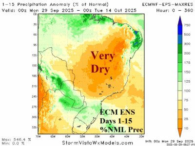
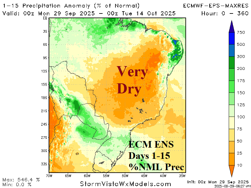
Brazil Heat and Dryness Accelerate Drought

The 15-day temperature and precipitation outlook across Brazil reflects the influence of a torrid drought on climate. Centered over the Brazil drought area, the ECM ENS forecasts extreme heat for much of the next 15 days while the rainfall forecast continues to shift into the arid category.
09/28/2025, 12:21 pm EDT
A pie chart with numbers and symbols AI-generated content may be incorrect.

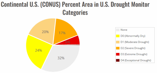
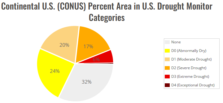
Midwest/Mid-south/Gulf Coast Drought Worsening

The late summer season drought in the Midwest States is strengthening. Dry-to-drought conditions have also developed and are intensifying in the Gulf Coast and Northeast regions. The late summer new drought generation has caused a shift in U.S. regions observing drought from 45% in mid-August to nearly 70% during late September.
09/28/2025, 9:36 am EDT
A map of the ocean AI-generated content may be incorrect.

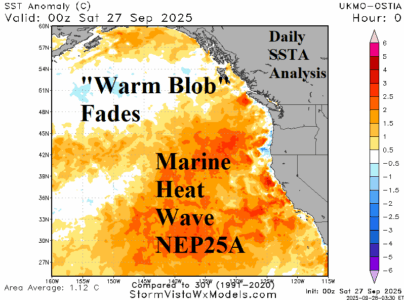
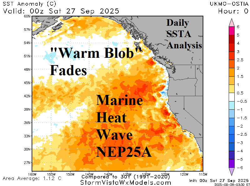
The “Warm Blob” in the Northeast Pacific Weakens

Last month, the “warm blob” returned to the Northeast Pacific. However, during September the “warm blob” has lost intensity and an atmospheric river (AR) storm track into Southwest Canada this week is likely to cause further erosion.
09/27/2025, 9:30 am EDT
A map of a storm AI-generated content may be incorrect.

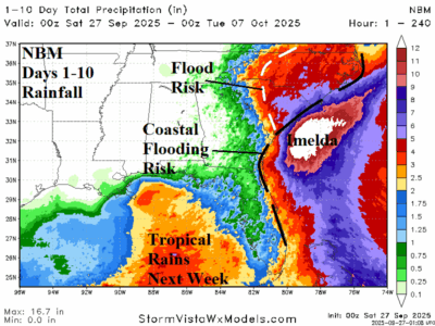
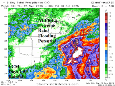
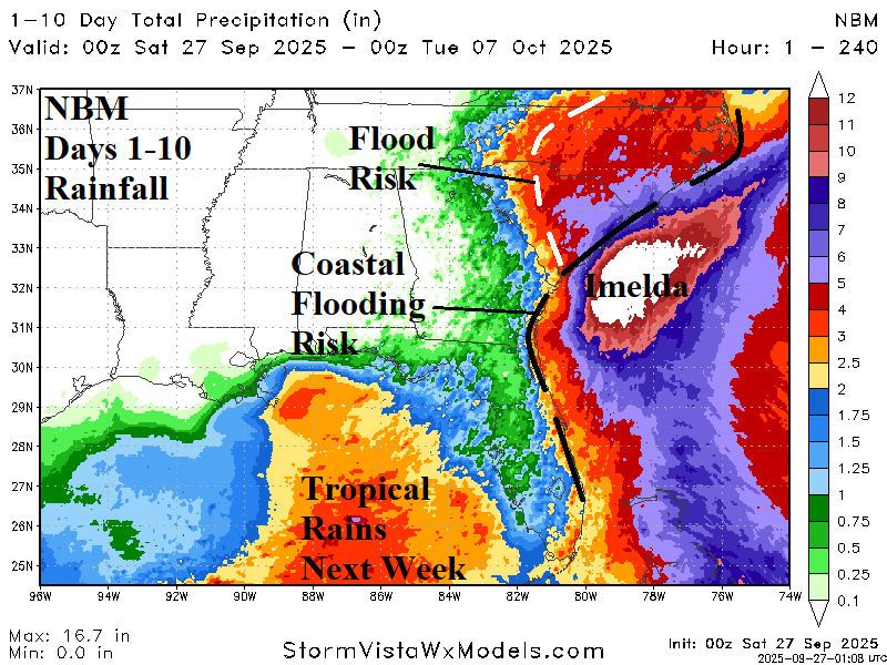
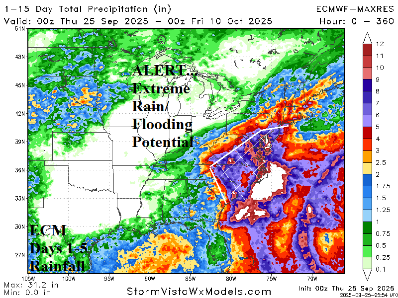
Imelda Flooding Rainfall Remains in Forecast; New Concern is Long-duration East Wind Causing Flooding

The primary weather effects/hazards on the Southeast U.S. Coast remains heavy rain but adds a long duration strong easterly wind flow likely to raise havoc on coastal beaches with extensive erosion and inland flowing ocean water through river inlets flooding areas well inland. The onshore wind flow/accelerating water rise problem lasts well beyond the immediate storm as strong high pressure over the northeast maintains strong east wind through next week.
09/25/2025, 6:05 am EDT
A map of a hurricane AI-generated content may be incorrect.

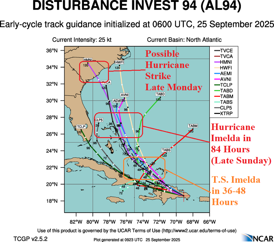
Possible Hurricane (Imelda) South Carolina Coast Monday Night; Humberto Likely to Become Major Hurricane

Tropical Disturbance 94L is located over the eastern Dominican Republic this morning. 94L is encountering westerly shear and the high terrain of the Dominican Republic inhibiting development. However, if the inner structure of the system can bypass the upper shear and orography effects, development is likely by early weekend in the Southeast Bahamas. NOAA/NHC indicates 80% chance of a tropical cyclone after 48 hours.
09/24/2025, 11:48 am EDT
A map of a hurricane AI-generated content may be incorrect.

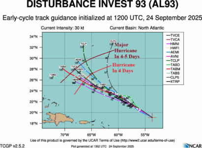
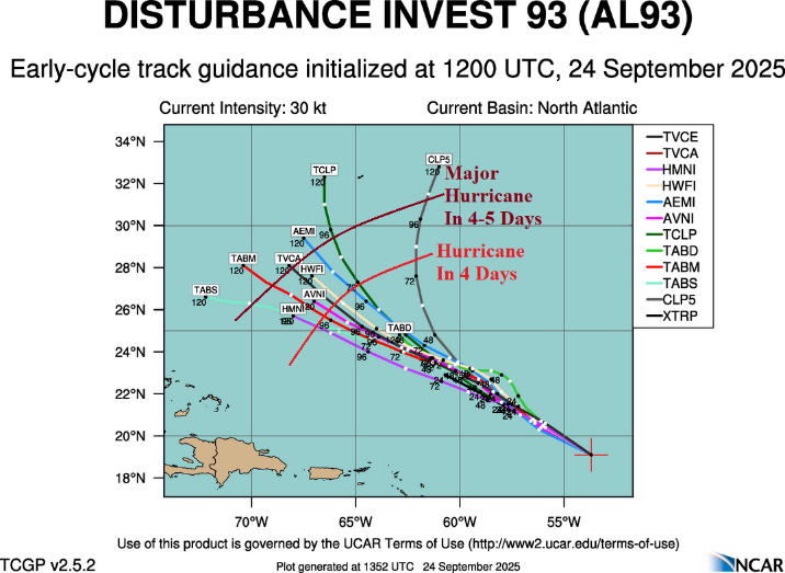
93L Could Become Major Hurricane in 4-5 Days; 94L Could Reach Carolinas Early Next Week

Ocean temperatures in the western North Atlantic basin feature 85F in the Bahamas eastward with 86F in the southern Bahamas extending eastward. Waters south and southwest of Bermuda stretching to Cuba are above too much above normal. In these areas, any passing tropical cyclone with a favorable development environment aloft, will become major hurricanes with ease. Currently, two tropical disturbances northeast of the Caribbean Sea and near Puerto Rico are monitored for development.
09/24/2025, 6:07 am EDT
A map of weather forecast AI-generated content may be incorrect.

Tropics to Activate; Busy October Ahead

The tropics are likely to activate to finish September extending well into October. So far, 7 tropical storms and 2 hurricanes have generated, and seasonal outlooks projected a minimum of 13 tropical storms and 5 hurricanes. Operational models project 3 events in the 15-day outlook.
09/24/2025, 6:02 am EDT
A map of the world with snow AI-generated content may be incorrect.

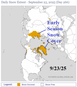
Expanding Early Season Snow Cover in Russia

Early season snow cover has developed over North/Northeast Russia. The snow cover in that region for later September is above normal. Snow cover expansion is likely. The GFS 15-day temperature anomaly forecast indicates widespread cooler than normal temperatures with snow snowfall across Northern Russia and the attendant cool air mass extending southward.