09/04/2025, 5:08 am EDT
A map of the world AI-generated content may be incorrect.

AG Market Hot Spot: South America Update

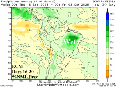
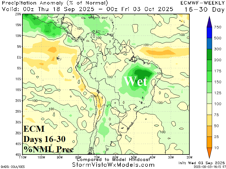
The best analog suggests that a developing weak La Nina favors ongoing dryness in Brazil during spring reversing wetter once summer arrives. Implied is the torrid Brazil drought worsens during spring with some relief into the new year. In the short-term, dry weather prevails in Brazil through 10 days. However, models are indicating a wetter change for the 11-15-day period carrying into the 16-30-day timeframe.
09/04/2025, 5:03 am EDT
A diagram of the weather AI-generated content may be incorrect.

Subsurface Equatorial Upper Ocean Heat Anomalies Dictate IOD/ENSO Ahead

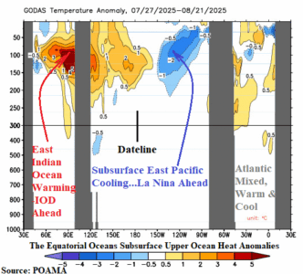
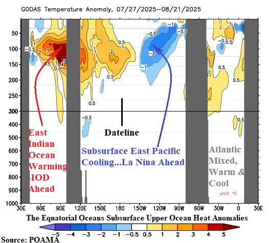
The subsurface equatorial upper ocean heat profile foreshadows phase change of various modes of climate variability. In the Indian Ocean, the eastern portion of the equatorial region has warmed significantly (Fig. 1). Implied is evolution of a potentially strong negative phase of the Indian Ocean dipole (-IOD). The daily IOD index is robust -1.04. The -IOD regime has arrived. In the equatorial Pacific, the eastern portion has cooled significantly. Implied is an approaching La Nina episode.
09/03/2025, 1:28 pm EDT
A map of the united states with red and blue lines AI-generated content may be incorrect.

NOAA September Wildland Fires: Rare New England Risk, Widespread California Risk, and All Hawaii Risk

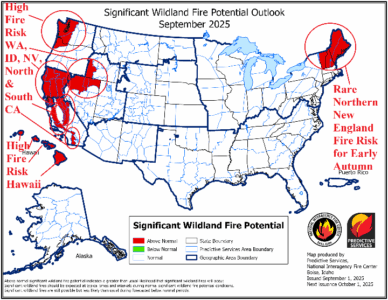
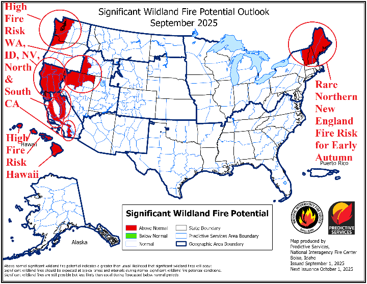
NOAA reissues their significant wildland fire potential outlook for September and October. Not surprising is the rapid risk increase for many parts of Central and Southern California plus all Northern California. The above average risk extends to Northern Nevada and Southwest Idaho. Added is the western portion of Washington. Wildland fire potential risk is above average near many major city and town locations for Western Washington and California.
09/03/2025, 6:02 am EDT
A map of weather forecast AI-generated content may be incorrect.

-IOD/La Nina Inspired Wet Climate Ahead for Australia

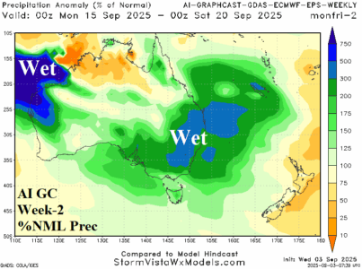
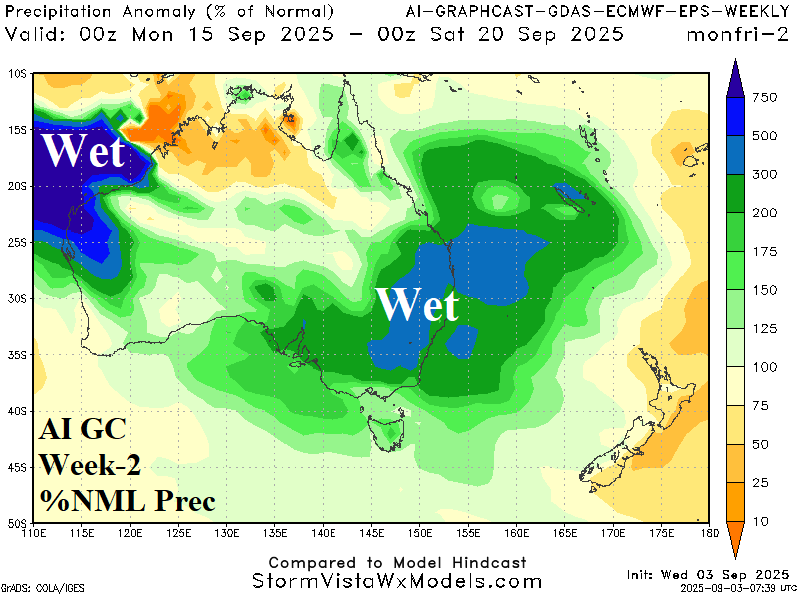
The Indian Ocean Dipole has shifted to negative phase and a borderline La Nina is developing. The last time -IOD and La Nina were present during SEP/OCT was in 2022 when buckets of rain fell on the East/Southeast! Be aware of potential over-achieving rains in the East for spring 2025! The AI Graph Cast week 2-4 outlook reveals the upcoming wet pattern for East Australia.
09/02/2025, 2:46 pm EDT
A map of the world AI-generated content may be incorrect.

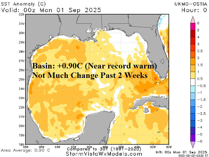
Overall, North Atlantic Cooler Than Recent Summer Seasons; But Gulf/Caribbean/MDR Very Warm!

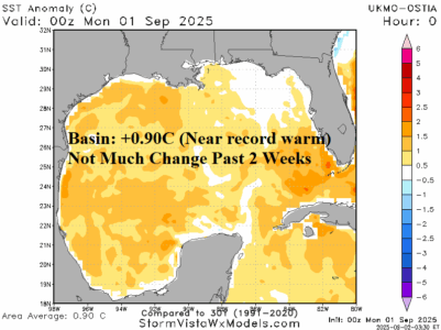
The North Atlantic basin SSTA is +0.28C which is quite cool compared to other years this decade. The 1-year change is -0.53C which is very impressive. However, there are basins which are very warm and capable of contributing to over-achieving tropical cyclones and their intensity. The Gulf of Mexico is near record warm (+0.90C) which is steady during the past 2 weeks. The Caribbean Sea is also very warm and unchanged during the past 2 weeks.
09/02/2025, 9:28 am EDT
A graph of different colored lines AI-generated content may be incorrect.

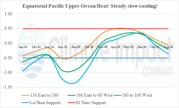
Slowly, Equatorial Pacific Subsurface Cools

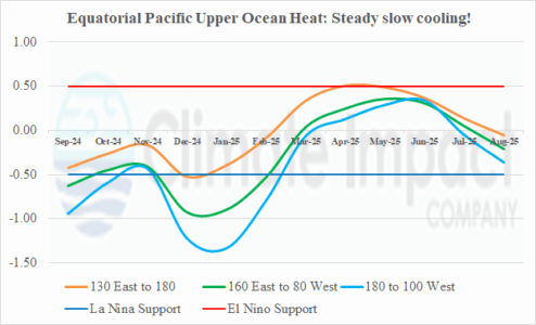
The equatorial Pacific Ocean upper-ocean heat is slowly cooling. The cooling trend, if continued, supports a return of La Nina for quarter 4/2025. The Nino34 SSTA is close to the La Nina threshold while the Nino3 SSTA has shifted to La Nina phase.
09/01/2025, 9:10 am EDT
A graph of the temperature of the month AI-generated content may be incorrect.

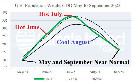
U.S. CDD’s Crash in August!

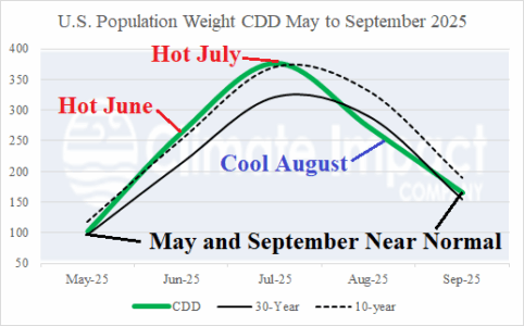
The official U.S. population weight CDD for August 2025 from NOAA will be published in a few days. Climate Impact Company (CIC) projects 272 CDD for August which is cooler than the 30-year normal (290 CDD) and much cooler than the 10-year normal (332 CDD). The NOAA assessment is (more) likely cooler than the CIC estimate. The AUG-25 CDD total is 2nd coolest (for AUG) this century trailing only 2004 (254 CDD).