12/30/2023, 7:51 am EST

Graph Cast AI-Generated SLP Forecasts Continue To Out-Perform Conventional Models

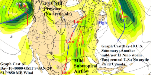
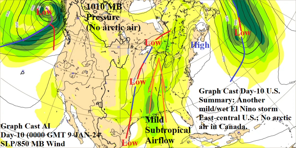
Based on Climate Impact Company review (so far), Graph Cast AI-generated day-10 SLP forecasts are consistently out-performing GFS and ECM. The latest important example was Graph Cast AI doubting risk of arctic air across Southern Canada and possibly into the U.S. (associated with a stratospheric warming event).
12/28/2023, 8:26 am EST

Doubting U.S. Arctic Air Threat Although West Is Colder In 11-15 Days

Energy markets grapple with risk of arctic air intrusion to the U.S. in 10+ days due to presence of a stratospheric warming event emerging over Eurasia over the next week or so, shifting into northwest North America in 10 days, and likely collapsing in 15 days (according to NOAA/CPC).
12/27/2023, 3:29 am EST

A Short Summary of AI in Weather Prediction and Its Use as a Tool for Forecast Development

AI-driven weather forecast models show strong achievement in reducing the amount of time required to create a weather forecast, as the models are not driven by the computationally demanding fundamental equations of the atmosphere like NWP. However, like NWP, weather forecasts generated by AI-driven models struggle with forecast accuracy at longer lead times, due to the iterative approach of weather forecasting to atmospheric variables that are chaotic and stochastic. 
12/26/2023, 2:49 pm EST

What A Rapidly Decelerating El Nino Brings To Major Crop Areas During MAR/APR/MAY and JUN/JUL/AUG 2024

Based on a MEI-driven constructed analog, drought concern for MAR/APR/MAY 2024 are likely for Brazil, Southeast Asia, the Mid-south U.S., and developing in U.K. plus the Black Sea region to West-central Russia. During JUN/JUL/AUG 2024, drought is likely to continue in the Black Sea region to West-central Russia, the British Isles, Western Tennessee Valley, and emerge in the Northeast U.S. Dryness shifts south back into Argentina during JUN/JUL/AUG 2024.
12/26/2023, 8:15 am EST

Active Madden Julian Oscillation Combined with Warming Stratosphere Creates Low Risk “Polar Vortex” Threat January 4th

In summary, the combination of an eastward shifting MJO across the tropical Atlantic and stratospheric warming over Siberia to northwest North America increases the risk of a brief sneaky cold pattern in North America. Forecast models indicate a low risk but close monitoring for significant changes of the forecast in early January is warranted. Through 10 days, AI models do not see the cold air risk for the U.S.
12/22/2023, 1:16 pm EST

Upper Air Forecast for January 2024 in the Northern Hemisphere

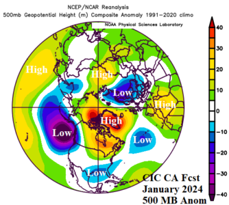
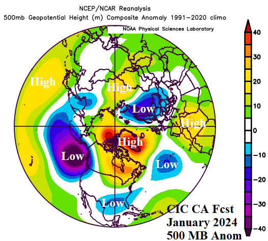
A comparison between the regional SSTA-based Climate Impact Company constructed analog 500 MB forecast for the northern hemisphere for January 2024 with the ECMWF outlook reveals generally similar characteristics for mid-winter.
12/22/2023, 1:05 pm EST

Stratospheric Warming Emerges In Early January!

Natural gas markets are concerned regarding the mid-winter El Nino analogs which end the early winter warmth and introduce colder/snowy weather for January increasing heating demand. An added concern is the emergence in the past 2 days of stratospheric warming forecasts in 12-16 days across North/Northeast Asia to the polar region.
12/21/2023, 5:42 pm EST

Southern Half of U.S. Looks Colder/Stormy First Half of January

The latest week 2-4 forecast by ECM needs adjustments across the southern half of the U.S. for the first half of January as a potent storm track generates locally chilly air (and snowfall) while the very warm pattern retreats farther north than indicated by the model.
12/20/2023, 12:38 pm EST

Graph Cast AI Identifies High Wind Events for Western Europe

Hurricane force wind gusts are projected across U.K. to Germany tomorrow due to a potent storm (960 MB) across southwest Scandinavia. By contrast, the high wind (60-80 mph) event in the Northeast U.S. earlier this week, was associated with a 980 MB low pressure system.
12/20/2023, 6:00 am EST

South America Pattern Change Focused on Brazil

A semi-permanent high-pressure system off the southeast cost of Brazil shifts eastward to Bolivia this week/weekend allowing wet weather to develop over East Brazil where the pattern of early meteorological summer has been dry. In the medium range, an upper trough forms off the East Coast of Brazil causing more heavy rain in this zone.
12/19/2023, 4:46 am EST

Identifying The Brazil Drought Trend

Deep layer (10-200 CM) soil moisture anomalies and their trend is an excellent “quick look” assessment of whether ongoing drought and drought potential is increasing or decreasing across the South America drought concern area in Brazil as meteorological summer 2023-24 has arrived.
12/18/2023, 7:33 pm EST

Models Starting to Show La Nina 2024 Developing  

The Community Earth System Model (CESM) projects developing La Nina for MAY/JUN/JUL 2024. Other forecast models have similar projections with varying speed of (La Nina) development. Elsewhere, global SSTA forecast models maintain a warm signature particularly in the Indian Ocean where positive Indian Ocean dipole (+IOD) ends and across both the North Pacific and North Atlantic as marine heat waves (MHW) expand.