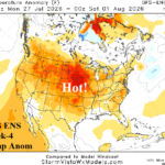
Plenty Of Impactful Heat Across U.S. In Latest Week 2-4 Forecast
06/30/2026, 4:51 am EDT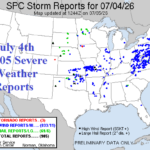
1,602 Severe Weather/Event Reports FRI/SAT; More Today and Tomorrow Focused on Mid-Atlantic
07/05/2026, 11:20 am EDT
Climate Impact Company Early AG Market ALERT
Issued: Wednesday July 1, 2026
Highlight: Tracking rain/heat core in the U.S., regenerating Europe heatwave.
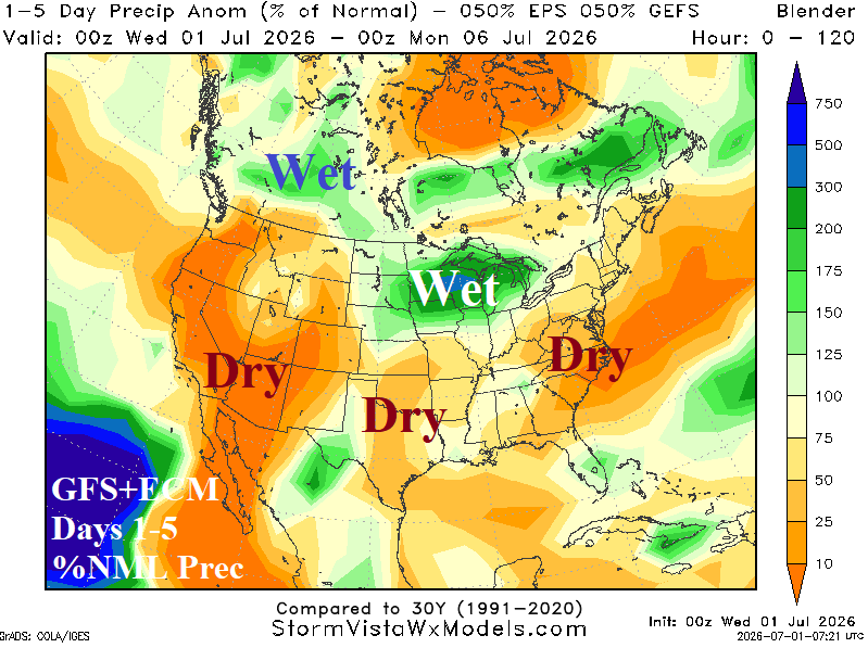
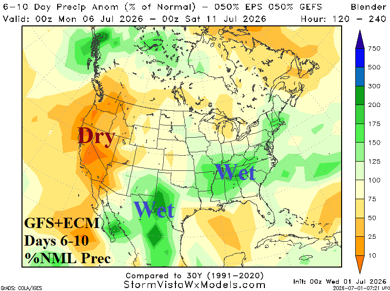
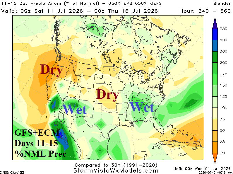
Fig. 1-3: GFS+ECM 15-day percent of normal rainfall forecast across North America.
Discussion: Equally combining GFS and ECM renders a rainfall forecast for the U.S. enabling tracking of core wet weather areas. Into the weekend, heavy rain and severe storms dominate the Upper Midwest/Great Lakes region (Fig. 1). In the 6-10-day-period, wet weather emerges in Texas and centers on the Tennessee Valley (Fig. 2). The 11-15-day forecast continues to shift wet risk southward including the Southwest and Southeast U.S. (Fig. 3). During the 15-day period the central and southern Great Plains are mostly dry. The extreme heat shifts into the East over the next 5 days (Fig. 4) while lingering days 6-10 in the East, the new hot weather core forms in the Intermountain West (Fig. 5). In the 11-15-day period, the new heat core in the Interior West expands to include much of the Great Plains (Fig. 6).
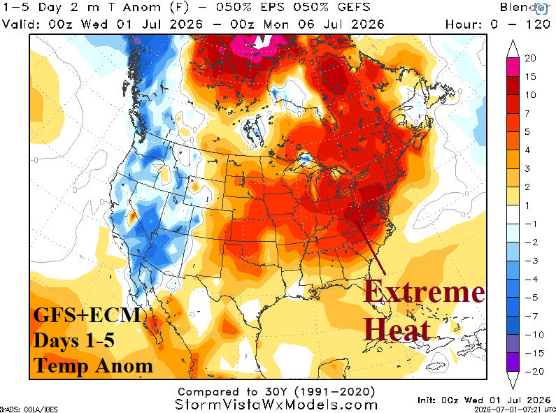
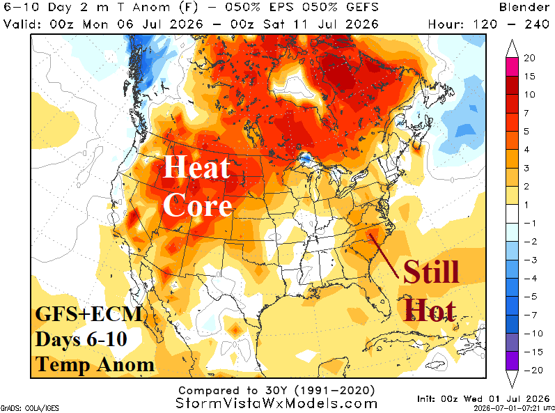

Fig. 4-6: GFS+ECM 15-day temperature anomaly forecast across North America.
In Europe, hot weather is regenerating across Southwest Europe in the 5-day outlook (Fig. 7), surging northward in the 6-10-day forecast (Fig. 8), and broadening across most of Central and Southern Europe in the 11-15-day projection (Fig. 9). The ECM 15-day rainfall forecast (Fig. 10) emphasizes dryness over France and combined with intense heat drought will worsen dramatically.
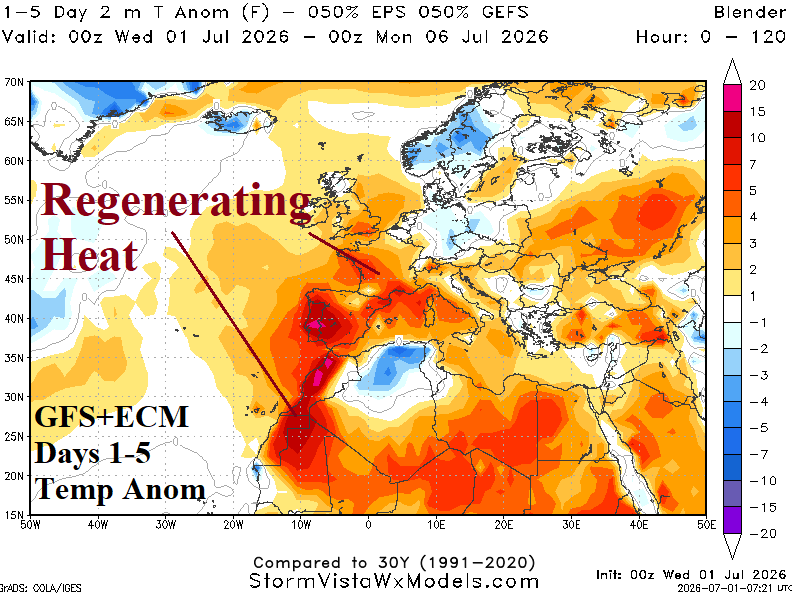
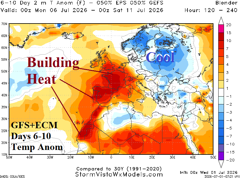
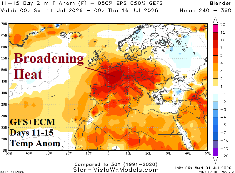
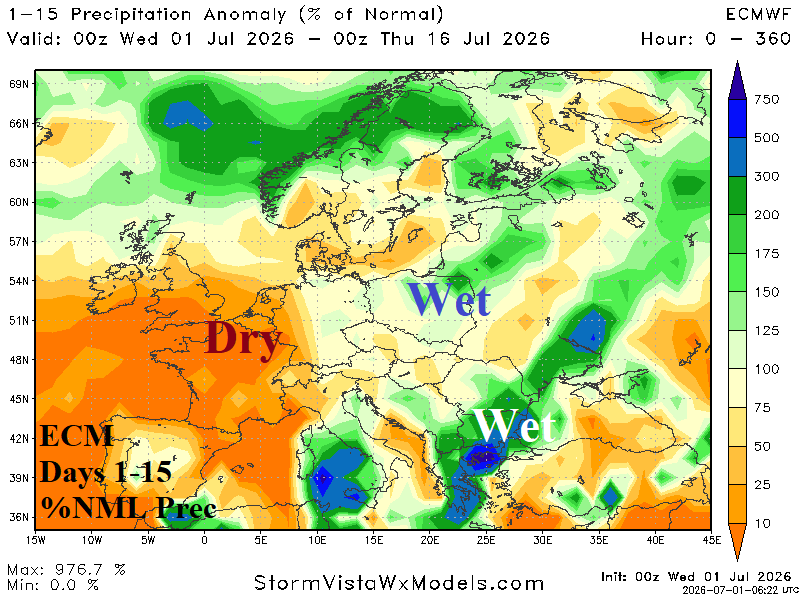
Fig. 7-10: GFS+ECM Europe/Western Russia 15-day temperature anomaly forecast plus the ECM percent normal rainfall outlook.
In the 16-30-day period, CFS V2 indicates wet zones in the Southeast U.S., the Intermountain West, and occasionally across the Northern Great Plains (Fig. 11). Dryness is emphasized across the Southern Great Plains and Texas and vicinity. All dynamic and AI models (Fig. 12) maintain the Europe heatwave in the 16-30-day period.
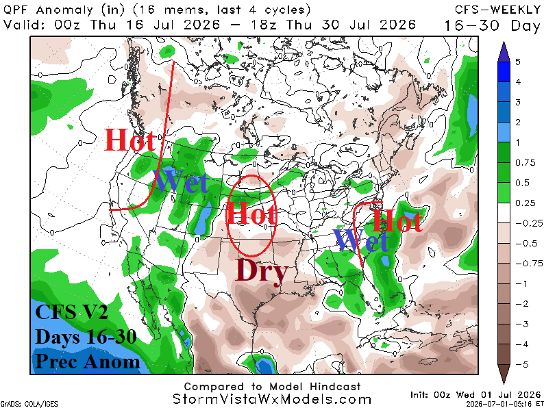
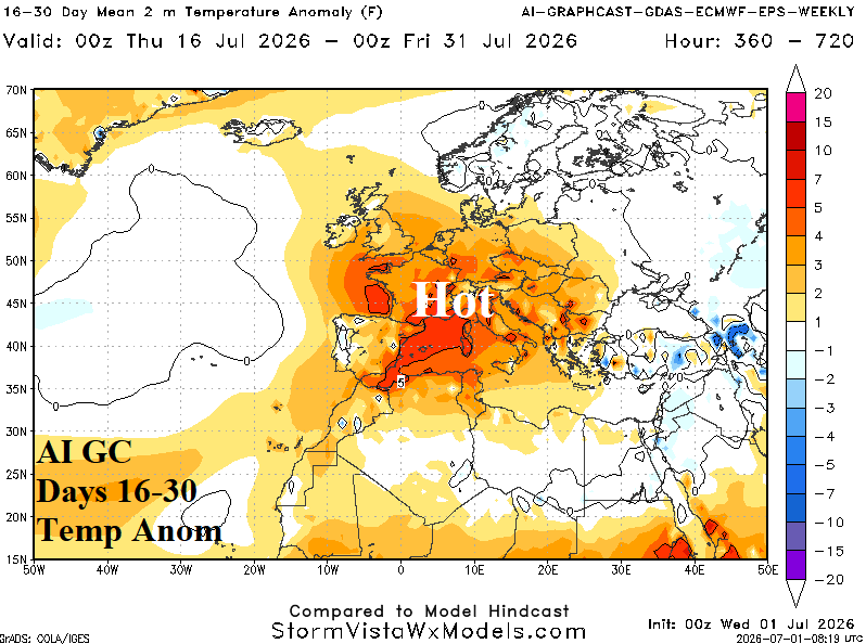
Fig. 11-12: CFS V2 16-30-day rainfall anomaly forecast across North America and the AI Graph Cast ECM ENS 16-30-day temperature anomaly forecast for Europe.
Finally, a lingering positive phase Antarctic oscillation (AAO) maintains a transitional pattern across Australia featuring patchy wet weather (Fig. 13). In South America, the forecast is adjusted somewhat cooler this week in Argentina and risk <32F could reach far Southeast Brazil (Fig. 14).
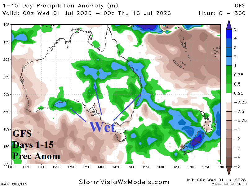
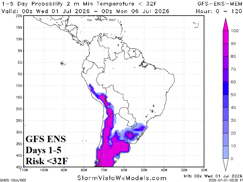
Fig. 13-14: GFS 15-day rainfall anomaly forecast across Australia and GFS ENS risk of <32F for South America through the weekend.