
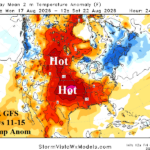
12Z GFS Builds Great Plains Heat Extended range; Europe Heatwave Continues!
08/07/2026, 1:48 pm EDT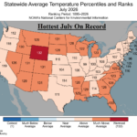
Hottest July on Record from the 133-year Climatology in U.S.
08/11/2026, 9:01 am EDT
Climate Impact Company Early AG Market ALERT
Issued: Monday August 10, 2026
Highlight: Arc of severe storms/flooding Midwest U.S. this week, extended range could shift drier. Dangerous heat/dryness Mid-south U.S. Europe heat may break.
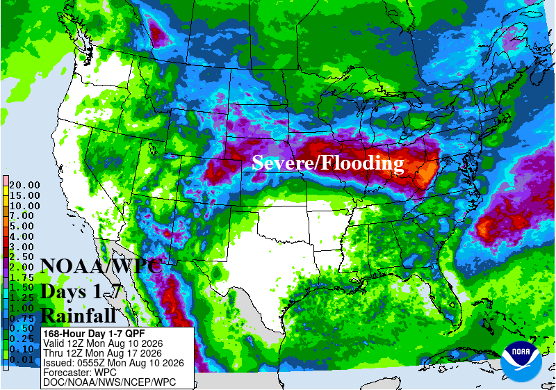
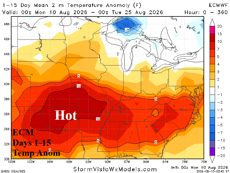
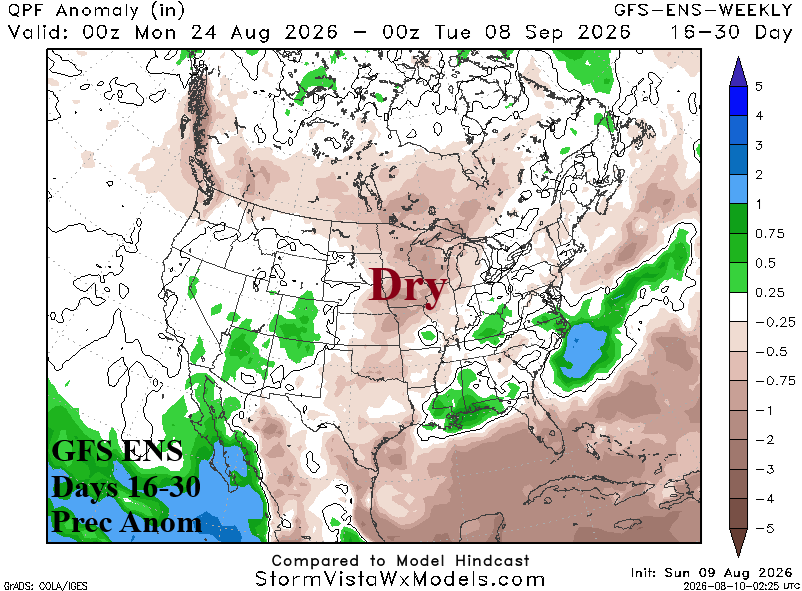
Fig. 1-3: NOAA/WPC 7-day quantitative precipitation forecast, ECM 15-day temperature anomalies outlook, and GFS ENS 16-30-day rainfall anomaly forecast.
Discussion: This week, a heavy rain with flooding potential and severe thunderstorm pattern stretches from the North-central U.S. through the Ohio Valley (Fig. 1). Along the southern periphery (and southward) of the active weather pattern, building anomalous heat is likely which lasts much of the next 2 weeks (Fig. 2). The risk of 100F reaches Southern Nebraska and Kansas to the Southern Missouri Valley (and southward) consistently during the hot period. The Mid-south, Southern Plains, and much of Texas receives no rain and Southern Plains drought is expansive. In the (16-30-day) extended-range period, dryness is likely to include the Midwest States as the short-term heavy rainfall pattern abates (Fig. 3).
Heat persists this week across West, Southwest, and South Europe (Fig. 4). However, in the 8-14-day period, forecast models are breaking the extreme heat (Fig. 5) and adding some rainfall for parts of South and Central Europe (Fig. 6).
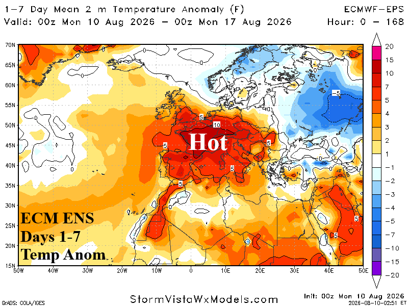
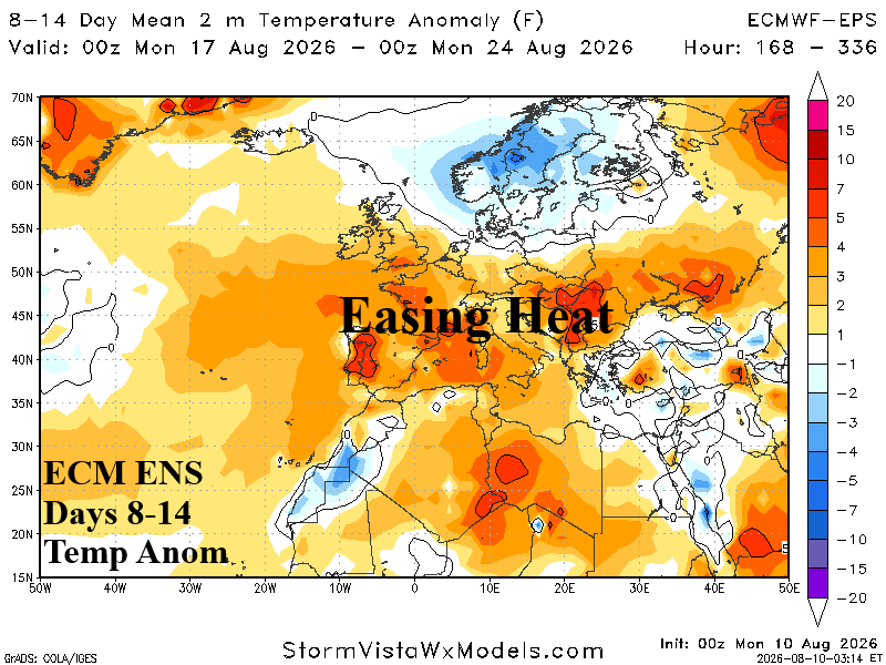
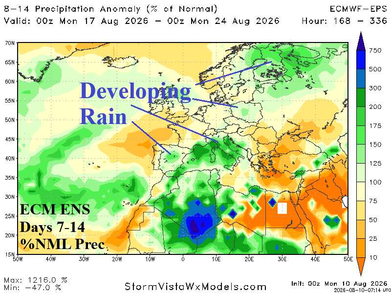
Fig. 4-6: ECM ENS 14-day temperature anomalies forecast for Europe and the 8-14-day percent normal rainfall outlook.