
Hurricane Isaias Should Reach Category-3 Major Hurricane Status Tomorrow
10/08/2026, 6:00 am EDT
Climate Impact Company North Atlantic Basin 10-Day Monitor
Issued: Friday October 9, 2026
Highlight: Over-achieving Isaias soon a major hurricane!
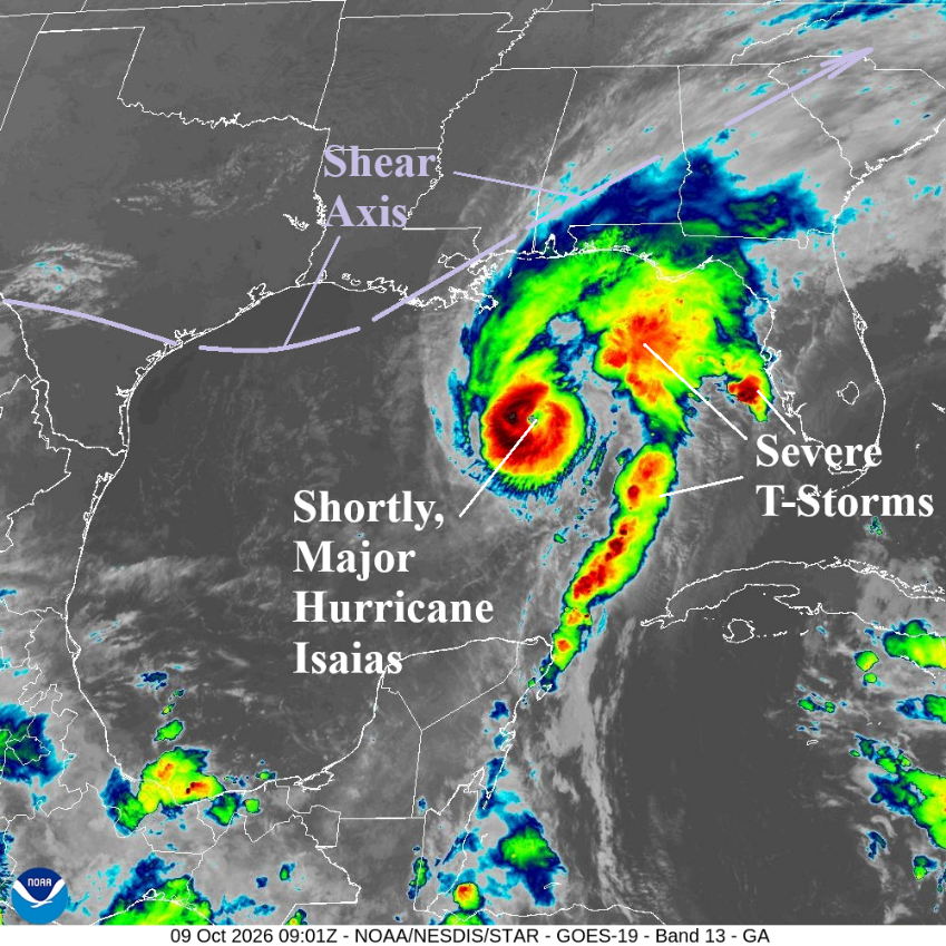
Fig. 1: Weather satellite view of the Gulf of America identifies angry Isaias and a large amount of severe storms east of the hurricane.
Discussion: At 5AM EDT, Hurricane Isaias was located at 26.4N/88.0W or about 200 miles south-southeast of the mouth of the Mississippi River. Isaias is moving north-northeast at 15 mph with top wind near 110 mph. Isaias will become a major hurricane shortly. Surface pressure has lowered to 963 MB. Weather satellite-view reveals an angry-looking Isaias with a well-defined eye which is strengthening its signature (Fig. 1). A massive area of severe thunderstorms is east and northeast of Isaias. HWRF and HMON intensity forecasts have been quite good forecasting a stronger than indicated (by NOAA/NHC) hurricane. HWRF projects a strong category-3 major hurricane later this afternoon while HMON takes Isaias to category-4 major hurricane status at midday (Fig. 2-3). HWRF and HMON take Isaias to the coast as a major hurricane while NOAA/NHC indicates a category 2 hurricane at landfall. Upper ocean heat is immense and having greater influence on Isaias’ intensity compared to the increasing vertical/horizontal wind shear. NOAA/NHC takes Isaias inland this evening on the AL/FL state line (Fig. 4). Storm surge forecasts have increased for east/southeast Louisiana and the northwest coast of Florida (Fig. 5). The 7-foot storm surge forecast where Isaias makes landfall could be higher. Excessive rain causing flash flooding is immense along the storm path and eastward through the weekend (Fig. 6). Hurricane force wind extends to 25-30 miles from the storm center (Fig. 7) while tropical storm gusts associated with Isaias will extend well inland this weekend (Fig. 8). Tornadoes are likely along and east of Isaias’ path the next 2-3 days (Fig. 9-10).
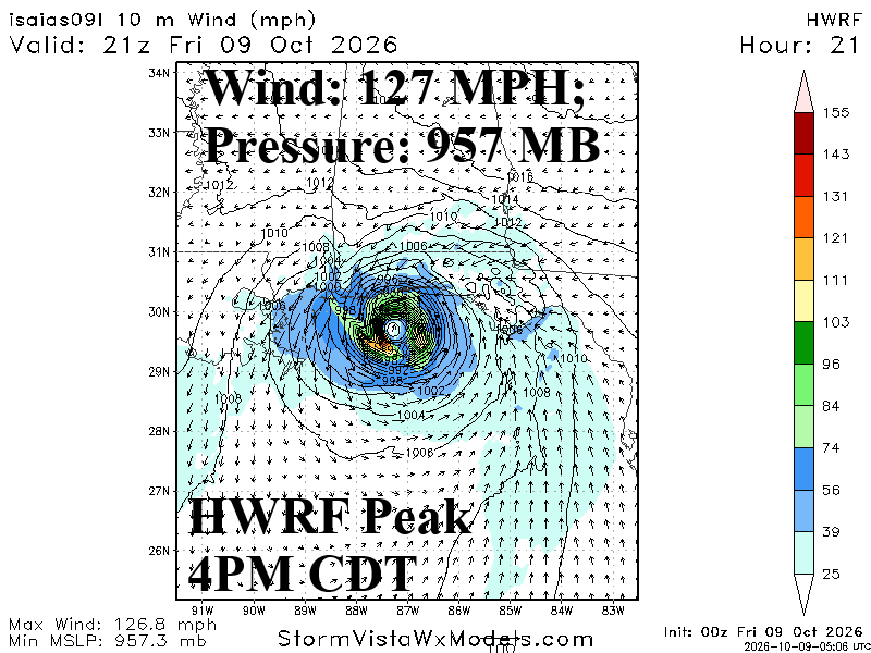
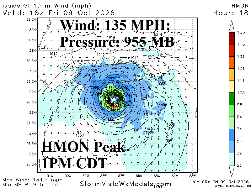
Fig. 2-3: Hurricane models HWRF and HMON and their peak intensity forecasts for Isaias.
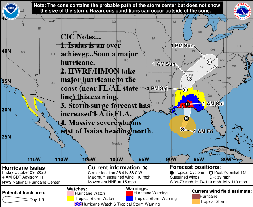
Fig. 4: NOAA/NHC forecast track for Hurricane Isaias with watch and warning areas included.
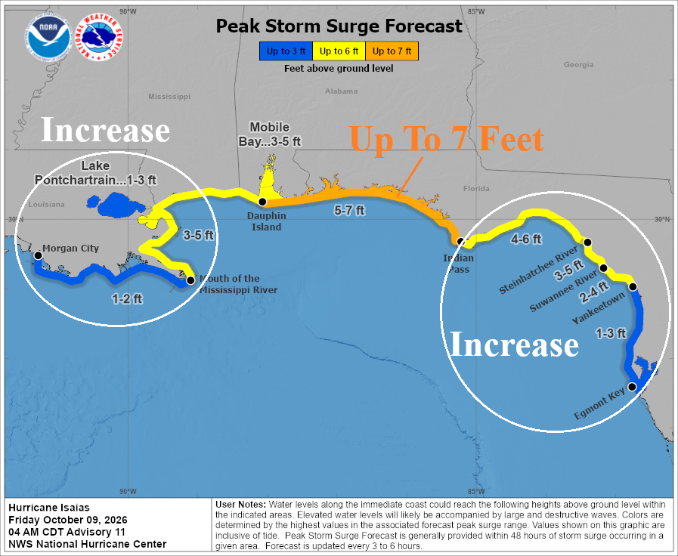
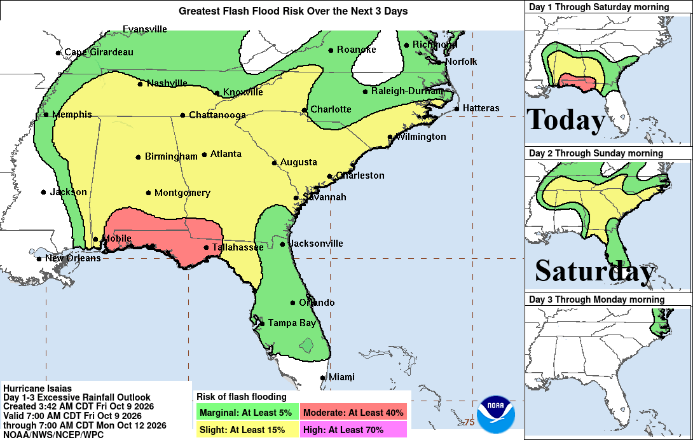
Fig. 5-6: NOAA/NHC storm surge and flash flood risk areas. Note that Louisiana and Florida storm surge has increased.
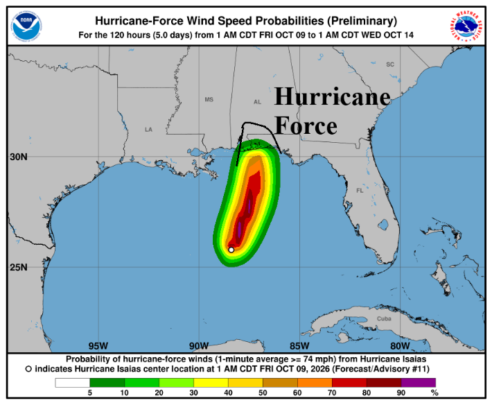
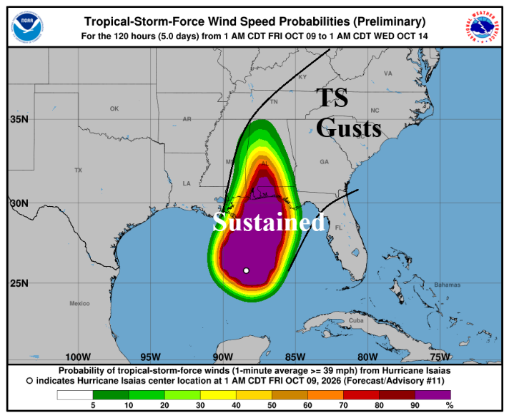
Fig. 7-8: NOAA/NHC hurricane and tropical storm wind probability forecasts.
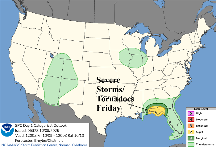
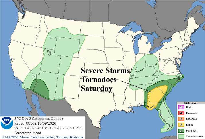
Fig. 9-10: Tornado risk areas for today and tomorrow according to NOAA/SPC.