
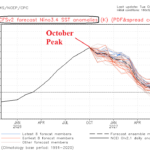
Has Super El Nino 2026 Peaked?
10/27/2026, 4:52 am EDT
Climate Impact Company Daily Feature
Issued: Wednesday October 28, 2026
Highlight: Unwanted cold ahead for France to Ukraine.
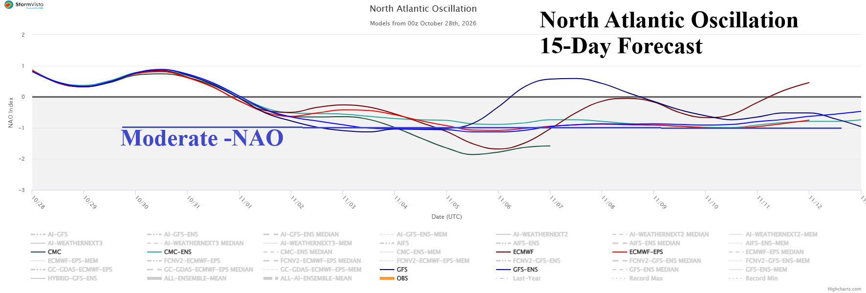
Fig. 1: The 2-week North Atlantic oscillation forecast utilizing all models.
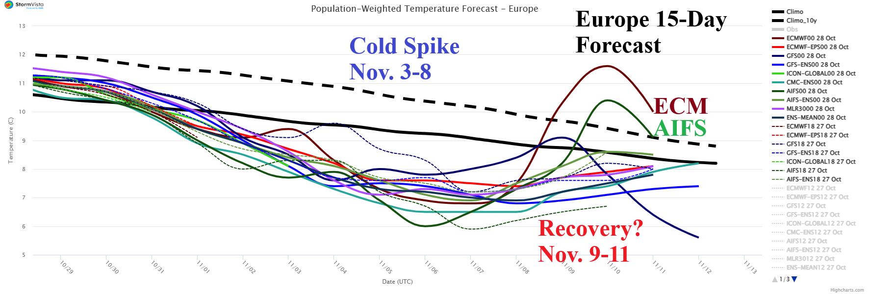
Fig. 2: The 15-day population weight daily average temperature forecast across Europe.
Discussion: Stratospheric warming develops during early November in parts of the polar region with varying response within the troposphere in the middle latitudes. The stratospheric warming event causes North Atlantic oscillation (NAO) to shift to moderate negative phase (Fig. 1). The -NAO pattern will produce cold weather in Europe peaking next week (Fig. 2). There are questions on whether the chill will break in the 11-15-day period. Combining GFS and ECM the chilly regime is well-developed throughout the medium range (Fig. 3-4). Snow cover expanse could sustain the chill in the extended range with an advance into Eastern Europe and Southwest Russia and possibly Ukraine (Fig. 5). The coldest widespread risk is indicated in the 11-15-day period by GFS ENS when -28F risk shifts west and south in Europe/Western Russia/Black Sea region/Turkey (Fig. 6).
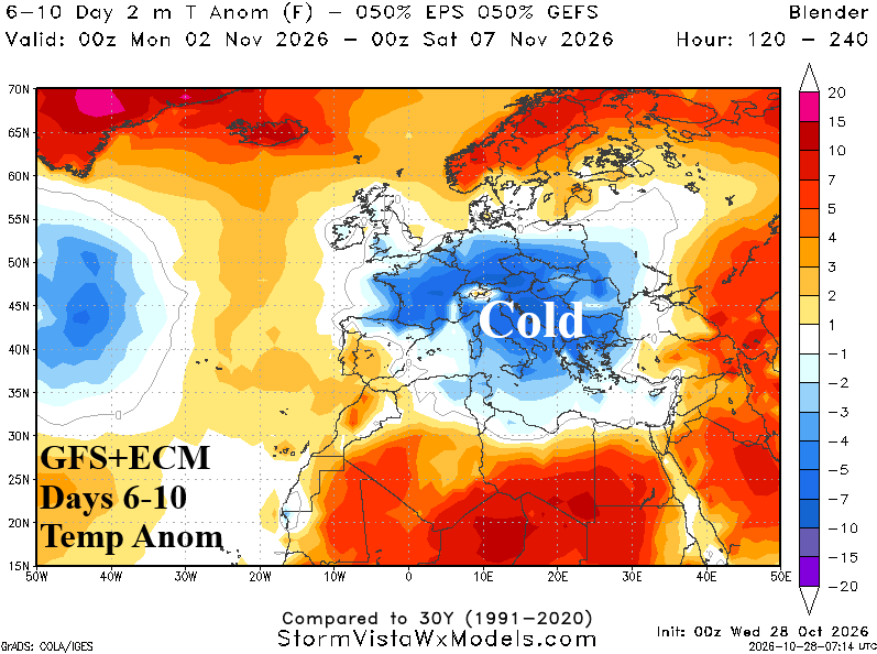
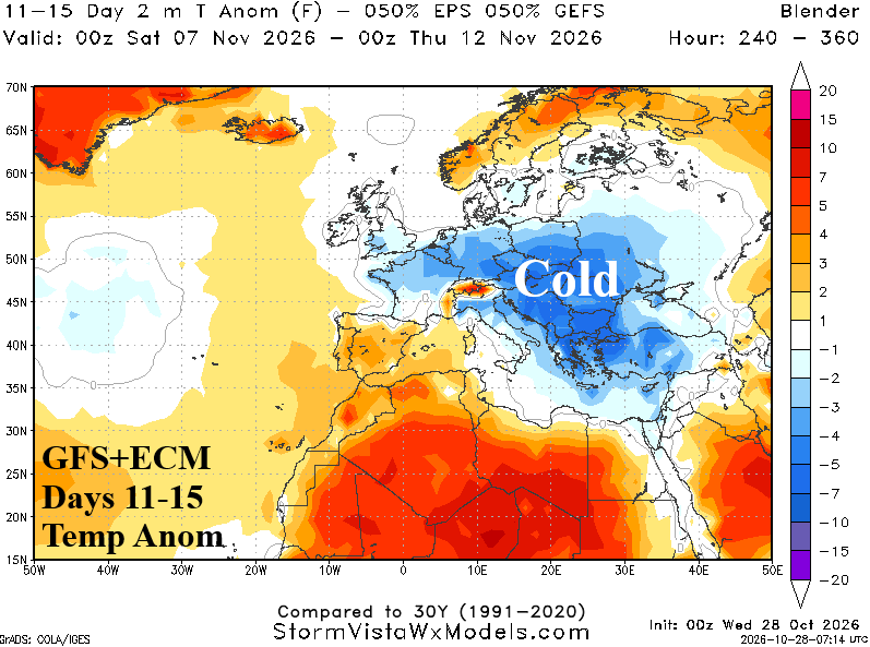
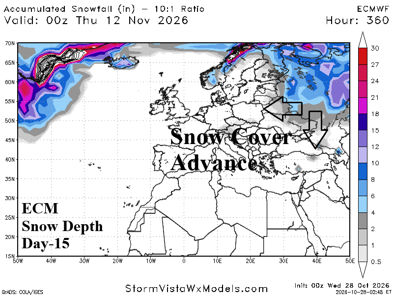
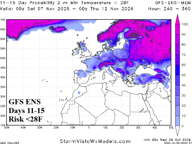
Fig. 3-6: GFS+ECM Europe/Western Russia medium range temperature anomaly forecast, ECM day-15 snow depth outlook, and GFS ENS 11-15-day <28F risk outlook.