07/31/2022, 12:07 pm EDT

Focus on Nebraska/Iowa Rapid Drought Development Risk

The 15-day hot and dry weather forecast for the Great Plains featuring some excessive heat coupled with vast worsening dryness for both shallow and deep layer soil moisture increases the risk for rapidly developing drought for the first half of August.
07/28/2022, 7:55 am EDT

North Atlantic Basin Starting to Warm

The North Atlantic basin is steadily warming. However, there are regions with robust warming and cooling that combine and lead to the warm anomaly.
07/28/2022, 5:04 am EDT

What Weather Pattern Makes a Cold Winter in Europe?

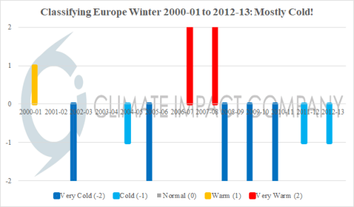
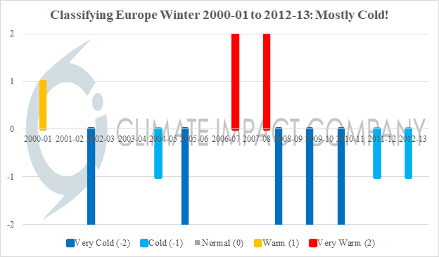
Before issuing the Europe winter 2022-23 climate outlook, a review of what makes a cold winter in Europe is reviewed. Wintertime since the turn of the century is examined. Results identify two regimes: A cold period for most of the first 13 winter seasons of this century and generally mild winter seasons during the past 9 years.
07/26/2022, 11:32 am EDT

Tropical Upper Tropospheric Trough across Western Caribbean Sea

In the western Caribbean Sea, an upper-level tropospheric trough (TUTT) is persisting. High-level wind identifies the northeast to east wind across the northern Gulf of Mexico to the south of an intense subtropical high-pressure area over Texas.
07/25/2022, 12:43 pm EDT

Strengthening Marine Heat Wave NEP22A Helping to Shape U.S. Pattern

Recently, waters off the West Coast have cooled dramatically. The release of the latent heat involved in this process may have amplified the upper ridge pattern roasting the Northwest U.S. All of the warming of the ocean surface during the past 2+ weeks is north of Hawaii where Marine Heat Wave NEP22A is intensifying.
07/25/2022, 5:05 am EDT

Cold Front Stalls – Drenches Mid-south and Tennessee Valley Mid-to-late Week!

A stalled cold front will trigger excessive rainfall across the Mid-south U.S. to the Carolinas midweek through the weekend. GFS indicates >5 in. of rain in Arkansas and Tennessee while ECM projects higher amounts. Flooding is expected with serval damaging wind events as the heavy rains break the recent heat.
07/22/2022, 12:04 pm EDT

3rd Year of La Nina Rainfall Climatology for North and South America

Forecasts for a 3rd consecutive La Nina year are confident. 3rd La Nina years are rare. Using the operational Nino index (ONI) for 1950-2022 yields 3 ENSO regimes (1956, 1975 and 2000) in which a 3rd consecutive La Nina year occurred. In that 3rd year of La Nina, widespread dryness affects the Central to Southeast U.S. and Brazil.
07/22/2022, 11:56 am EDT

Surging Europe Dryness!

Europe soil moisture anomalies continue to indicate a drying trend due to the ongoing heatwave and attendant dryness. The precipitation outlook across central and southern Europe through the next 4 weeks remains mostly dry.
07/21/2022, 10:13 am EDT

Climate Impact Company Issues New Season 1-3 Ahead Outlook

The Climate Impact Company U.S. season 1-3 ahead forecast valid for meteorological autumn 2022, winter 2022-23 and spring 2023 is issued. The forecast is based on a constructed analog (please see methodology on CIC client pages). High impact highlights include a warm autumn season featuring very dry weather in the Mid-south States. Autumn tropical cyclone risk is highest in Florida and the Mid-Atlantic Coast. Next winter is cold and snowy across the North-central U.S. while the South and East enjoy a mild season.