08/31/2020, 4:53 pm EDT

Deep Layer Soil Moisture Deficits Increase Flash Drought Risk

Late season heat in Iowa last week coupled with deep layer soil moisture deficit over the northern state and widespread soil moisture deficts in the shallow soil moisture produced a borderline flash drought episode. Deep layer soil moisture deficits are spread across the North-central U.S., western Great Plains and Southeast U.S. Fortunately, early autumn cool weather and likely a wet regime in the Southeast eases additional flash drought risk.
08/30/2020, 12:02 pm EDT

Classic -PDO/+AMO Late Summer Drought In Iowa

Research (Greg McCabe, Julie Betancourt and Michael Palecki) has shown that the -PDO/+AMO regime has a tendency to increase drought risk across the Southwest and Midwest U.S. during the warm season. The current U.S. soil moisture regime certainly recognizes the -PDO/+AMO influence on late summer soil moisture.
08/26/2020, 11:58 am EDT

NOAA/NHC Now Forecasting 15-20 Foot Storm Surge Southwest Louisiana Coast

The NOAA/NHC storm surge forecast has increased to 15-20 feet near the TX/LA state line eastward along the southwest coast of Louisiana. The storm surge is 10-15 feet on the upper Texas coast and 10-15 feet central Louisiana coast. The forecast identifies a record storm surge for this location with catastrophic coastal damage extending well inland for low-lying land and also major loss of life for anyone along or just inland the coast.
08/22/2020, 8:11 am EDT

Laura and Marco Face Different Hazards Trying to Intensify

Tropical Storm Marco is a little stronger at 8AM EDT Saturday. However, a 30-40 knot southwest upper shear band is ahead across the central Gulf of Mexico. Marco will need to fight through that shear to survive. Tropical Storm Laura is forecast to track west-west-northwest across Hispaniola and Cuba over-the-weekend which is a tough course to follow to survive due to the high terrain. HOWEVER, if each storm survives these obstacles the super warm Gulf of Mexico could allow strengthening to a hurricane before eventual landfall in the north or northwest Gulf of Mexico.
08/19/2020, 8:29 pm EDT

Madden Julian Oscillation Cause California Heat Wave

The convective phase of the Madden Julian oscillation stretched across the eastern tropical Pacific Ocean and into the western Atlantic tropics (phase_8/phase_1) the past 7-10 days with moderate-to-strong intensity. The result is widespread tropical convection spawning many tropical events (4 in both the East Pacific and North Atlantic tropics including Elida, Fausto, Genevieve and Isaias plus several potent tropical disturbances). The latent heat release poleward of the tropical convection and the attendant tropical systems into the middle atmosphere of the middle latitudes amplified a high pressure ridge in the Western U.S. causing the California heat wave.
08/17/2020, 3:27 pm EDT

NOAA Long-lead Forecast Predicts Excessive Rainfall for August in Virginia

Occasionally, NOAA/CPC long-lead forecasts will produce relatively bold probabilities in extended-range forecasts. If so, risk managers interested in possible adverse climate conditions should take note. The NOAA/CPC outlook for meteorological summer (from last February) indicated an unusually wet probability (given the 3.5 to 6.5 lead time) across Virginia which has certainly verified given the historic rainfall observed in August.
08/17/2020, 10:07 am EDT

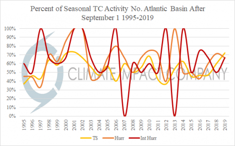
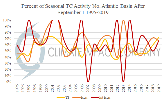
Only 2 Hurricanes So Far in North Atlantic. Can 10+ Still Occur As Seasonal Forecasts Indicate?

So far the 2020 North Atlantic tropical cyclone season has yielded 11 tropical storms which is certainly above normal for middle August. However, only 2 minimal hurricanes so far lags behind the normal amount. Seasonal forecasts by Climate Impact Company, Colorado State University, Tropical Storm Risk U.K. and NOAA indicate near if not more than 10 hurricanes of which 3-6 could become major hurricanes. Can that level of activity still happen?
08/11/2020, 7:53 am EDT

Strongest U.S. Derecho Since June 2012 Strikes Midwest U.S.

On June 29, 2012 a derecho surged east-southeast from the Ohio Valley across the Mid-Atlantic region causing widespread wind damage resulting in the loss of 4,000,000 people without power. Yesterday a similarly intense derecho moved rapidly across the Midwest U.S. knocking out power to over 500,000 people.
08/07/2020, 1:28 pm EDT

North Atlantic Tropics Saharan Dust Continues But Mid-Atmosphere RH Increasing

Steady pulses of African dust continue to emit westward in the North Atlantic tropics suppressing tropics cyclone activity. However, the relative humidity/available moisture at mid-level atmosphere is increasing. The mid-level atmosphere increased humidity is very supportive of the tropics starting to percolate.
08/04/2020, 9:58 am EDT

Cool Equatorial Pacific Subsurface Lost in July BUT May Regenerate

A La Nina Watch remains in-place for 1-3 months from now and there are some signs of La Nina diagnostics returning. Last week the Nino34 SSTA lowered to -0.8C. The SOI in July was in the positive phase and the subsurface cool water near the Dateline is new and expanding. Despite the loss of the APR/MAY cool subsurface there remains a chance of La Nina onset by early in quarter 4 of 2020.