12/30/2024, 4:28 am EST

January 2025 Adjusted Colder in the East U.S.

The cold burst into the East during the first half of January biases the previous January 2025 temperature anomaly outlook slightly colder in the East and the adjustment is indicated above. A La Nina climate is developing and should bias the East U.S. warmer in February while cold risk shifts to the northwest quadrant of the U.S.
12/29/2024, 10:13 am EST

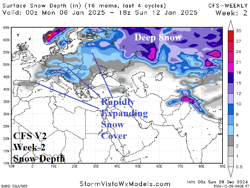
The Colder/Snowier Shift in Europe into Mid-winter

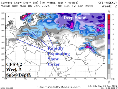
Upper trough settles on Western Europe. A colder pattern develops across most of Europe. The storm track stretches from Spain to Southeast Europe and Southwest Russia. As cold air increases, the storm track begins to produce snowfall. The snow cover will expand across much of Europe enhancing the incoming cold.
12/29/2024, 10:02 am EST

U.S. Gas Population Weight HDD Forecasts Trending Colder/Longer Duration

The U.S. gas population weight HDD forecast certainly identifies the increasing heating demand. Utilizing all models, the HDD forecast consensus through mid-January is colder than yesterday and trend colder for the second half of January into early February according to CFS V2/ECM consensus. The longer duration cold will occur if snow cover expansion is sustained late in January.
12/27/2024, 7:22 am EST

Forecast Change: Models See Arctic Air Western Canada Days 6-10; Ejected Eastward Days 8-14/11-15!

Overnight, the U.S. gas population weight HDD forecast for Jan. 3-9 was revised colder by ALL models (except GFS). During Jan. 10-16, U.S. heating demand settles to the 30-year normal. The extended range HDD forecasts for the second half of January are near to below normal. Consequently, Jan. 3-9 is the coldest week of mid-winter.
12/26/2024, 4:20 am EST

Stratospheric Cooling/La Nina Climate Strengthening: Trend Is Away from Important Cold East U.S. in January

In a new twist, ECM is forecasting a cold stratosphere across the polar region and eastern North America in the 11-15-day period. Elusive stratospheric warming shifts to Eurasia. Beneath the cold stratosphere, GFS indicates a mild ridge pattern in the East U.S. instead of an evolving polar vortex pattern as previously reported.
12/26/2024, 4:18 am EST

La Nina Has Generated; Intensifying Rapidly!

The daily Nino34 SSTA has cooled to -1.06C qualifying as a moderate La Nina signature. The cooling is remarkable with a 30-day change of a stunning -0.81C. The subsurface is as impressive as a strong cool anomaly intensified across the equatorial East Pacific and upper ocean heat east of the Dateline has cooled to a peak for the evolution of La Nina during 2024.
12/24/2024, 9:47 am EST

Dealing With Cold Weather After Holiday Season in U.S.

An expected cold change in January for North America is indicated by ECMWF which is vividly much colder in the extended range outlook. Most of the precipitation across the Northern U.S. is snow helping to enhance the cold.
12/22/2024, 11:11 am EST

Brazil Wet Bias GFS/ECM Forecasts; Machine Learning Outlooks Gain Visibility

ECM has carried a wet bias with their 15-day operational outlooks throughout mid-to-late spring and early summer. Recently, GFS wet bias has (also) increased and is similar to ECM. Presented is an excellent opportunity for machine learning forecasts to compete with GFS and ECM as they may understand the wet bias and make adjustments to the operational forecast.
12/20/2024, 10:58 am EST

Cold Snap Next Few Days East U.S., Another One Second Week of January

The next cold temperature issue arises in the week-3 forecast when all “weeklies” models project an evolving upper trough in the East U.S. ECM continues with the strongest trough forecast. For the moment, arctic air is not anticipated with this upper trough.
12/19/2024, 6:45 am EST

Climate Forecasts Project Potential Significant Drought Risk Canadian Prairies to Midwest U.S. Next Warm Season

Yesterday’s year ahead climate forecast for North America reveals a dry climate pattern setting up across the northwest Great Plains to the Ohio Valley during APR/MAY/JUN 2025 expanding northward across the Canadian Prairies during JUL/AUG/SEP 2025. The dry pattern is accompanied by anomalous heat and implies potential for a large drought developing during the 2025 warm season.
12/17/2024, 4:06 am EST

Despite Developing La Nina, Eastern Australia Is Dry/Hot Late-DEC to Mid-JAN

Typically, La Nina brings wet weather to Eastern Australia. The daily Nino34 SSTA descends to -0.85C and La Nina onset is imminent. Short-term heavy rains are in the forecast for Coastal Queensland. However, the week 2-4 outlook (from ECM) is widespread drier and hotter than normal across Eastern Australia, very different from a typical La Nina climate.