
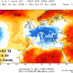
Unwanted Cold Ahead for France to Ukraine
10/28/2026, 6:02 am EDT
Climate Impact Company North America Medium Range Report
Issued: Monday November 2, 2026
Highlight: Turning stormy West/Southwest; Resurgent warmth east of Divide.
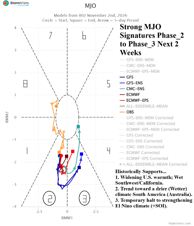
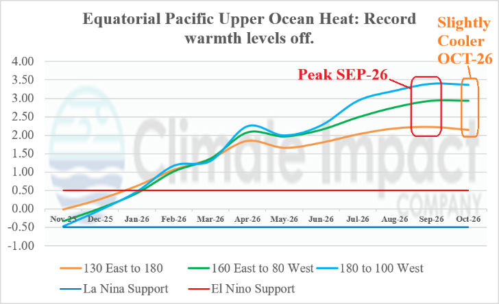
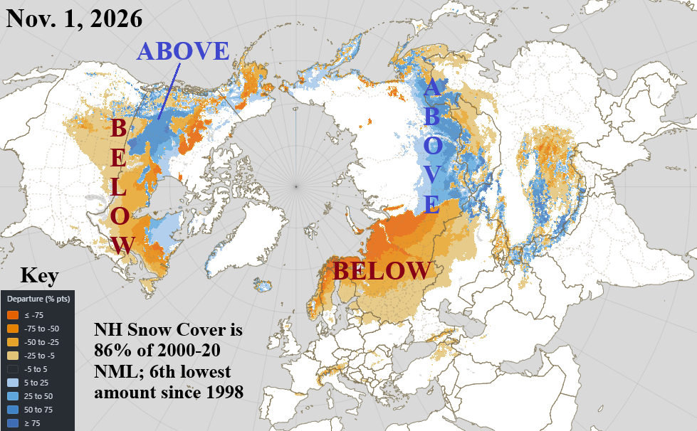
Charts of the day: MJO, equatorial Pacific upper ocean heat, and northern hemisphere snow cover.
Discussion: Of interest is a resurgent convection phase of the Madden Julian oscillation in the tropical Indian Ocean. Super El Nino tropical convection across the Pacific tropics from the Dateline eastward has dominated since boreal summer. The eastward shift of convection may have contributed to the stratospheric warming in the polar region of the northern hemisphere as latent heat release from the Indian Ocean tropical convection poleward and upward (via Rossby Wave) warmed the high atmosphere high latitudes. The MJO is in phase_3 and intensifying. A shift to phase_3 in the medium range (historically) supports widening warmth in the U.S., a wet regime in California and the Southwest U.S., and a pattern change toward a wetter climate in Australia and drier South America. The MJO P2 to P3 shift also (historically) suggests the Super El Nino climate intensity weakens. The October 2026 upper ocean heat anomalies across the equatorial Pacific Ocean indicate values peaked during September and eased slightly in October although still record warm. Finally, and no surprise, given the warm Super El Nino climate influence, early November northern hemisphere snow cover is under-achieving averaging about 86% of the 2000-20 climatology and 6th lowest since 1998.
Medium-range 6-10 Day Forecast Valid November 7-11, 2026 (AI WX NEXT V3 and 24-hour change)
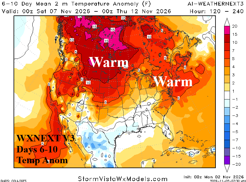
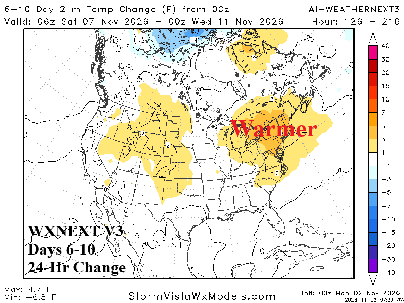
Discussion: Despite a trough in the East, the 4-day average is warmer than normal while the upstream upper ridge warms the West/North-central U.S. and Canada. The 24-hour change is warmer in the East as the cool air associated with upper trough is brief.
Medium-range 11-15 Day Forecast Valid November 12-16, 2026 (AI WX NEXT V3 and 24-hour change)
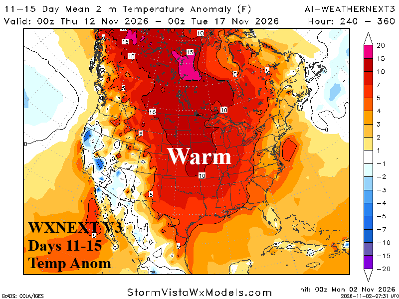
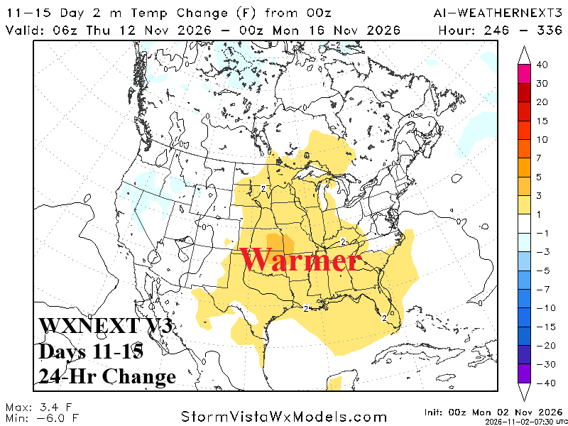
Discussion: Broadening upper ridge warms the U.S. east of the Continental Divide while an upper trough produces a storm track suppressing warm risk West.
U.S. Medium-range Precipitation Forecast (AI WX NEXT V3)
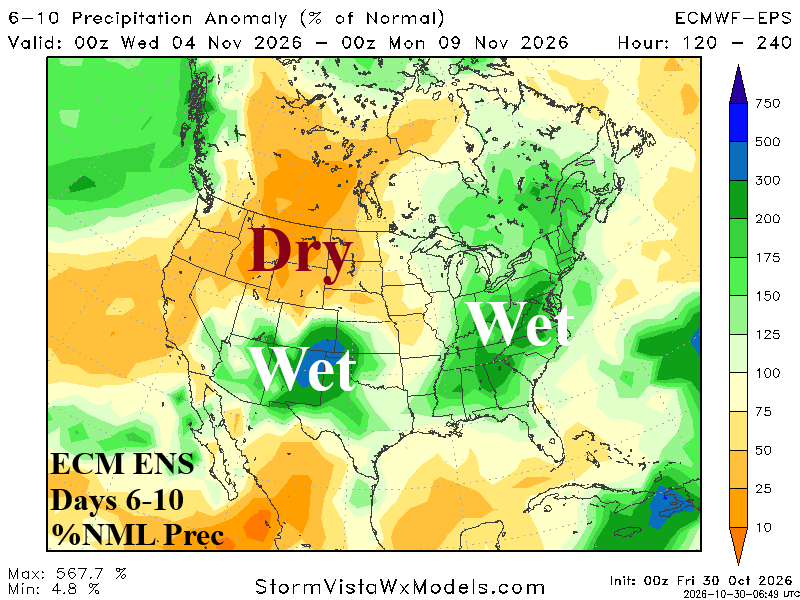
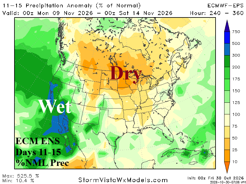
Discussion: Upper trough brings showers to the East in the 6-10-day period followed by a West Coast trough causing soaking rains for California and the Southwest States in the 11-15-day period.
Days 16-20 Extended range Temperature Forecast valid-November 17-21, 2026
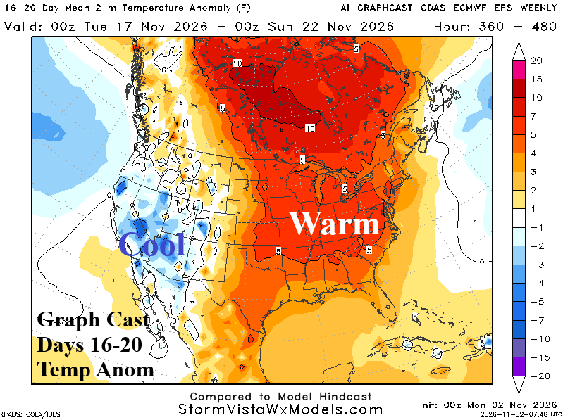
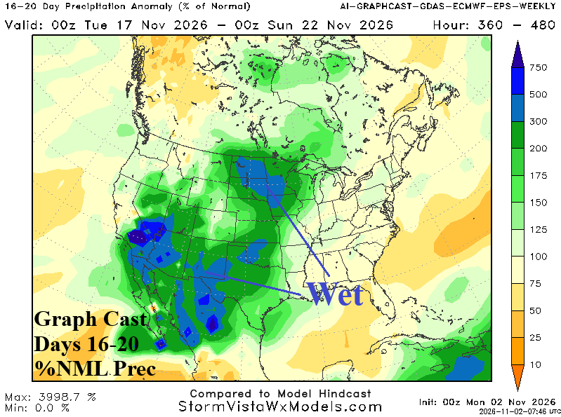
Discussion: Storminess pushes into the Central U.S. while east of the Divide the pattern remains warm.