
New ECMWF Climate Forecasts for DEC/JAN/FEB 2026-27 (North America, Europe, South America, and Australia)
10/06/2026, 12:12 pm EDT
Climate Impact Company North Atlantic Basin 10-Day Monitor
Issued: Thursday October 8, 2026
Highlight: Isaias should reach category-3 major hurricane status tomorrow; Moves inland near Mobile, AL tomorrow early evening.
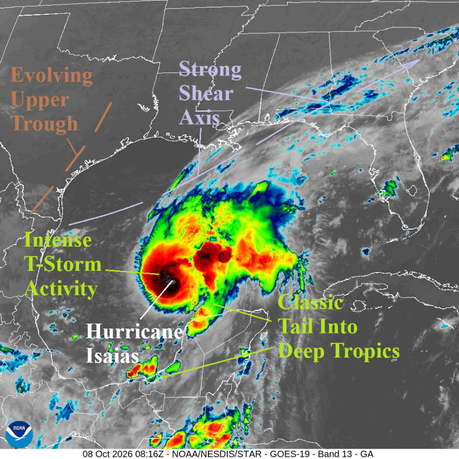
Fig. 1: Weather satellite view of the Gulf of America.
Discussion: At 5AM EDT, Hurricane Isaias was located at 23.3N/91.2W or about 420 miles south-southwest of the Mississippi River. Maximum wind is near 80 mph with central pressure 979 MB and movement east-northeast at 9 mph.
Overnight, Isaias gained intensity and is moving slightly faster. Morning weather satellite view reveals a concentric strong thunderstorm signature with additional heavy convection extending to the east plus a “tail” into the lower latitudes (Fig. 1). This signature indicates additional intensification is likely. The upper shear is immense northwest and north of the hurricane. However, the upper shear is not directly affecting Isaias (yet).
The HWRF and HMON hurricane models continue to intensify Isaias after the encounter with the upper shear begins tomorrow afternoon (Fig. 2-3). HWRF indicates storm peak intensity at 4PM CDT tomorrow at 114 mph, a category-3 major hurricane. HMON brings Isaias to a category-4 major hurricane (134 mph) around 1PM CDT tomorrow. Both forecast model(s) peak intensity forecasts are when Isaias is about 80 miles south of Mobile, AL. HMON is slightly east of HWRF. Landfall is early evening, ranging from just east of Mobile to just east of Pensacola.
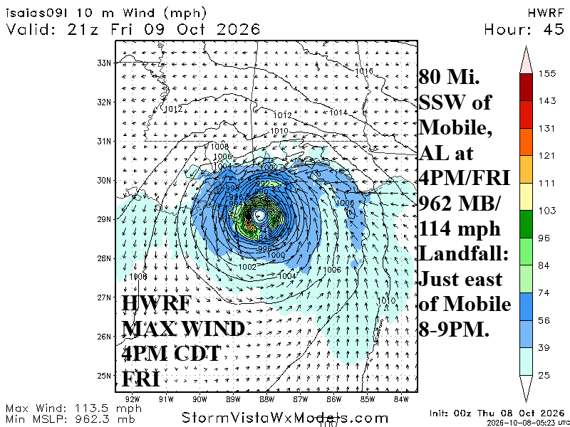
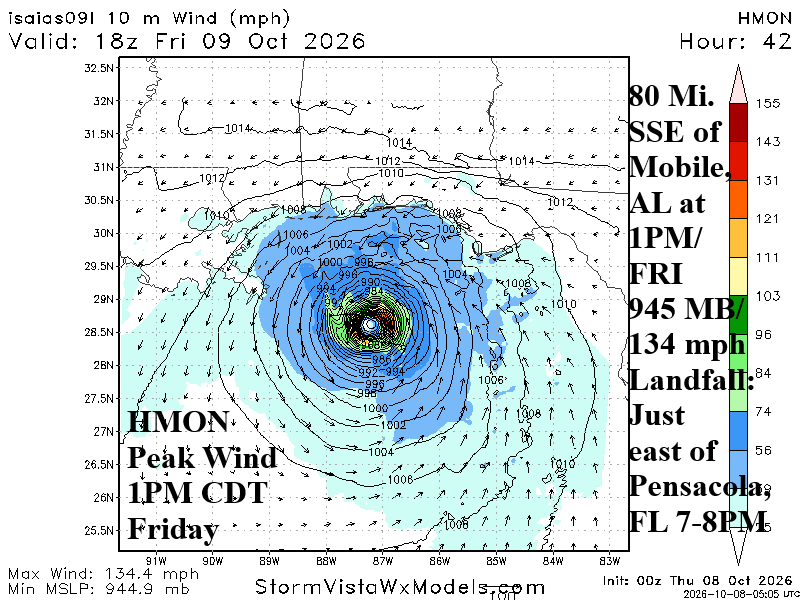
Fig. 2-3: Hurricane models HWRF and HMON and their peak intensity forecasts for Isaias.
Tropical cyclone models are split between just west or just east of Mobile, AL early Friday evening (Fig. 4). Intensity forecasts are also split between a category-1 or category-2 hurricane with one model reaching category-3 major hurricane status (Fig. 5).
Given the information cited and AI Weather Next V3 (Google Deep Mind), Climate Impact Company projects landfall around 8PM CDT just east of Mobile, AL as a category 3 weakening to category 2 hurricane. NOAA/NHC strengthens Isaias to just beneath category-3 major hurricane status and has landfall near or just east of Mobile, AL early Friday evening (Fig. 7).
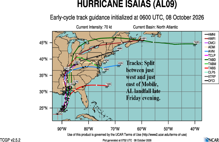
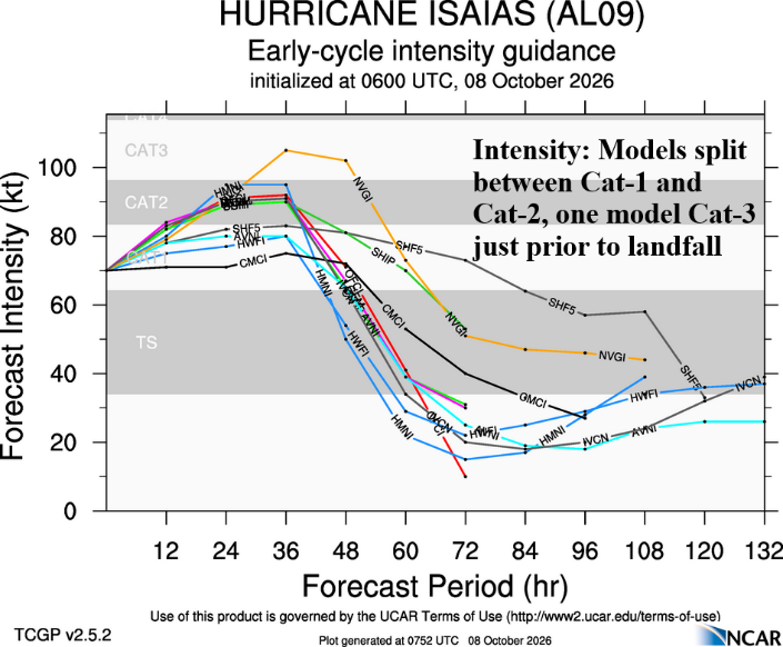
Fig. 4-5: Tropical cyclone models tracks and intensity forecasts.
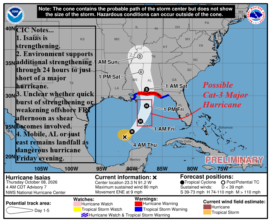
Fig. 6: NOAA/NHC 4-day forecast track for Hurricane Isaias.
The first concern is storm surge forecast up to 7-8 feet from the Mississippi Coast to western Florida Panhandle Coast (Fig. 7). Highest storm surge is just to the right of the landfall location. Rainfall amounts are likely to exceed the NBM forecast (Fig. 8) over land in Alabama to the Florida Panhandle with 10-15 inches possible. Tornadoes will affect much of northwest Florida to southwest Georgia into southern Alabama. Tropical storm force wind extends 100 miles west of landfall and 140 miles east of landfall with hurricane force wind within 25 miles of landfall.
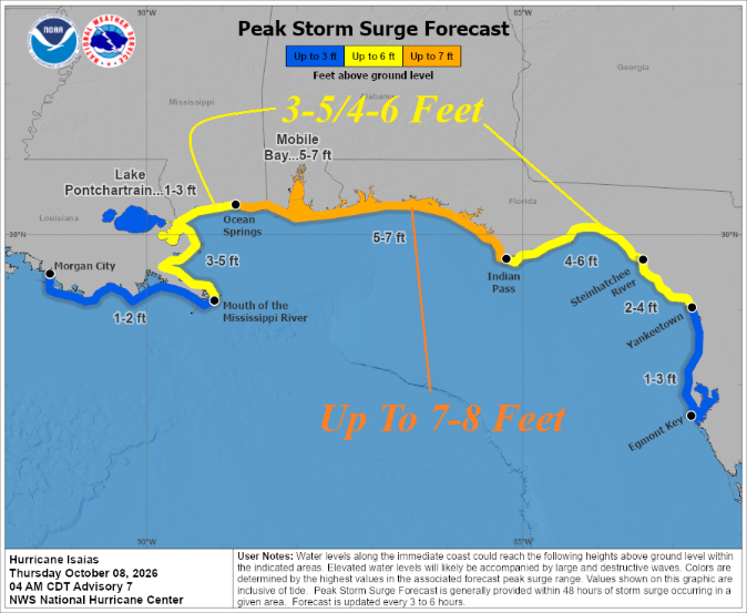
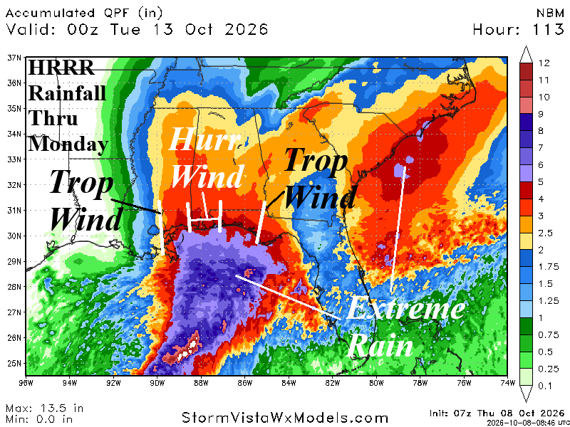
Fig. 7-8: Storm surge forecast from NOAA/NHC and NBM (model) rainfall amount outlook through Monday.