11/27/2024, 10:38 am EST

ECM and CFS V2 in Disagreement on 2nd Half of December in U.S.

The cold burst into the U.S. next week remains in the forecast easing in the 11-15-day period. Interestingly, ECM maintains a colder edge to the mid-to-late December forecast based on heating degree day projections while the CFS V2 is much warmer. The HDD forecasts are heavily weighted by the high population East U.S.
11/27/2024, 10:34 am EST

Wet Pattern in Brazil Continues; Shifts South

The rainfall across parts of Brazil and Bolivia has been in the 4-8-inch range during the past week. Aerial coverage of the wet weather pattern is immense and includes most of Brazil (except northern areas) and Argentina (except western areas). Interestingly, the rainfall occurs during the subsidence phase (across the America tropics) of the Madden Julian oscillation (MJO) which normally inspires a drier South America climate.
11/26/2024, 8:40 am EST

East U.S. Cold Days 11-15: GFS/ECM Vs. AI Forecasts

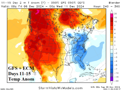
Taking a look at the 11-15-day East U.S. temperature anomaly outlook reveals lingering cold when combining the GFS and ECM forecasts. However, AI models offer wildly different projections (colder or warmer). So...a look at climate diagnostics reveals what direction to rely.
11/26/2024, 8:37 am EST

First New England Snowfall Event of the Season

An early season exercise in snowfall forecasting is offered by the emerging colder weather pattern shifting into the East and the interpretation by the GFS, ECM, and AIFS. Thanksgiving Day looks snowy as cold air filtering into a frontal zone stretched across central and southern New England yields a swath of day-long snow accumulating to 4-8 in. according to GFS.
11/24/2024, 3:11 pm EST

PJM/SERC Hit by Significant Heating Demand Nov. 29-Dec. 5

After a warm autumn, a significant pattern change starting meteorological winter. A much colder forecast for the East trending colder during the 6-10/8-12-day period since late last week. Increased snow cover across Southern Canada into the Northern U.S. inspires the effectiveness of the cold air delivery. Significant heating demand, days when the average temperature is >10F colder than normal, is projected Nov. 29-Dec. 5 across both PJM and SERC sectors.
11/21/2024, 12:40 pm EST

New NOAA Long-lead Forecasts for Winter 2024-25

The NOAA/CPC Seasonal Drought Outlook weakens the Midwest and Interior Northwest drought conditions while maintaining drought in the Northeast Corridor, northwest Great Plains, and much of the southern states.
11/21/2024, 8:46 am EST

Regenerating Argentina Drought in the Summer 2024-25 Outlook

The Climate Impact Company Summer 2024-25 Climate Outlook for South America is updated. The outlook maintains strongest risk of anomalous heat and dryness across Argentina and Central/Northeast Brazil. The wet zone is confined to the south-central coastal region of Brazil.
11/18/2024, 5:40 am EST

MJO-inspired Drier Brazil Climate into Middle December

Expected is a drier climate bias across South America due to emergence of Madden Julian oscillation in the tropical Indican Ocean/Maritime Continent over the next 2-3 weeks. The drier bias is underway during the past week centered on Paraguay, Northern Argentina, and Southeast Brazil. In South America, drought conditions continue across many sectors.
11/17/2024, 10:09 am EST

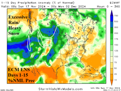
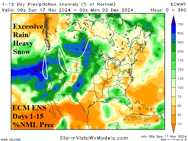
Big Storms Ahead in U.S., Especially for the West Coast

A stormy weather pattern develops on the West Coast this week. Heaviest precipitation is on the Northwest Coast early this week shifting the California Coast late this week/weekend. ECM ENS maintains the stormy pattern across California next week.
11/17/2024, 6:52 am EST

The Inevitability of a Northeast U.S. Drought Caused by the North Atlantic Warm Hole Upper Air Pattern

Red Flag Warnings issued due to high fire risk are relatively rare for the northern Mid-Atlantic to southern New England States. However, warnings for high fire risk have been common during late meteorological autumn across this region as historical drought has developed. The powerful atmospheric subsidence to produce the drought is related to the recent evolution of an upper air pattern caused by the North Atlantic Warm Hole.