08/30/2022, 8:21 am EDT

Mostly Very Warm Weekly Population Weight CDD Totals Summer 2022 in U.S.

Using NOAA population weight CDD observations, the U.S. weekly population weight CDD was variable – normal and warm – early during summer 2022. The hottest part of summer climatologically is when the hottest weekly CDD count occurred in July. Recently, briefly cooler national CDD was observed. The warm season 2022 finishes somewhat warmer than normal.
08/28/2022, 8:56 am EDT

Suppressed Tropics in August About to Change?

Circumstances leading to an unusually dry mid-troposphere during August should start to ease in early September and allow tropical cyclone development to occur and flourish in some sectors. Tropical Disturbance 91L in the central North Atlantic tropics has a chance to become a tropical cyclone while an uptick in southwest Gulf of Mexico and outer North Atlantic tropics activity is likely by late this week.
08/26/2022, 8:38 am EDT

Europe Drought Pattern to Fade

Latest week 2-4 outlook for Europe reveals steady increasing wet risk to evolve in September leading to a fade of the historic summer of 2022 drought pattern.
08/26/2022, 8:19 am EDT

ECM Week 1-6 Outlook Suggests Peak of Tropical Cyclone Season is Around October 1st in North Atlantic

ECMWF indicates the low relative humidity in the low-to-middle troposphere across the central North Atlantic tropics inhibiting August tropical cyclone development eases very slowly in September and not until late month and early October is that pattern favorable for widespread tropical threats. A late peak of season this year!
08/25/2022, 8:03 pm EDT

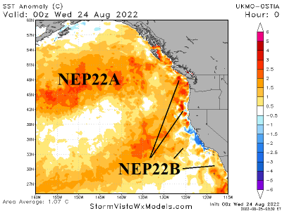
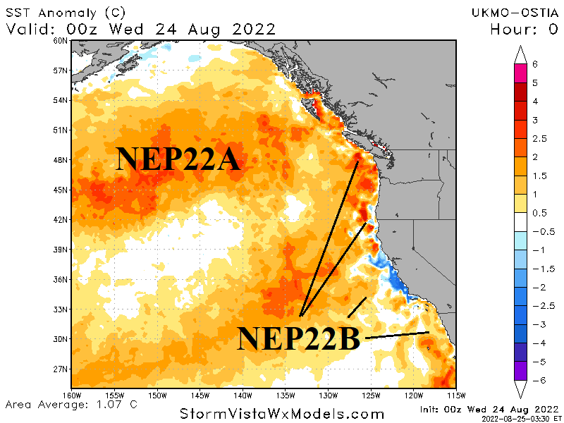
If NEP22A/NEP22B Merge…Cold East U.S. November Likely

Currently, two "warm blobs" are in the northeastern Pacific Ocean. A similar signature was present during early autumn 2014. What happened? The "Warm blobs" merged, and the atmosphere responded with a "ridge bridge" pattern across Alaska and compensating downstream "polar vortex" in the East U.S. by November. A similar scenario is POTENTIALLY setting up now!
08/24/2022, 5:20 am EDT

An Update on Global Drought Areas

Strong to sometimes historic drought has affected many key areas during JUN/JUL/AUG 2022 including China, Europe, the U.S. and South America. 15-day rainfall outlooks indicate more dryness for China, redeveloping dryness in South America, wiping out the Southern U.S. drought and some beneficial rains for parts of the Europe drought area.
08/22/2022, 7:11 pm EDT

North Atlantic Basin Reginal SSTA Trends

As. September 1st approaches, the main development region for hurricanes in the outer tropical North Atlantic is marginally warmer than normal, the greatest warming trend is in the Caribbean Sea and the northeast Gulf of Mexico is steadily warming.
08/22/2022, 4:50 am EDT

The China Drought Catalyst

The summer 2022 China drought is yet another example of large areas of super-warm SSTA (off the East Coast of Asia) and their correlation to drought-producing summertime upper-level high-pressure ridge areas. A similar phenomenon was observed in Europe this summer season.