08/23/2026, 6:43 am EDT

Marine Heatwave NEP25A Shaping The U.S. Upper Air Pattern

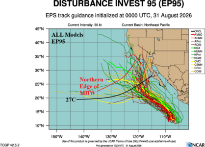
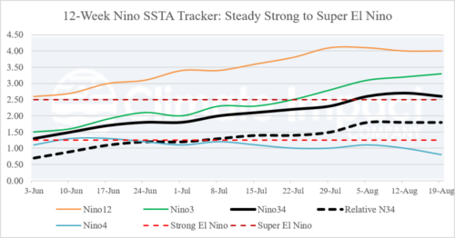
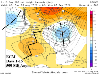
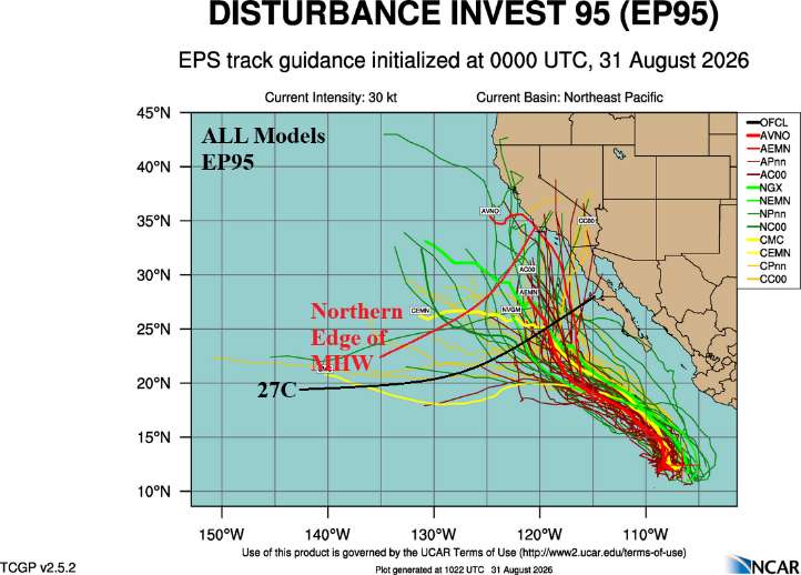
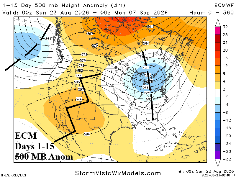
A lot of talk about Super El Nino, but the late summer 2026 upper air pattern is shaped mostly by the influence of strong marine heatwaves (MHW) in the East Pacific and the cooler SSTA zone in-between. Most prominent is Super MHW25A, forming late last year and persisting at record warm levels to date, this warm ocean feature is well-correlated to amplified high pressure centered on the Southwest U.S. and causing this sector of the nation to experience their warmest year on record.
08/19/2026, 4:31 am EDT

Evolving Central/North Brazil Drought/Flood Rain Southeast Brazil ALERT for SEP-DEC 2026

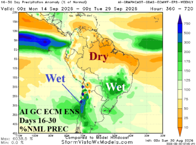
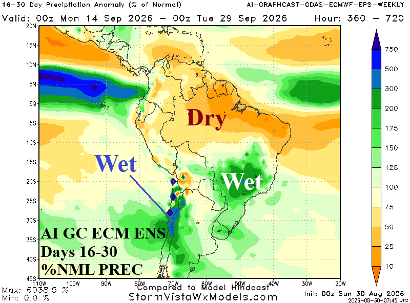
The Climate Impact Company month 1-4 ahead forecast for South America is updated. The outlook is based primarily on the evolution of Super El Nino and variable anomalous warm SSTA off each coast. The outlook warrants an ALERT for developing/widening/intensifying drought in Brazil as meteorological summer 2026-27 arrives. Additionally, excessive rainfall causing dangerous flooding emerges in Southeast Brazil and may expand westward as summertime arrives.
08/18/2026, 8:11 am EDT

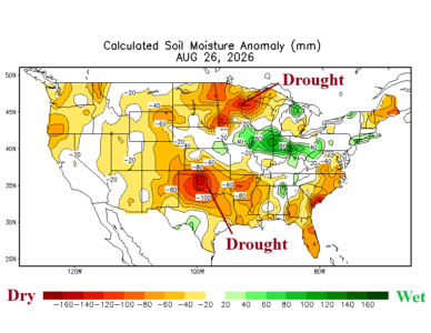
The New Drought Area: Mid-south U.S./Texas/North Gulf Coast

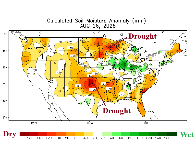
NOAA/CPC issues an alert for the medium range for extreme heat risk covering the southern half of the Great Plains and much of the Southern U.S. The attendant lack of rain is causal to flash drought affecting eastern and northern Texas, all of Oklahoma, southeastern Kansas, western Arkansas, and most of Louisiana and Mississippi.
08/17/2026, 2:10 pm EDT

Super El Nino Propelled by Extremely Warm Subsurface Ocean Temperatures

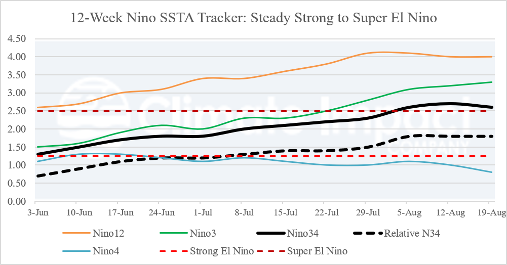
The warmest eastern equatorial Pacific Ocean subsurface temperature anomalies on record are identified by NOAA valid for Aug. 9, 2026. The warmest anomalies are 10-11C warmer than normal near 100-meter depth. The historic warm water identifies the potential energy to warm the ocean surface inspiring an intense El Nino climate.
08/16/2026, 3:45 pm EDT

Beneficial Rainfall Cools off Europe

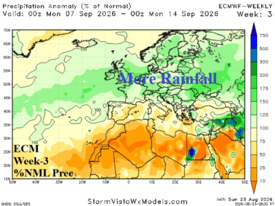
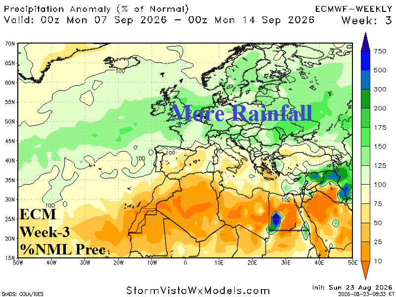
Upper trough elongates across Western Europe causing widespread rain and cooler temperatures to initiate the week 2-4 outlook. The wet weather carries into early September. Farther downstream, anomalous heat continues in the Black Sea region.
08/16/2026, 3:37 pm EDT

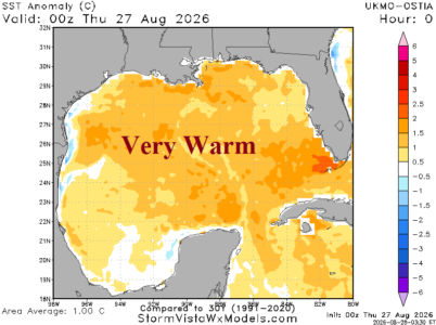
Warm North Atlantic Surface but Upper Ocean Heat Gulf of Mexico Decreases Sharply

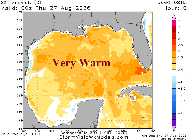
Mexico, Caribbean Sea, and western North Atlantic basin are moderately warmer than normal with little recent change. In the tropics, SSTA is near normal in the central basin with sharp warming off the West Africa Coast. Upper ocean heat in the deep tropics is near normal given the 2013-25 available climatology. Interestingly, upper ocean heat in the Gulf of Mexico has plummeted to lowest levels on record given the 2013-25 climatology.
08/16/2026, 3:33 pm EDT

Extremes In U.S. Soil Moisture Anomalies/August Change

Extremes are evolving in mid-August. Flash drought in a dry climate with excessive heat is underway in the Mid-south U.S. Meanwhile, to the north of the rapidly emerging drought, ring of fire thunderstorms is flooding the Midwest States.
08/14/2026, 8:50 am EDT

Still Hot U.S. Population Weight CDD Forecast

The U.S. population weight CDD forecast indicates a slow decline in anomalous warmth from peak hot week ending August 12th to near normal for the week ending Sep. 2.
08/14/2026, 5:48 am EDT

After Marine Heatwaves Inspire Summer 2026 Heat and Drought, Super El Nino Next Influence on Europe Late 2026 Climate

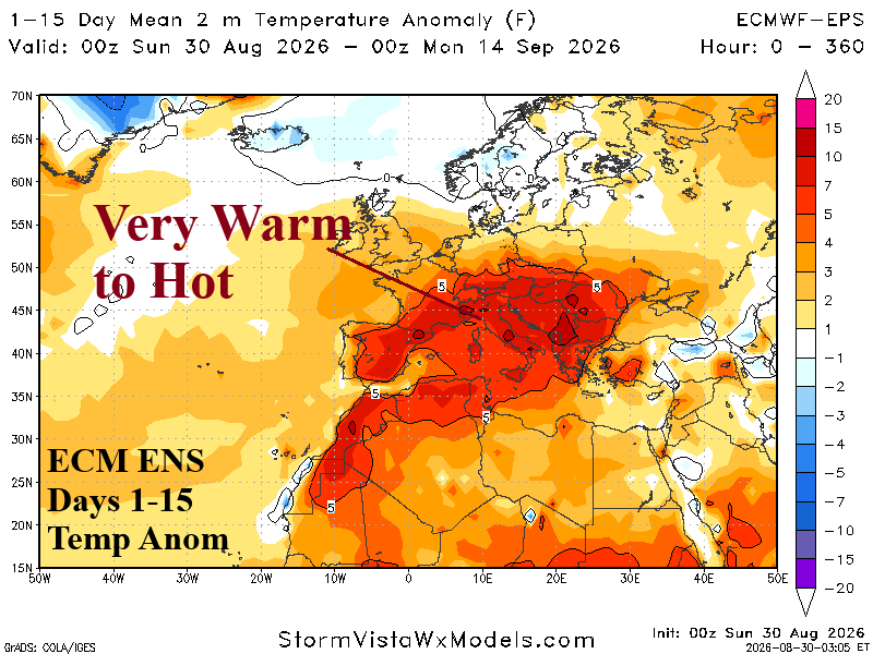
The catalyst to the Europe 2026 heat waves was rapid strengthening of record warm marine heatwaves off the West and Southwest Coast of Europe plus the Mediterranean Sea during late spring to early summer. While African heat (also) initiated the anomalous heat, MHW’s sustained the subtropical high pressure ridge maintaining heat waves through summer 2026. Up next is influence on climate by a record El Nino episode.