
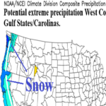
Initial CIC U.S. Winter 2026-27 Outlook
08/27/2026, 10:13 am EDT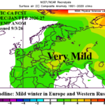
Mild Winter 2026-27 Europe/Western Russia Outlook
09/03/2026, 5:50 am EDT
Climate Impact Company U.S. Medium Range Report
Issued: Monday August 31, 2026
Highlight: Mid-south heat pulsing eastward through the middle third of September.
Chart of the day: EP95A should lead to Southern California flooding.
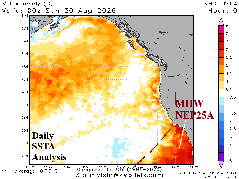
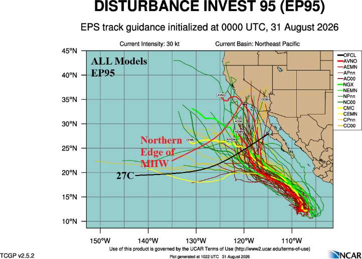
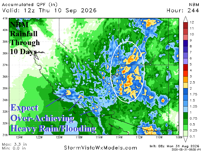
Discussion: Tropical Disturbance EP95 difts northward across the record-strength marine heatwave off the Southwest Coast of North America enabling the system to carry attendant tropical moisture farther north than usual potentially leading to over-achievuing flooding rainfall in Southern California.
Medium-range 6-10 Day Forecast Valid September 5-9, 2026 (AIFS ENS and 24-hour change)
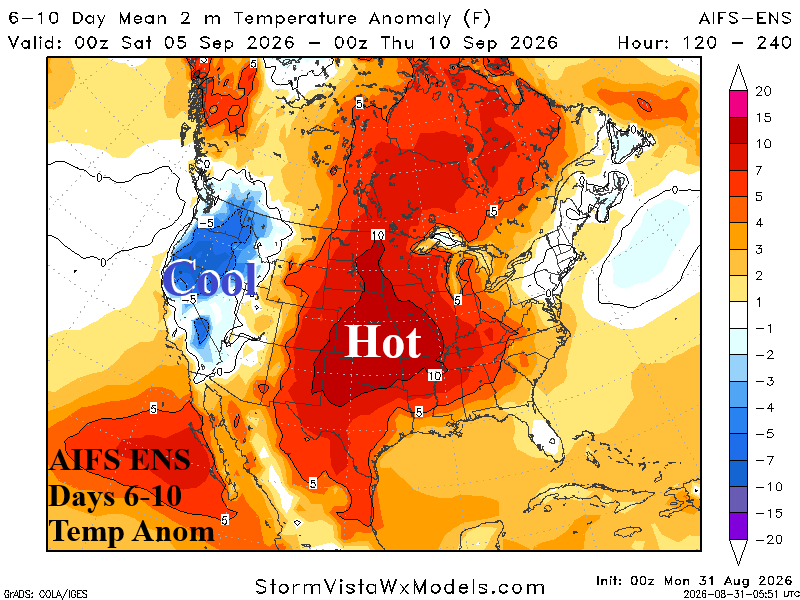
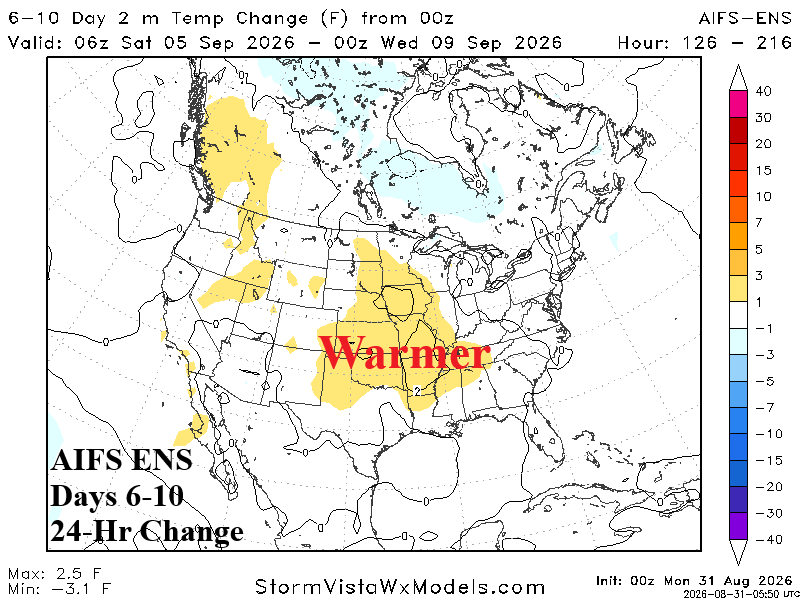
Discussion: AIFS ENS indicates an amplified trough on the West Coast entraining tropical moisture into the Southwest U.S. and California. Upper ridge heats the Central/East-central U.S. with torrid late season heat Kansas to Texas.
Medium-range 11-15 Day Forecast Valid September 10-14, 2026 (AIFS ENS and 24-hour change)
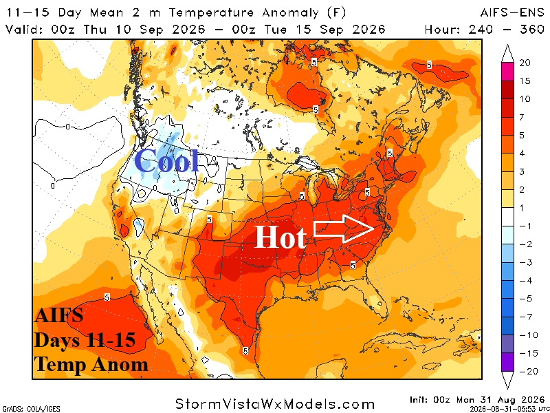
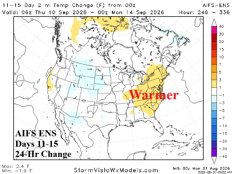
Discussion: Upper ridge settles in the Gulf States and westerly flow on the northern fringe surges Mid-south heat into the East although modified. The Northwest stays cool while California is warmer.
U.S. Medium-range Precipitation Forecast
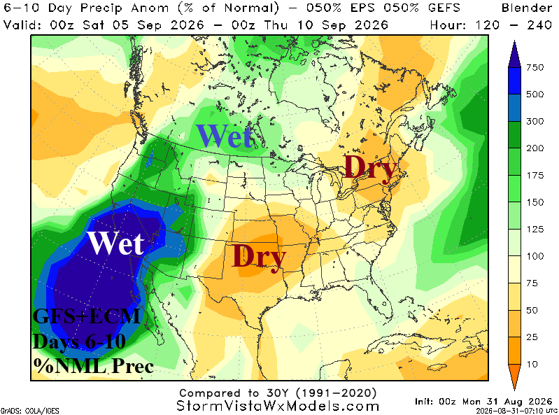
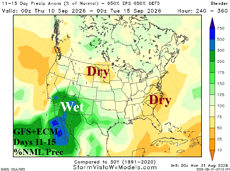
Discussion: East Pacific tropical/subtropical moisture strengthens the Southwest U.S. wet monsoon. Some of the rain spills into Texas in the 11-15-day period. The East is generally drier than normal through the period.
Days 16-20 Extended range Temperature Forecast valid September 15-19, 2026
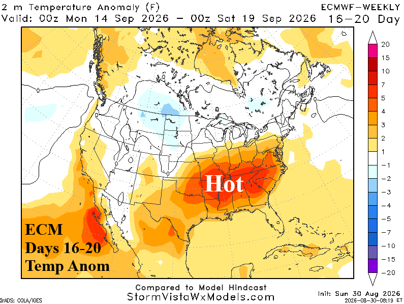
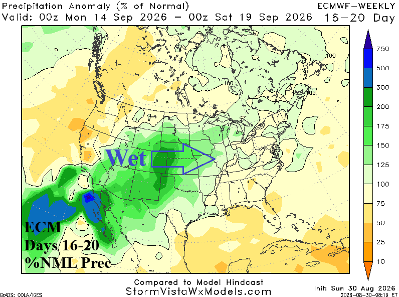
Discussion: ECM indicates another surge of Mid-south and eastward anomalous heat for mid-September while the wet Southwest U.S. monsoon regime extends to the Central U.S.