05/29/2025, 11:34 am EDT
A map of canada with red and white colors AI-generated content may be incorrect.

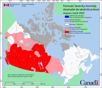
Ongoing Canada Fires/Dangerous Summer Outlook

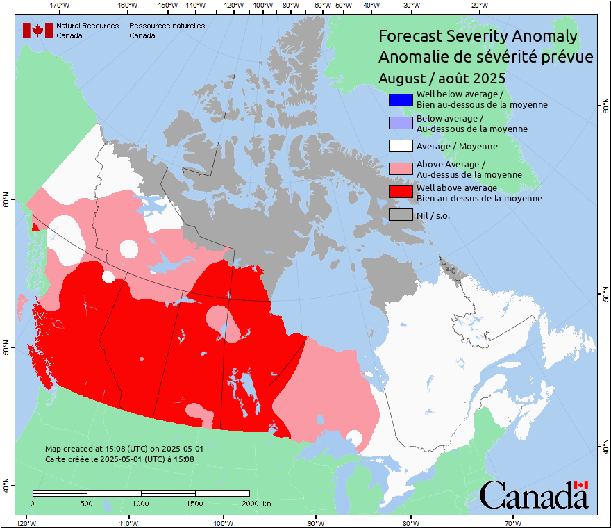
The Canadian Meteorological Center indicates an evolving fire risk across Western Canada during June with a well above normal fire risk for Southwest Canada by July reaching all Southwest and Central Canada (plus Northwest U.S.) during August.
05/29/2025, 9:10 am EDT
A graph showing the temperature of the ocean AI-generated content may be incorrect.

Upper Ocean Heat in Tropical North Atlantic Continues to Lower

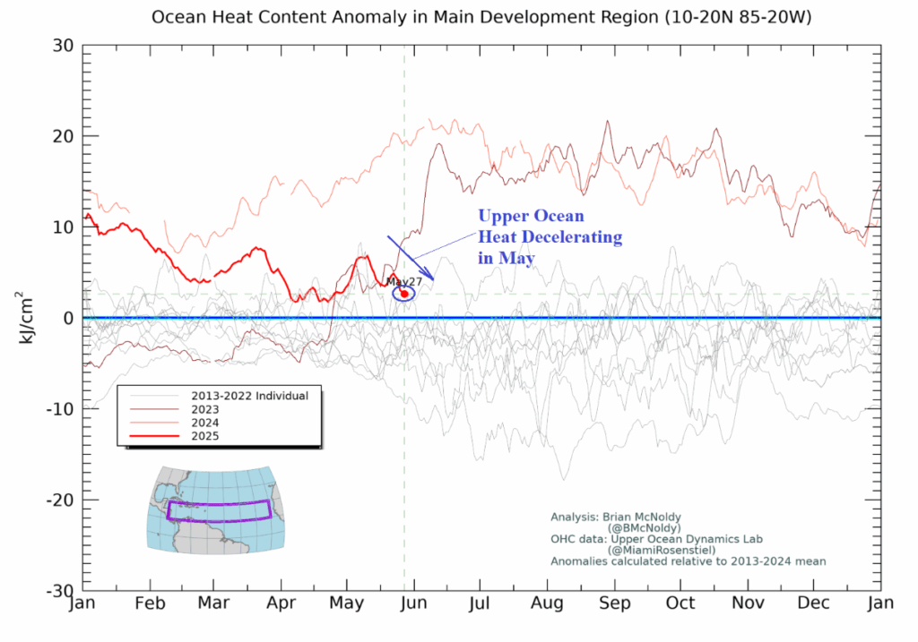
Upper ocean heat across the tropical North Atlantic basin rivaled the warmest values on record established last year to start 2025. However, upper ocean heat is shifting less impressive as June approaches and is now below the record warmth of the past 2 years and within the upper limit of the 2013-22 climatology. A notable decline is observed in May.
05/29/2025, 3:54 am EDT
A map of the weather AI-generated content may be incorrect.

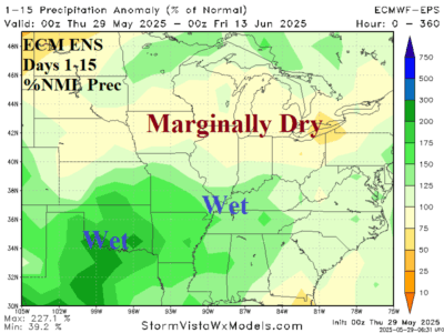
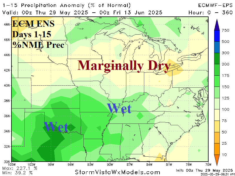
Mid-south U.S. Trends Wetter; Looks Wet for June

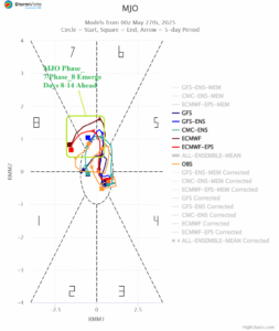
The Madden Julian oscillation 14-day forecast settles on phase_7/phase_8 during the medium range with increasing intensity justifying a cooler and wetter East U.S. forecast. The ECM ENS 15-day percent of normal rainfall outlook indicates wet weather, possibly heavy rain in the southern Great Plains with the wet regime expanding to the Tennessee Valley and southern Ohio Valley.
05/28/2025, 12:31 pm EDT
A map of north america with different colored areas AI-generated content may be incorrect.

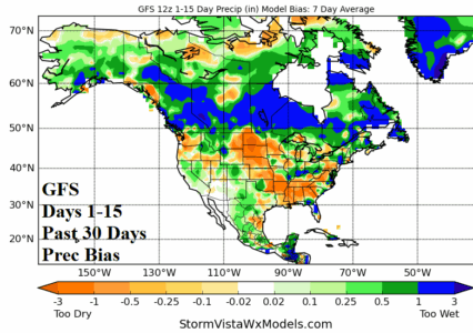
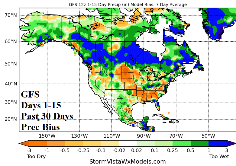
GFS and ECM Rainfall Forecast Bias across U.S. AG Belt

During the past month, both the GFS and ECM have produced dramatic too wet forecast bias across Southern Canada and too dry forecast bias across much of the U.S. AG Belt. The ECM is also too wet on the U.S. East Coast.
05/27/2025, 5:38 am EDT
A graph of a graph showing the weather AI-generated content may be incorrect.

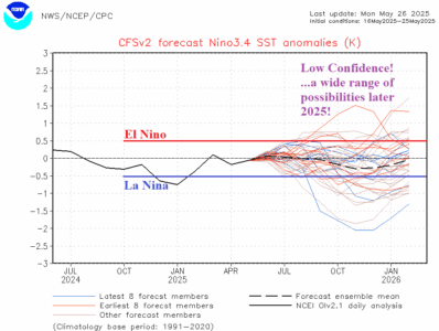
Neutral ENSO Continues; Wildly Uncertain Forecasts!

ENSO is in neutral phase as mid-year approaches. The outlook for later this year is uncertain. In fact, the latest NCEP CFS V2 Nino34 SSTA forecast reveals a range of ENSO phase possibilities ranging from strong El Nino to strong La Nina or continuation of neutral phase for the last third of 2025.
05/27/2025, 5:32 am EDT
A graph of a number of people AI-generated content may be incorrect.

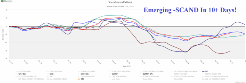
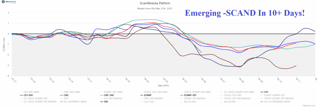
Negative Scandinavia Index Pattern Develops; Cools/Soaks North/Central Europe

Over the weekend, GFS indicated potential for an emerging chilly trough across Northwest Eurasia in the 11-15-day period. Last night, ECM joined forces with GFS as forecast confidence increases dramatically. The negative phase of the Scandinavia Index supports the presence of the projected Northwest Eurasia trough by the operational models.
05/27/2025, 5:28 am EDT

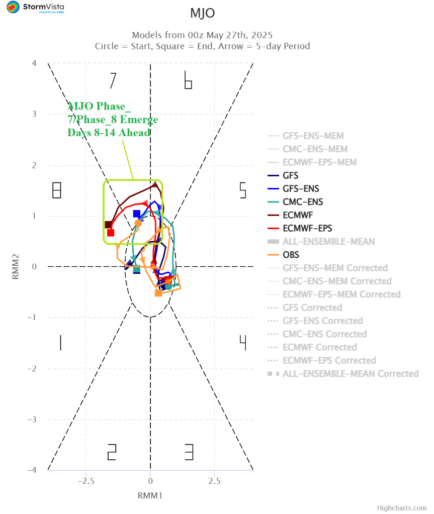
Madden Julian Oscillation Influence to Increase

Operational models are indicating increased risk of anomalous wet weather across much of the Southern U.S. and Brazil during early-to-middle June. Support for the wetter tropical/subtropical weather is increasing as forecasts of the convection phase of the Madden Julian oscillation (MJO) are trending stronger east of the Dateline in the tropics to the American longitudes (phase_7 and phase_8).
05/23/2025, 9:12 am EDT
A map of the weather AI-generated content may be incorrect.

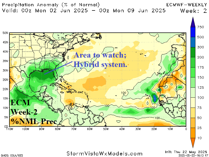
Watching The Gulf of Mexico for Early Season TC Risk

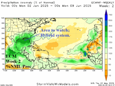
An upper trough located in the northwestern Gulf of Mexico spawning a massive amount of rain across the Gulf of Mexico affecting the coastal region. A careful watch late in the period for any subtropical/tropical low-pressure development.
05/23/2025, 5:08 am EDT

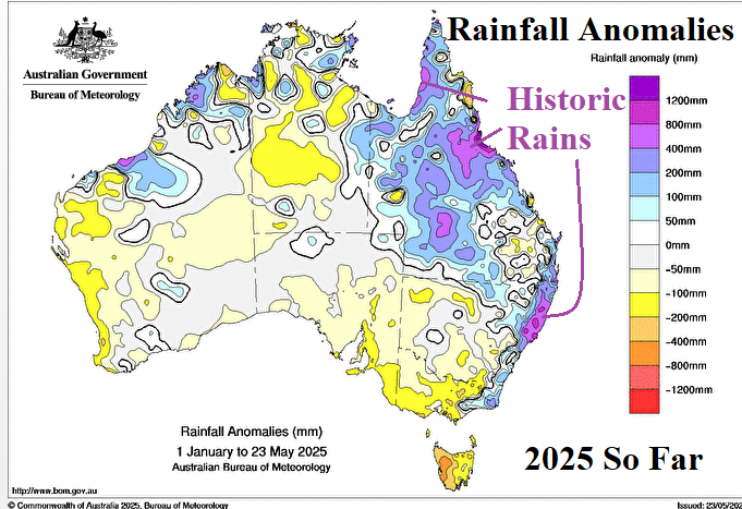
Marine Heatwaves Fueling Historic Australia Rains in 2025

A large increase in MHW’s during the past decade appears to be a leading contributor to global ocean temperature rise and Australia is a location directly affected by the attendant climate produced by MHW’s.
05/21/2025, 9:37 am EDT
A map of the weather AI-generated content may be incorrect.

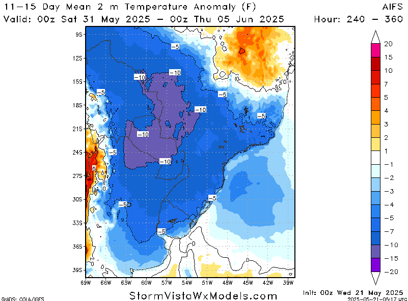
Season’s First Chilly Risk to Southern Brazil in 10+ Days

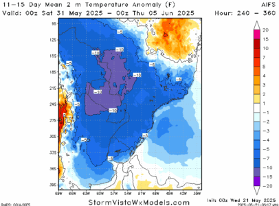
A chilly outbreak remains in the 11-15-day forecast across Argentina into Southwest Brazil as meteorological winter 2025 arrives. There is marginal <32F/<0C risk in northeast Argentina with the season's first cool burst. The intensity of this potential event may be a guide on additional cold risk as wintertime arrives in South America.
05/19/2025, 6:13 am EDT
A graph of different colored lines AI-generated content may be incorrect.

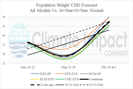
Chilly End to May in U.S.

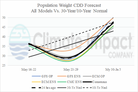
Another week of severe storms and heavy rain in the Central/East U.S. followed by an unusually cool ending to May as indicated by next week's U.S. population weight cooling degree day forecast utilizing all forecast models.
05/19/2025, 4:26 am EDT
A map of the north america AI-generated content may be incorrect.

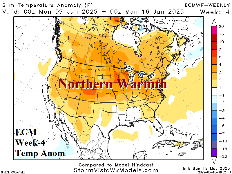
Cool Ending to May East U.S.; Warm-up in June

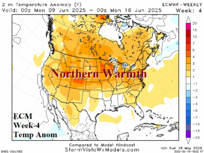
Unusually cool weather across the East U.S. the last third of May but warmer changes in June are forecast by ECMWF including robust anomalous warmth for most of the U.S. by week-4 (June 8-14). A tendency for wet weather in the northwest Gulf region is likely to continue in June.