07/31/2025, 8:43 am EDT
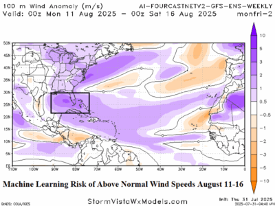
A sophisticated analog system, the machine learning AI 4Cast Net V2 GFS ENS, projects above normal wind speed risk (at 100 meters) in the Gulf of Mexico to the Bahamas for middle August and across the Caribbean Sea for late August. Implications for potential tropical cyclones are suggested by these forecasts.