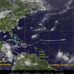
North Atlantic ITCZ Gaining Significant Strength!
07/29/2025, 9:09 am EDT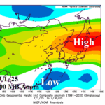
West Pacific Marine Heatwave Maintains China/Japan Excessive Heat Risk
08/01/2025, 12:06 pm EDT![]()
Climate Impact Company Midday Update
Issued: Wednesday July 30, 2025
Headline: 12Z GFS explodes hotter days 11-15 into the Northeast U.S.; If so, hotter than current week!
Tropical environment is improving, despite no imminent threats. Very active pattern is likely to emerge by middle third of August.
New U.S. season 1-4 ahead forecast on website.
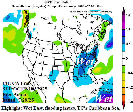
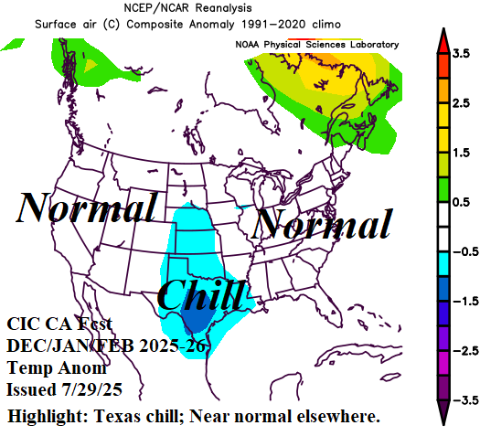
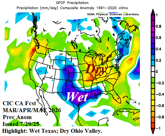

Fig. 1-4: Climate highlights for autumn (Appalachian flooding), winter (normally cold), and next spring/summer (Texas flooding).
Discussion: Climate Impact Company issued the season 1-4 ahead climate outlook for North America valid through next summer earlier today on the CIC website/client pages. Forecast highlights include heavy rain/flood risk for the Appalachian States during autumn (Fig. 1), a (rare) normally cold winter (Fig. 2), and many months in a row of wet weather causing flooding in Texas (Fig. 3-4).
The 12Z GFS is hot in the Southwest during the 6-10-day period and trending warmer from the eastern Canadian Prairies to Quebec (Fig. 5). In the 11-15-day period, the 12Z GFS explodes hotter into the Northeast U.S. (Fig. 6) causing 106 CDD for Aug. 8-14 (Table 1) which would easily exceed the current week.


Fig. 5-6: The 12Z GFS medium range temperature anomaly forecast.
| EIA End | Forecast | 12-Hour Change | 24-Hour Change | 30-Year Normal | 10-Year Normal |
| 7/31 | 96.9 | +0.1 | -0.3 | 80.8 | 87.9 |
| 8/7 | 78.3 | +2.7 | +1.3 | 78.7 | 85.7 |
| 8/14 | 106.0 | +16.7 | +27.2 | 76.1 | 82.7 |
Table 1: The midday 12Z GFS U.S. population weight CDD projections into middle August. Note the hot Aug. 8-14, 2025, projection.