
Broadening U.S. Warmth Ahead; Includes Mid-Atlantic
05/05/2026, 9:24 am EDT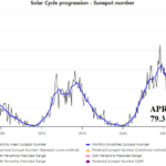
Decelerating Solar Intensity
05/12/2026, 9:34 am EDT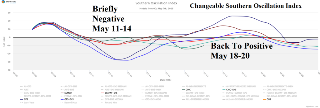

Climate Impact Company Madden Julian Oscillation Outlook
Issued: Thursday, May 7, 2026
Highlight: An active MJO and/or El Nino onset to ignite a wetter pattern change across the U.S. not indicated (yet) through the next 4-6 weeks.,
Discussion: A U.S. pattern change featuring a wetter climate, mostly affecting the Southern States, is forecast by various probabilistic and dynamic models for later this month and early meteorological summer. Required to inspire a wetter pattern is persistent negative southern oscillation (SOI) or the onset and intensification of an El Nino climate.
Currently, the SOI is variable, with a 30-day average of -0.9 which favors El Nino (climate) development (Fig. 1). However, the recent daily SOI is very weak and 15-day forecast maintains a variable signature (Fig. 2). Implied is a shift to an El Nino climate is slow.
The most recent multivariate ENSO index (MEI) valid for MAR/APR 2026 was still in a marginal La Nina (climate) regime (Fig. 3) revealing a significant transition required to produce an El Nino onset. MEI is lagging the ENSO phase trend established by Nino34 and Relative Nino34 SSTA which is away from neutral phase and toward El Nino.
In summary, an obvious shift to steady negative SOI or onset of intensifying El Nino is not (yet) indicated which lowers the risk of a wetter U.S. pattern change later this month to early June increasing the risk that drought expands.
Once the atmosphere shifts to a persistent El Nino phase with attendant negative SOI, realization of the immense upper ocean heat in the eastern equatorial Pacific Ocean (Fig. 4) should force rapid (El Nino) intensification.
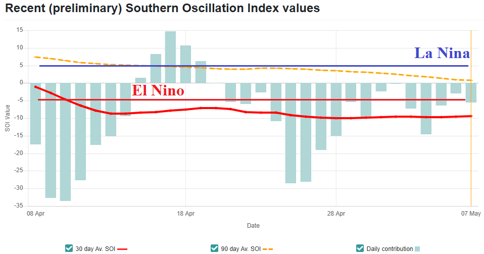
Fig. 1: A sustained negative southern oscillation index to fuel an onset of El Nino is trying but failing as early May arrives.

Fig. 2: The 15-day southern oscillation index forecast indicates choppy character and not the persistent negative signature to force El Nino onset.
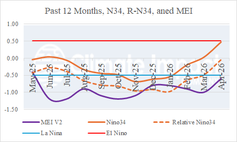
Fig. 3: The multivariate ENSO index, an indicator of the effect of equatorial Pacific Ocean SSTA on global climate, indicates a weak La Nina climate is hanging on while traditional oceanic SSTA observations are warming toward an El Nino episode.

Fig. 4: Upper ocean heat in the eastern equatorial Pacific Ocean is immense and indicates the potential energy to cause an intense El Nino episode is available.