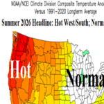
Updated Summer 2026 Outlook: Hot Northwest/West and Gulf States; Wet Midwest; Late Summer Drought Mid-south/Texas
05/04/2026, 5:28 am EDT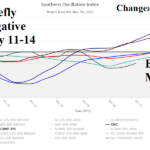
Active MJO and/or El Nino Onset to Ignite Wetter U.S. Pattern Not Indicated (Yet)
05/07/2026, 1:47 pm EDT
Climate Impact Company Week 2-4 Outlook
North America
Issued: Tuesday, May 5, 2026
Highlight: Warm-to-hot pattern shifts to the Great Plains; Heat reaches Mid-Atlantic. Southwest U.S. wet monsoon appears.
Chart of the day: Tracking PJM heat risk for later this month which is increasing.

Discussion: Risk of important heat in the Chicago to Mid-Atlantic PJM Sector is increasing, especially for later this month.
Week-2 Ahead Forecast valid May 17-24, 2026: Increasing confidence in warm pattern broadening across the U.S.
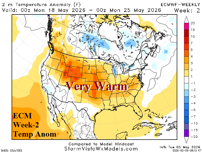
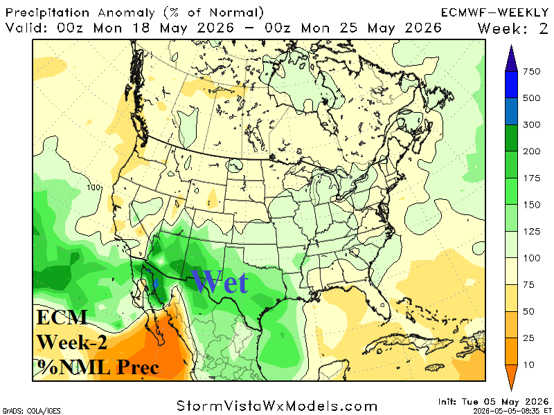
Discussion: Forecast trend is in the direction of high-pressure ridging across the Central U.S. centered near Chicago. The sensible weather is very warm to hot beneath the ridge stretching from the Interior Northwest to the Great Plains and eastward into the Carolinas. ECM projects an upper trough off the West Coast, a low confidence forecast. This feature invites Gulf moisture into the Southwest to produce clouds and showers.
Week-3 Ahead Forecast valid May 24-31, 2026: Broadening warm pattern intact; Southwest and California thundershower risk.
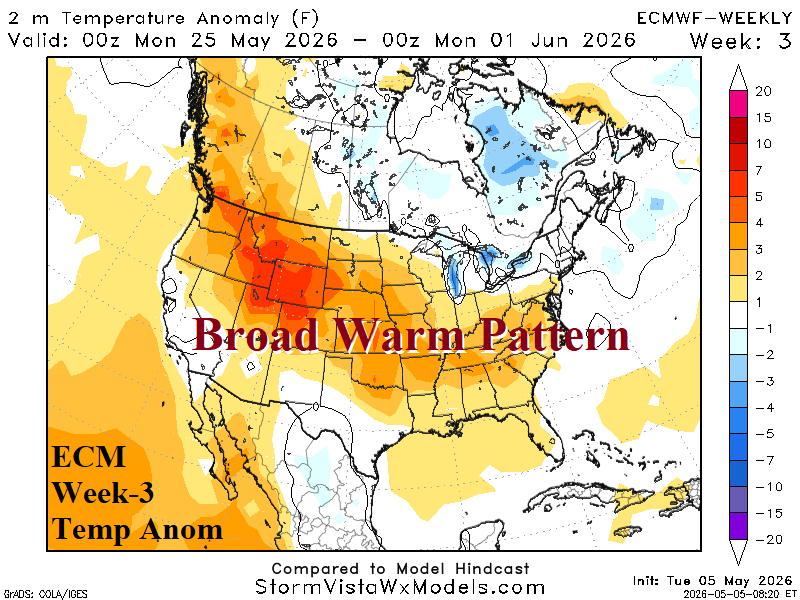
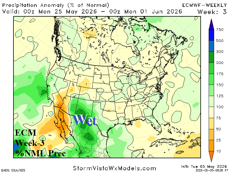
Discussion: Upper ridge finding a home over the Central U.S. promoting heat and dryness late month Northwest, Central, and Mid-Atlantic/Southeast U.S. Wet weather is projected across New Mexico. Upper air pattern supports showers/thundershowers in California.
Week-4 Ahead Forecast valid June 1-7, 2026: Southwest wet weather; Northwest heat/dryness.
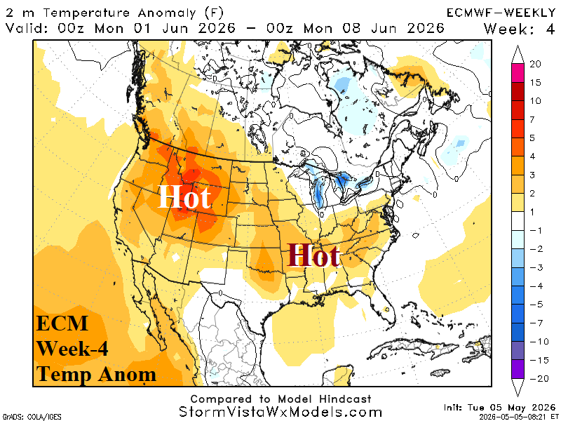
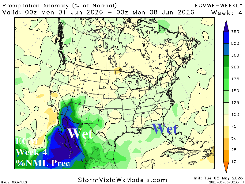
Discussion: Upper ridge is shifting back into the Northwest. In this pattern, monsoon moisture is invited into the Southwest U.S. Anomalous warmth (also) persists Mid-south to the Carolinas.