
Hottest July on Record from the 133-year Climatology in U.S.
08/11/2026, 9:01 am EDT
After Marine Heatwaves Inspire Summer 2026 Heat and Drought, Super El Nino Next Influence on Europe Late 2026 Climate
08/14/2026, 5:48 am EDT
Climate Impact Company Daily Feature
Issued: Wednesday, August 12, 2026
NOAA issues alert for excessive heat/flash drought centered on Mid-south U.S. and extending across Southeast States.
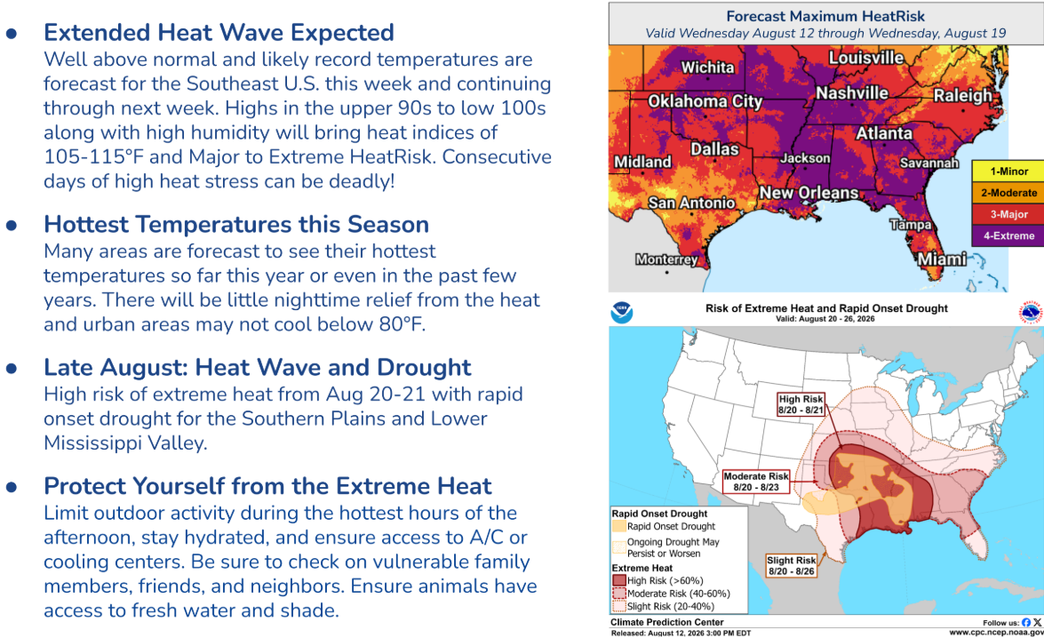
Fig. 1-2: The NOAA/CPC excessive heat/flash drought alert announcement.
Discussion: NOAA/CPC issues an excessive heat/flash drought alert already underway in the Mid-south States and likely to intensify and persist most of the remainder of August while expanding into the Southeast States. The “Extreme” heat stress indicated in the purple zones valid through the next 7 days indicate a life-threatening scenario with >100F days, high humidity and extreme heat index, and not much recovery at night (Fig. 1). The extreme risk extends from Southern Illinois to the Gulf States and includes the southern Great Plains and Carolinas. “Major” heat risk reaches Southern Virginia.
The excessive heat continues in the 8-14-day period (Fig. 2) un-leashing a flash drought extending from the Southeast Great Plains to Eastern Texas and eastward through the Mid-south States to the Central Gulf States.
AIFS ENS 15-day temperature and precipitation anomalies forecasts identify the core of the heat accompanied by an arid climate pattern (Fig. 3-4). The hottest 15-day forecasts are Tulsa and Little Rock where the consensus of forecast models project 106-107F maximum temperatures for much of next week (Fig. 5-6).
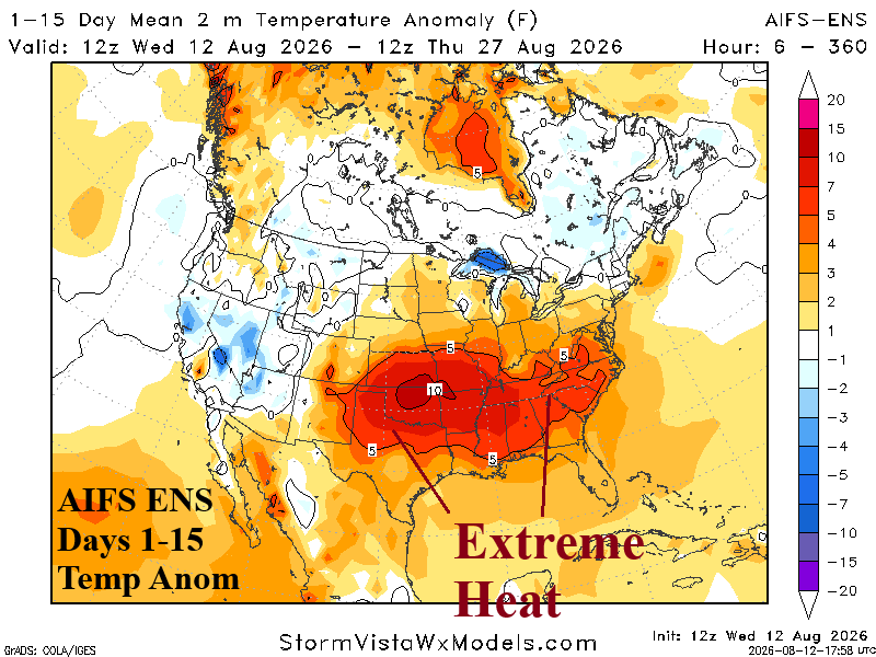
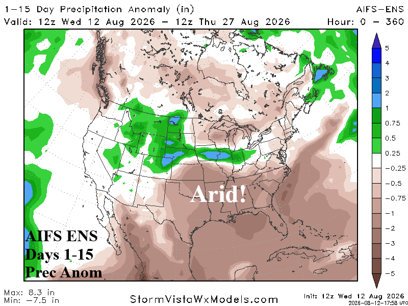
Fig. 3-4: AIFS ENS 15-day temperature and precipitation anomalies outlooks.
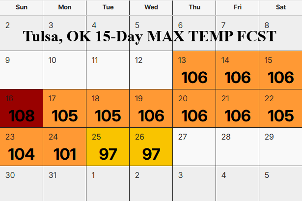
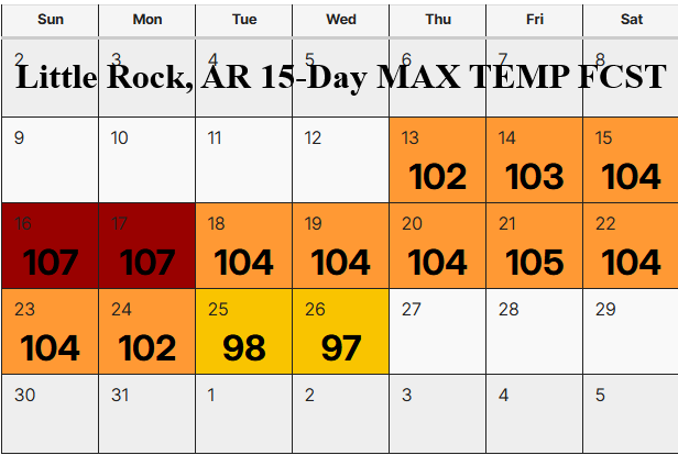
Fig. 5-6: Utilizing all models, the hottest 2 maximum temperature forecasts.