05/31/2022, 11:30 am EDT

The Likely Evolution of “Alex”.

An area of low pressure is situated over far Southeast Mexico and is expected to consolidate into a more organized center in about 48 hours off the north coast of Belize. At that time, ECMWF indicates this system is likely a tropical depression. This system drifts north-northeastward on the back side of the North Atlantic subtropical ridge late this week and crosses water sufficient to allow intensification to a tropical storm.
05/30/2022, 9:58 am EDT

La Nina Trend Weaker and That Trend is Likely to Continue

Last week the Nino SSTA regions warmed as moderate intensity La Nina weakened slightly. The slight weakening trend is likely to continue although the La Nina climate pattern is likely to hold for 2022.
05/30/2022, 9:49 am EDT

Madden Julian Oscillation Shifts to Atlantic in Early June Increasing TC Risk

The convection phase of the Madden Julian Oscillation has shifted into the tropical East Pacific and helped trigger Hurricane Agatha. Forecasts indicate the MJO shifts to the tropical Atlantic in early June which supports tropical cyclone activity development - most likely in the Gulf of Mexico.
05/27/2022, 9:55 am EDT

Projected U.S. High Impact Climate June Through September

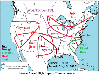
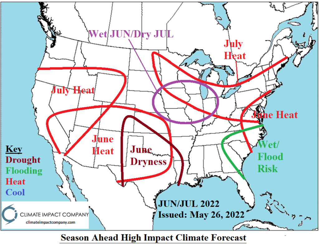
The primary concerns heading into summertime are drought (and attendant anomalous heat) and coastal tropical cyclone risk. The JUN/JUL 2022 outlook emphasizes dryness (and anomalous heat) across Texas and into the Southwest States. Drought in this region, particularly Texas strengthens. The Midwest States are wet in June and flip very dry mid-summer.
05/27/2022, 9:45 am EDT

Mid-Atlantic Squall Line Features Tornado Risk

A TORNADO WATCH is in effect for the Mid-Atlantic States to 2PM EDT. A new watch for this afternoon extending across the northern Mid-Atlantic States is likely! The HRRR model identifies the axis of the squall line across west-central Virginia to far northeast South Carolina at 10AM. The squall line produces a tornado risk, wind gusts to 6-65 mph, heavy rain and moderate lightning frequencies. By 1PM EDT, the squall line reaches the Baltimore/Washington to Richmond stretch.
05/26/2022, 10:04 am EDT

The Amundsen Sea Semi-Permanent Low-Pressure Trough

Beginning in 2020, a large area of low-pressure formed in the Amundsen Sea off the Antarctic Coast well southwest of South America. The upper trough has intensified and persisted through 2022 so far. There is correlation between the presence of this upper trough and winter cold risk in South America.
05/24/2022, 8:34 am EDT

Accumulated Cyclone Energy Index Vs. Atlantic Multidecadal Oscillation

Since the middle 1990’s, the “activeness” of the North Atlantic basin seasonal tropical cyclone activity has generally been above too much above normal due to the long-term warm cycle of AMO and the lack of El Nino presence (only 24% of the months from 1995-2022).
05/23/2022, 12:32 pm EDT

Oceanic La Nina Moderately Strong; La Nina Atmosphere Very Strong

The Nino23 SSTA regions remain consistent in the moderate intensity of La Nina range for mid-May. However, mostly very negative daily southern oscillation index implies the atmosphere is locked-in on strong La Nina presence. Models are indicating some weakening of La Nina for just-after mid-year but no signs of that weakening yet.
05/22/2022, 11:15 am EDT

East-central/East China Continue Drier

East-central/East China wheat-growing areas have turned much drier in recent weeks. Last week no rainfall was reported in this region and 15-day outlooks maintain the dry concern.
05/22/2022, 11:07 am EDT

May 2022 North Atlantic TC Seasonal Activity Forecast Update: La Nina Continues – Seasonal Activity Forecast Increases

The Climate Impact Company 2022 North Atlantic seasonal activity forecast has increased slightly since the initial projection one month ago. The number of tropical storms, hurricanes and intense hurricanes each increases by a count of 1 to 20 storms, 10 hurricanes and 5 intense hurricanes. The ACE index increases from 135 to 149. The increase in activity is due to a more confident La Nina climate forecast.
05/18/2022, 3:59 pm EDT

GFS/ECM Trending MUCH Wetter in Texas in 6-10-Day Forecast

The GFS produced a consistent tropical cyclone risk in their medium/extended-range forecasts since late last week. However, the GFS has dropped that idea late last night and today. Instead, GFS produces an excessive rainfall episode as an upper trough entrains western Gulf of Mexico moisture next week producing >10 in. of rain in some spots based on today’s 12Z GFS.