
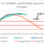
Record Strength El Nino Ahead for Later 2026!
07/16/2026, 4:34 am EDT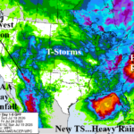
Favorable Madden Julian Oscillation: New TC in Gulf, Wet Southwest Monsoon, and Wet East Coast
07/19/2026, 2:02 pm EDT
Climate Impact Company Week 2-4 Outlook
North America
Issued: Friday July 17, 2026
Highlight: Late July/early August shifts hotter Central U.S. followed by an emerging wet pattern defeating heat first 2 weeks of August.
Chart of the day: Rapidly intensifying strong El Nino in August, typical climate.
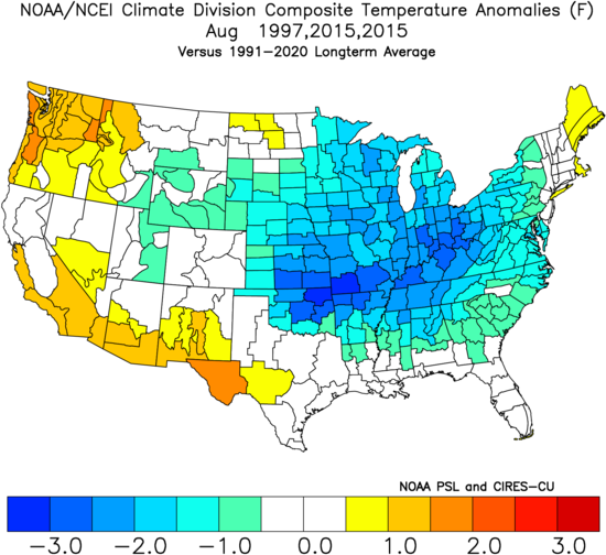
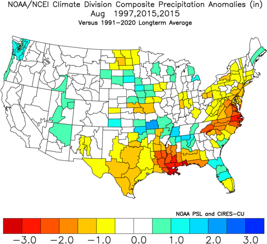
Discussion: 1997 and 2015 produced rapidly strengthening intense El Nino climate patterns. In the U.S., the temperature bias during August is cool across most of the eastern half of the U.S. while dryness dominates the Gulf States and Mid-Atlantic region. The 2015 El Nino weights twice due to the much warmer global oceans compared to 1997. In 2026, global oceans are much warmer than 2015 lending a warm bias to the cool analog.
Week-2 Ahead (July 26-August 2, 2026): Expansive Central U.S. heat.
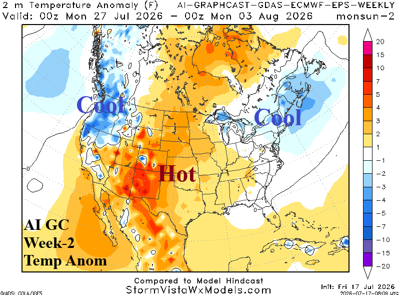
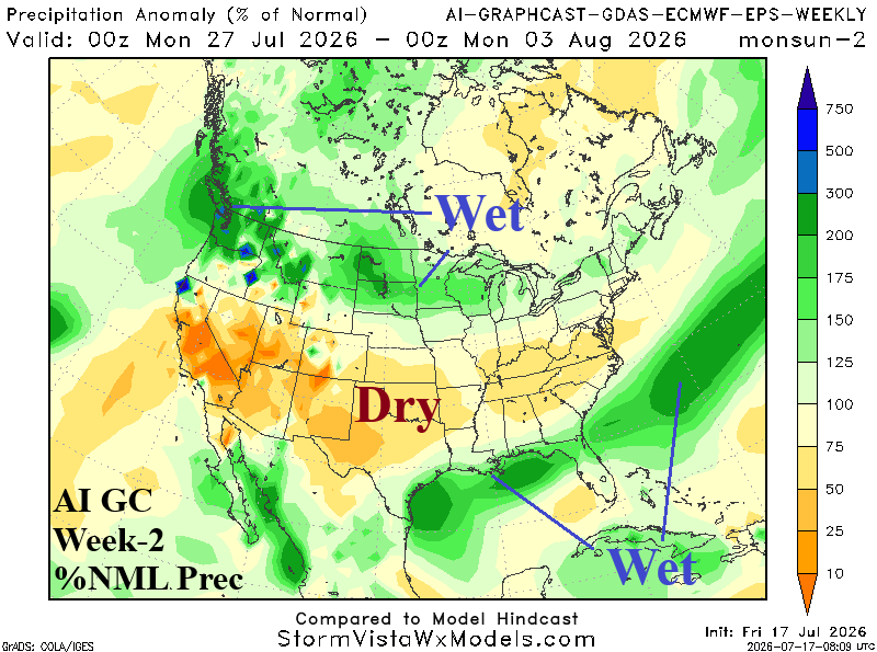
Discussion: Upper troughs in the Northwest and Northeast forces an amplified hot high-pressure ridge in the Central U.S. The Southwest to Mid-Atlantic States is dry. Thundershowers pounce on the Northwest U.S.
Week-3 Ahead (August 2-9): Northeast quadrant likely to avoid heat; West U.S. is hotter.
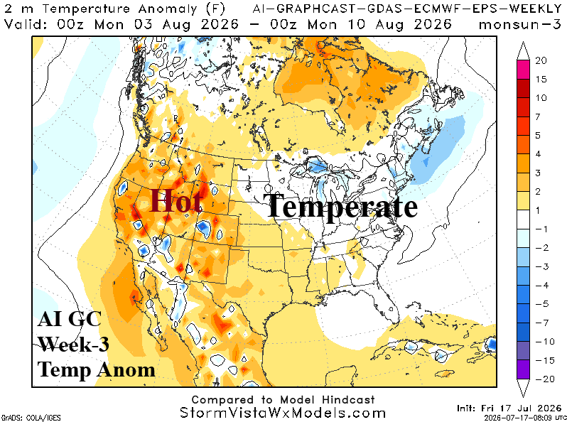
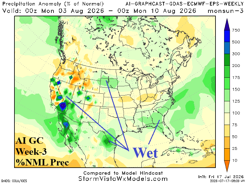
Discussion: El Nino climate supports cooler East and a westward push of anomalous heat indicated by Graph Cast in early August. The Southwest U.S. wet monsoon redevelops.
Week-4 Ahead (August 9-15): Nationally, wetter! Northeast could be warmer than indicated.
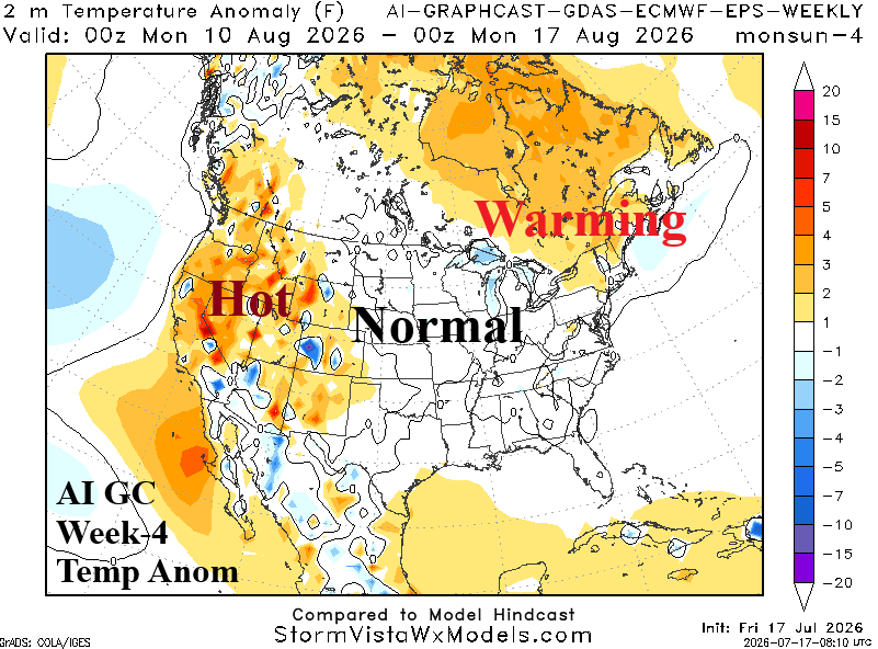
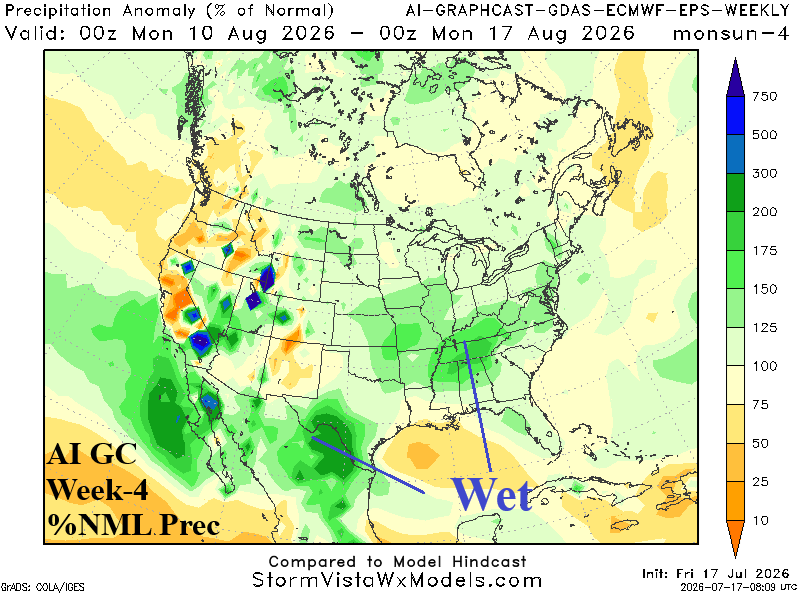
Discussion: Wetter trend is prominent in the week-4 Graph Cast forecast and the rains suppress heat risk. The Central and East are near normal. Upper ridge brings anomalous warmth to Quebec which may extend farther south to the Northeast U.S. Corridor.