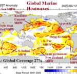
Global Marine Heatwave Aerial Coverage is 27% and Forecast to Reach 40% Q3/2026
04/23/2026, 8:28 am EDT
Slow Expansion of Great Plains D2-D4 Drought
04/30/2026, 12:17 pm EDT
Climate Impact Company Northwest Hydro Report
Issued: Tuesday, April 28, 2026
Highlight: Faster emergence of very warm temperatures to produce rapid snowmelt/flooding potential in Southwest Canada.
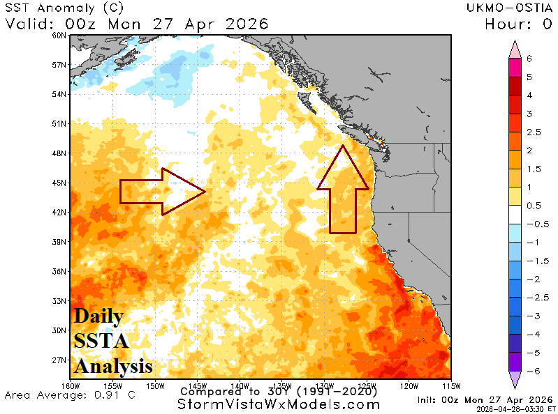
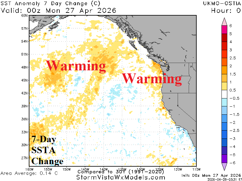
Fig. 1-2: Record aerial coverage of the Northeast to Southeast Pacific marine heatwave (NEP25A).
Discussion: Last year, NOAA identified the semi-permanent marine heatwave (MHW) NEP25A off the U.S. West Coast and a second MHW (NEP25B) off the Baja California/Southwest California Coast. At one point (last September), NEP25A reached a near record aerial coverage. NEP25B was different, displaced farther south and not seen since in this region since the 2014-16 “warm blob” era. Importance is to maintain a distinction between the two MHW’s which for some reason dropped by NOAA. NEP25B is impressive although holding steady while extending over 5,000 miles to the south of Hawaii. Meanwhile, NEP25A is strengthening off the Northwest Coast, also expected to continue.
The issue is important due to anticipated correlation between warm MHW oceanic regimes and high-pressure ridging over the Northwest U.S. and Southwest Canada. The anticipated pattern has developed early. An amplified high-pressure ridge brings very warm temperatures to Southwest Canada extending into next week likely causing significant snowmelt and potential flooding to due rapid runoff.
Previously, this regime was expected in full force during the late calendar spring. However, early arrival will melt much (not all) of high elevation snow. The climate link to the anomalous warm Northeast Pacific continues well into summer. Consequently, additional warm weather and melting snow events occurring earlier than previously expected is likely. Once meteorological summer arrives, the upper ridge becomes persistent, especially after a wetter than normal Southwest U.S. wet monsoon arrives.
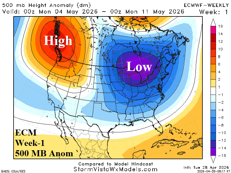
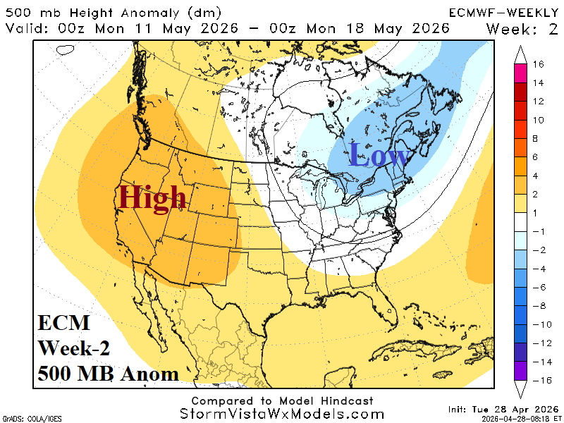
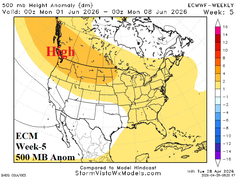
Fig. 3-5: ECM “weeklies” indicate a powerful 500 MB high pressure ridge across Southwest Canada next week, displacement of the ridge to Western U.S. the following week, and potential for another amplified upper ridge in 5 weeks.