07/06/2025, 12:20 pm EDT
A map of different colors AI-generated content may be incorrect.

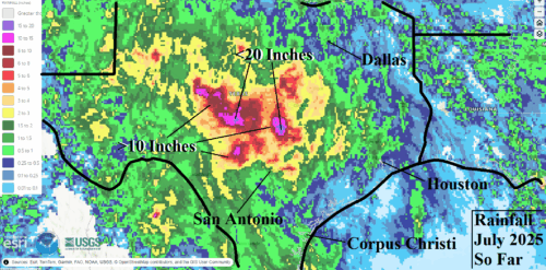
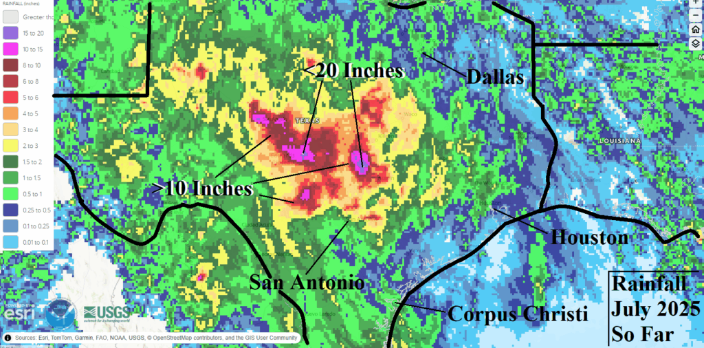
Ongoing Texas Heavy Rain Bursts/Flooding

A semi-permanent upper-level low-pressure trough located over southeast New Mexico during early July entrained tropical moisture off the East Pacific Ocean and western Gulf of Mexico creating the perfect set-up for persistent heavy rains. The development of the semi-permanent low-pressure area was potentially related to the unusually wet monsoon pattern of early summer. The early July rainfall observations across Central Texas indicate widespread >10-inch regions with high spots exceeding 20 inches.
07/06/2025, 7:03 am EDT
A map of the united states AI-generated content may be incorrect.

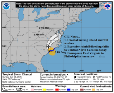
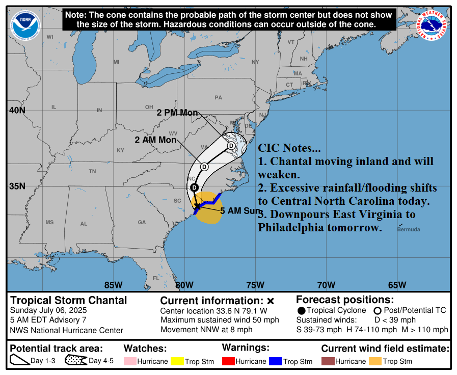
Tropical Storm Chantal Moves Inland South of Myrtle Beach, SC

The NOAA 2-day forecast track indicates Chantal turns northward across central North Carolina later today and weakens completely drifting across Chesapeake Bay late tomorrow. The heavy rain/flood risk shifts to north-central South Carolina and central North Carolina today and across Eastern Virginia to near Philadelphia tomorrow.
07/05/2025, 11:15 am EDT
A map of different colors AI-generated content may be incorrect.

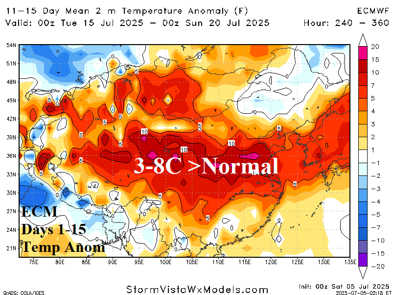
Another Marine Heatwave Induced Excessive Hot Weather Regime: East China/Japan

Yet another location struck by marine heatwave enhanced air temperature during late JUN/early JUL as East China (and Japan) have turned excessive excessively hot (and dry). During the 7-day period ending July 3, 2025, temperature anomalies range from 2-4C >normal for East China and South Japan and near 8C >normal in parts of Northeast China.
07/05/2025, 7:01 am EDT
A map of a storm AI-generated content may be incorrect.

TD 3 Expected to Become a TS; Drift Into South Carolina Tomorrow

Tropical Depression 3 is forecast to strengthen to a tropical storm today, turn north-to-northwestward, and strike the upper coast of South Carolina Sunday morning. Tropical storm conditions are expected on the upper South Carolina Coast/Lower North Carolina Coast late tonight and Sunday. The next storm name is Chantal.
07/02/2025, 5:51 am EDT
A map of the world AI-generated content may be incorrect.

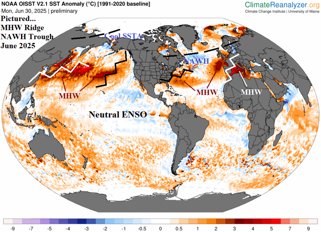
Marine Heatwaves and the June 2025 Northern Hemisphere Climate

Neutral or weak ENSO events do not imply low skill climate forecasts. Recognizing the new mid-latitude (mostly warm) SSTA regimes can not only foreshadow climate patterns ahead but also recognize the potential for extreme events such as heatwaves, droughts, and flooding rainfall episodes.
07/01/2025, 9:48 am EDT
A map of the united states with rain and flood warning AI-generated content may be incorrect.

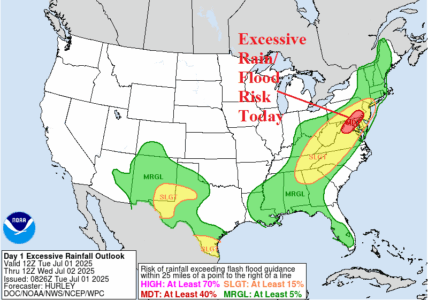
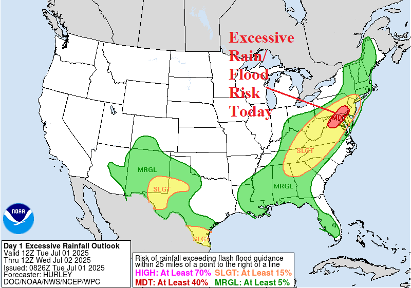
Excessive Rainfall/Flooding Mid-Atlantic Today

NOAA/SPC projects strong thunderstorms across the East and Southeast U.S. for today. Included is a severe weather risk caused by damaging wind potential in Virginia, Maryland, Delaware, Pennsylvania, and New Jersey. The event is lengthy, mid-afternoon to midnight, therefore repeat events can cause excessive rain and flooding most likely in the Washington/Baltimore area.
07/01/2025, 5:40 am EDT
A graph of different colored lines AI-generated content may be incorrect.

Equatorial Pacific Upper Ocean Heat Remains Marginally Warm in June

Regarding ENSO, the equatorial Pacific upper ocean heat anomalies stay marginally warm in JUN-25. Implied is no risk of La Nina return, although NCEP CFS V2 is boldly forecasting La Nina for late 2025, with marginal support pointed toward El Nino.
07/01/2025, 5:27 am EDT
A map of the weather AI-generated content may be incorrect.

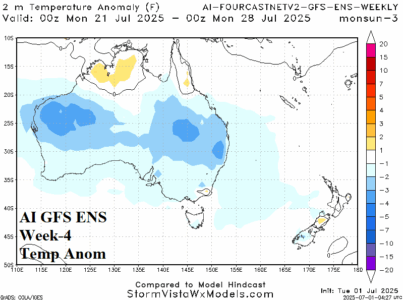
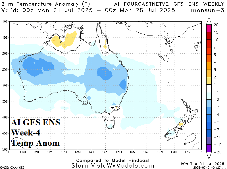
Australia Week 2-4 Outlook: Comparing ECM and AI Temperature Forecasts

An interesting comparison between ECM "weeklies" and the AI GFS ENS 2-4-week temperature anomaly forecast for Australia whereas there is agreement on the upper air pattern (which supports increasing risk of cold in July) and AI GFS ENS offers the cold while ECM "weeklies" doubts the cold risk.