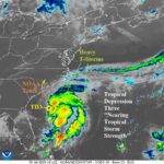
TD 3 Expected to Become a TS; Drift Into South Carolina Tomorrow
07/05/2025, 7:01 am EDT
ENSO Remains Boring…Steady Neutral Phase
07/07/2025, 3:55 pm EDT
Climate Impact Company North Atlantic Basin 10-Day Monitor
Issued: Sunday July 6, 2025, 7:00AM EDT
Highlight: Chantal moves inland to the south of Myrtle Beach. Brings flooding rain to central North Carolina later today.
| Tropical Storms | T.S. Days | Hurricanes | Hurricane Days | Major Hurricanes | Major Hurricane Days | |
| 2025 | 3 | 2.25 | 0 | 0 | 0 | 0 |
| Normal | 1.6 | 3.6 | 0.2 | 0.3 | 0.0 | 0.0 |
Table 1: Tropical cyclone season so far across the North Atlantic basin.
| Tropical Storms | Hurricanes | Intense Hurricanes | ACE Index | |
| NOAA | 13-19 | 6-10 | 3-5 | 115-215 |
| CSU | 17 | 9 | 4 | 155 |
| TSR/U.K. | 16 | 8 | 4 | 146 |
| CIC | 16 | 7 | 3 | 137 |
| 30-Year NML | 14.4 | 7.2 | 3.2 | 122 |
| 2016-24 | 18.8 | 8.6 | 3.9 | 151 |
Table 2: Current North Atlantic Basin 2025 seasonal activity forecasts.
Discussion: Including Chantal, three tropical storms have formed in 2025 so far which is nearly twice normal for this date (Table 1). However, the number of tropical storm days (2.25) is about 60% of normal (3.6) for July 6. So far, tropical cyclone activity has occurred in the subtropics. As a reminder, the operational seasonal North Atlantic basin activity forecasts are each above the 30-year normal (Table 2). However, the 2025 forecast is generally near or slightly below the 2016-24 active period climatology. The upper ocean heat across the deep tropics remains below the 2013-24 climatology and much cooler than the past 2 years.
At 5AM EDT, Tropical Storm Chantal was located at 33.6N/79.1W which is on the upper coast of South Carolina, a short distance south of Myrtle Beach. Top wind is near 50 mph and surface pressure is 1004 MB. Chantal is moving north-northwest at 8 mph and will weaken drifting inland today. The NOAA 2-day forecast track indicates Chantal turns northward across central North Carolina later today and weakens completely drifting across Chesapeake Bay late tomorrow (Fig. 1). The heavy rain/flood risk shifts to north-central South Carolina and central North Carolina today and across Eastern Virginia to near Philadelphia tomorrow. Strong to severe thunderstorms are expected today across north/northeast South Carolina and the eastern half of North Carolina. The remains of Chantal are absorbed by a cold front on Tuesday affecting the Northeast Corridor likely to produce widespread strong to severe thunderstorms.
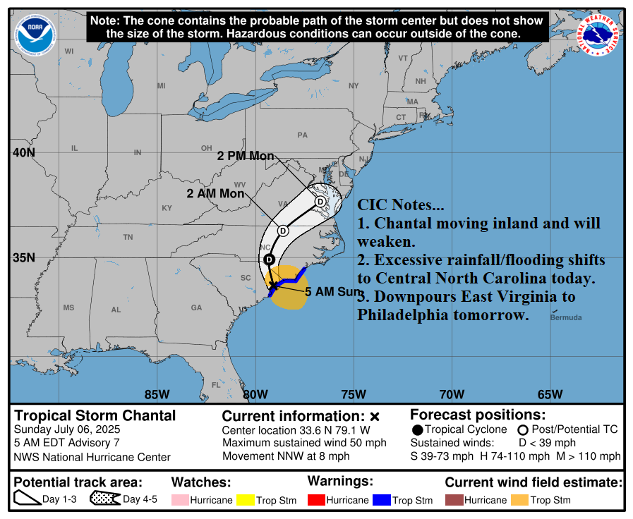
Fig. 1: NOAA/NHC forecast track for Tropical Storm Chantal.