
Tropical Storm Chantal Moves Inland South of Myrtle Beach, SC
07/06/2025, 7:03 am EDT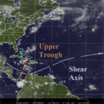
Tropical Upper Tropospheric Trough Forms
07/08/2025, 9:15 am EDT
Climate Impact Company Weekly ENSO Climate Diagnostics
Issued: Monday July 7, 2025
Highlight: Steady neutral ENSO continues.
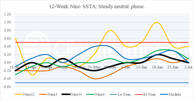
Fig. 1: The 12-week monitor of the Nino SSTA regions.
Discussion: The Nino SSTA regions are all within neutral range entering July (Fig. 1). Recent warming in the Nino12 region off the northwest coast of South America has eased back into the neutral range. In the subsurface equatorial East Pacific, a shallow warm layer has strengthened slightly during the past 1-2 weeks (Fig. 2). The warming is not strong enough to support El Nino development although there is clearly no sign of La Nina trend. The daily southern oscillation index (SOI) shifted to negative phase during the weekend. The SOI trend is away from a persistent La Nina-like weak positive phase during recent weeks (Fig. 3).
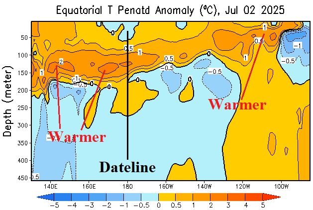
Fig. 2: The equatorial Pacific upper ocean heat anomalies convey a weak warm anomaly in the shallow ocean.
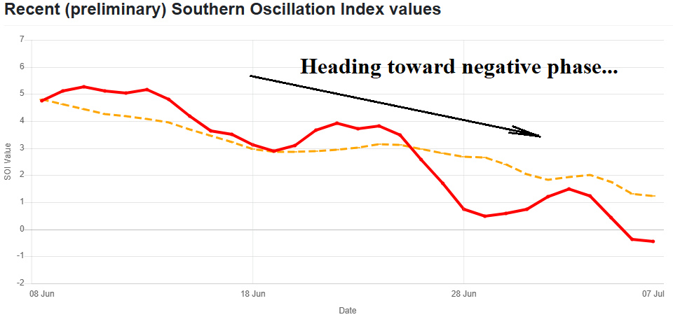
Fig. 3: The past 4 weeks southern oscillation index is trending toward negative phase.