
Heatwave Suppressed Next Week, Redevelops/Expands Middle Third of June
05/26/2026, 8:37 am EDT
MJO Activates; El Nino Climate to Develop. Cooler East U.S. Extended-range Possible
05/31/2026, 1:44 pm EDT
Climate Impact Company Midday Update
Issued: Friday May 29, 2026
Highlight: A “cold blob” storm; Northeast is warmer with 12Z GFS in medium range.
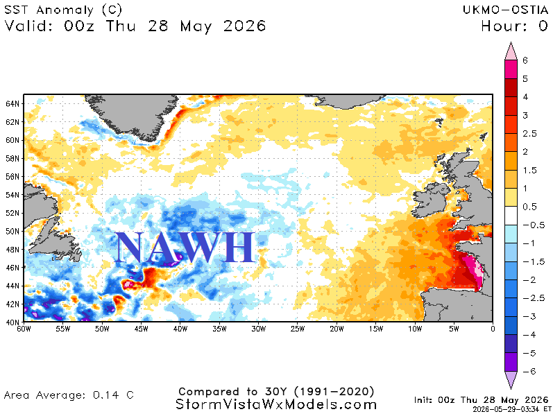
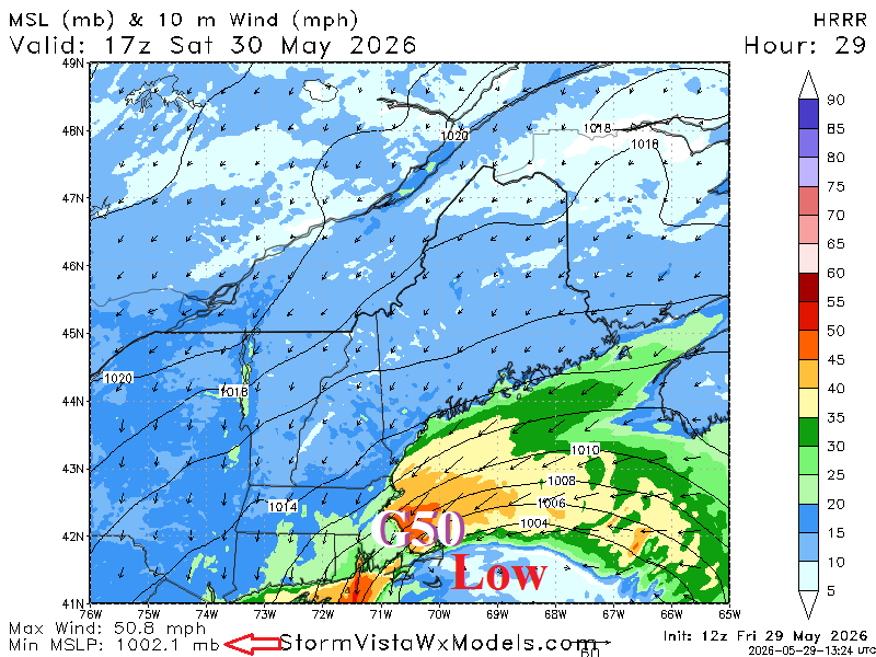
Fig. 1: The North Atlantic warm hole is vividly on display south of New England and a potent storm off the New England Coast tomorrow afternoon.
Discussion: The North Atlantic warm hole (NAWH) is alive and well south of Greenland (Fig. 1)! Just published research reveals the cool pool has formed due to the slowing the Atlantic Meridional Ocean Conveyor (AMOC) Belt which began in the late 1990’s. The cool pool has forced the Labrador Current to carry a cold countercurrent (to the Gulf Stream) to east of New England this late spring season. The colder waters are correlated to an upper trough which intensifies tomorrow propelling rain, snow, and high wind (Fig. 2).
The 12Z was warmer in New England and (also) the northern Mid-Atlantic region throughout the medium range (Fig. 3-4). The Interior West shifts steadily warmer.
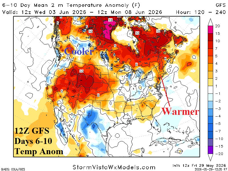
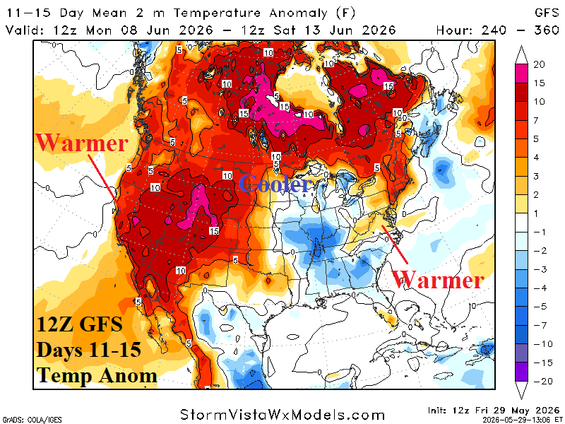
Fig. 3-4: The 12Z GFS U.S. medium range temperature anomaly outlook.
| CDD EIA End | Forecast | 12-Hour Change | 24-Hour Change | 30-Year Normal | 10-Year Normal |
| 6/4 | 38.7 | +0.3 | +1.2 | 42.0 | 45.8 |
| 6/11 | 59.6 | -1.1 | +7.4 | 49.2 | 53.8 |
| 6/18 | 65.2 | +0.4 | 0.0 | 56.7 | 62.6 |
Table 1: The midday 12Z GFS U.S. population weight CDD projections through the middle third of June.