Focus on U.S. Soil Moisture/Rainfall Forecasts and ENSO Update
05/17/2026, 10:07 am EDT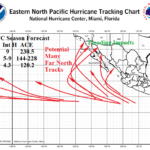
East Pacific 2026 Hurricane Outlook: 13 Hurricanes Forecast in 2026!
05/22/2026, 8:44 am EDT
Climate Impact Company Early AG Market ALERT
Issued: Tuesday May 19, 2026
Highlight: Tropical forcing to increase; Supports significant rainfall/flood risk for Texas/Louisiana/Southeast Great Plains ahead.
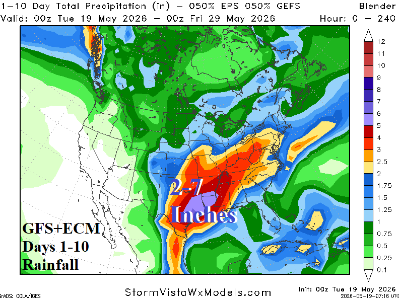
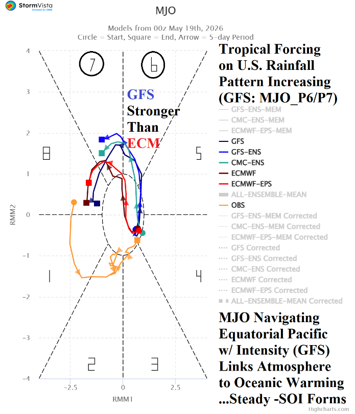
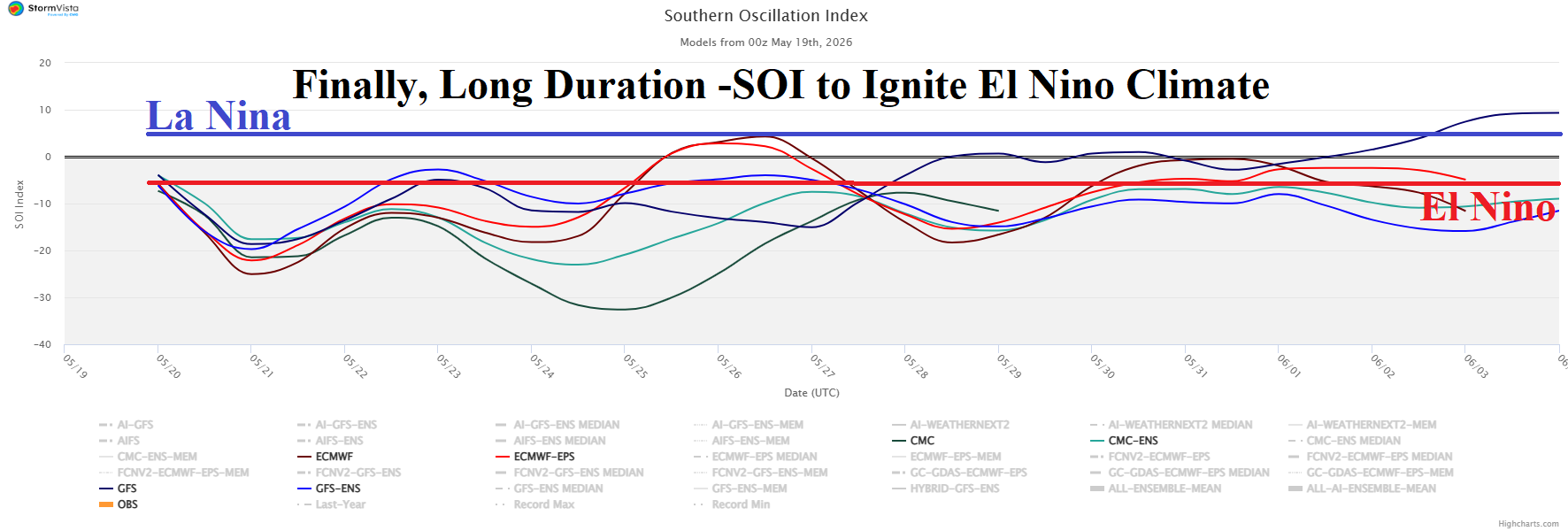
Fig. 1-3: The GFS+ECM 10-day rainfall forecast for the U.S. which has tropical forcing support (from the GFS) Madden Julian oscillation and southern oscillation index outlooks.
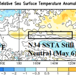
Discussion: Combining GFS and ECM yields a heavy rain weather pattern evolving this week and extending into next week yielding 7+ inches of rain in East Texas to Southwest Arkansas and Northwest Louisiana (Fig. 1). The forecast is made increasingly convincing by a potentially eastward shifting active Madden Julian oscillation (MJO) as forecast by GFS (Fig. 2). ECM is not as strong as GFS with MJO evolution. NOAA/CPC issues a Flood Alert for Texas/Louisiana and the Southeast Great Plains extending to May 29th. The southern oscillation index (SOI) has recently shifted to negative phase on a consistent basis as the 30-day average has increased to -0.94. The 15-day SOI forecast from CWG/SVWM indicates a moderate to strong -SOI during the next 15 days (Fig. 3). The -SOI projection supports the east-shifting equatorial Pacific transiting active MJO forecast by GFS. Additionally, the east-shifting MJO and the attendant lengthy -SOI regime will initiate an El Nino climate in response to the vast eastern equatorial Pacific warming of recent weeks. The relative Nino34 SSTA reached the El Nino threshold last week. NOAA/CPC announcement of El Nino onset should follow by early June with an El Nino climate emerging shortly thereafter. The springtime ENSO prediction barrier closes in less than 2 weeks. Nino34 SSTA forecasts which have been indicating a Super El Nino for the second half of 2026 should increase reliability.
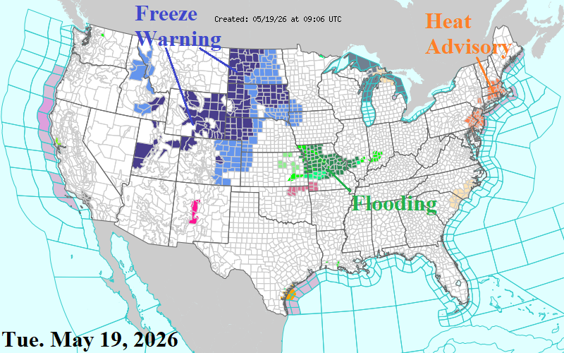
Fig. 4: The latest NOAA/NWS weather watch, warning, and advisory areas.
Another late season snowstorm emerged yesterday across the central and northern Rocky Mountains including the northwest Great Plains. Following cold mornings cause a Freeze Warning across the northwest Great Plains this morning with frost advisories extending to northwest Kansas and Iowa (Fig. 4). A forecast change for mid-to-late week and early weekend is a showery regime centered on the vigorous Nebraska drought area (Fig. 5).
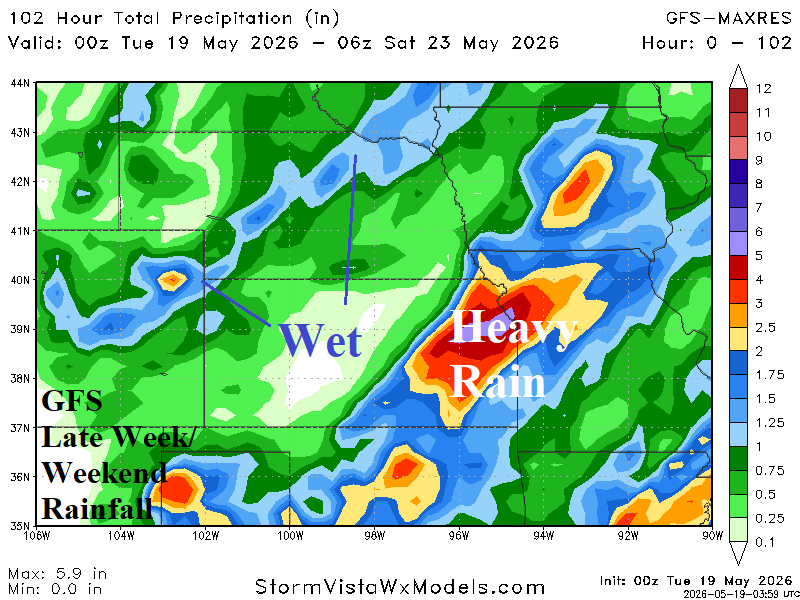
Fig. 5: GFS rainfall forecast through the weekend adds Nebraska and vicinity.