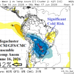
South America Cold Weather Threat Mid-June
06/03/2026, 1:47 pm EDT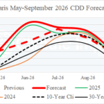
The Heathrow/Paris Vs. Berlin CDD Forecast Divide!
06/07/2026, 9:42 am EDT
Climate Impact Company Early AG Market ALERT
Issued: Thursday June 4, 2026
Highlight: Immense marine heatwave fuels hot/dry later June Europe forecasts, Intense MJO supports excessive wet GFS forecast for the Midwest, and South Brazil freeze potential days 11-15.
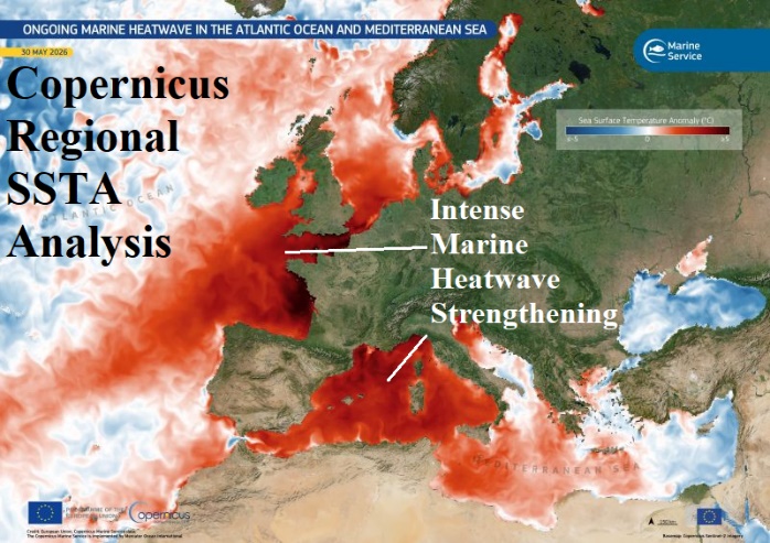
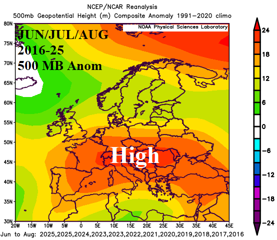
Fig. 1-2: An immense heatwave, the tendency for similar warming 2016-25, and the correlating JUN/JUL/AUG 500 MB anomaly pattern.
Discussion: Currently, an intense marine heatwave (MHW) is present across the western half of the Mediterranean Sea and off the West Europe Coast (Fig. 1). During June, MHW’s similar in aerial coverage and intensity have located in this region, strongest last year and 2023. The JUN/JUL/AUG 2016-25 500 MB anomalies identify that on average a strong subtropical high-pressure ridge stretches across Southern Europe (Fig. 2) increasing the risk of lengthy dry periods and anomalous heat that can aggravate or produce drought and summer 2026 will be no different. The operational forecasts indicate a wet contribution to the Europe weather pattern offered by an upper trough across or east of the immense North Atlantic warm hole (NAWH) SSTA pattern south of Greenland through the next 10 days (Fig. 3). However, the MHW-inspired upper ridge amplifies after day-10 and should allow far Southwest Europe anomalous heat to expand northward in the 11-15-day period (Fig. 4). The ECM “weeklies” project the MHW-induced ridge and attendant heat across Europe in the week 3-4 outlook (Fig. 5-6).
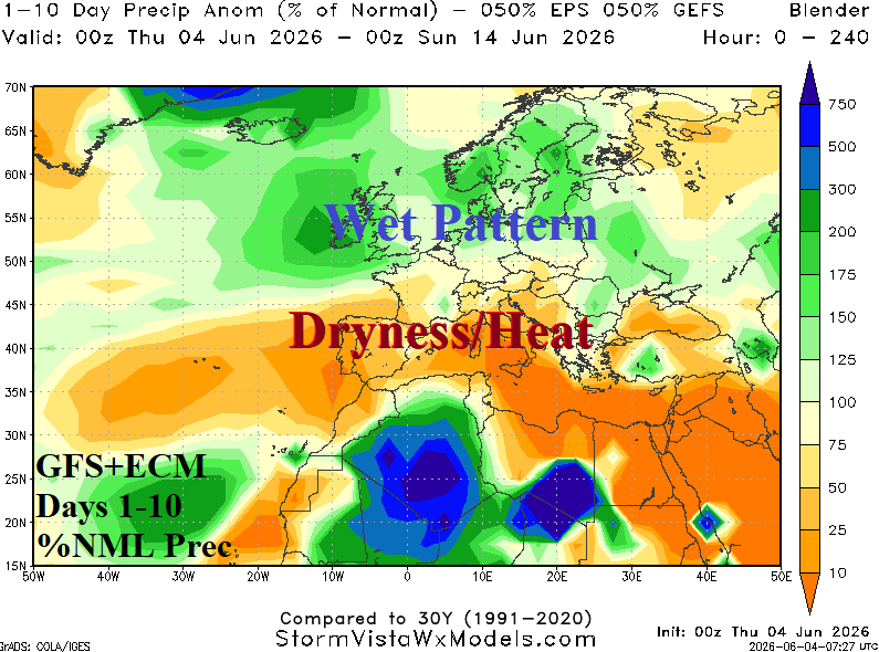
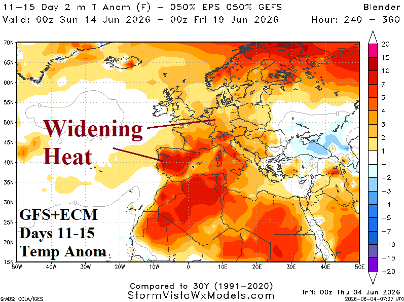
Fig. 3-4: The GFS+ECM 10-day rainfall anomaly forecast for Europe and 11-15-day temperature anomaly outlook.
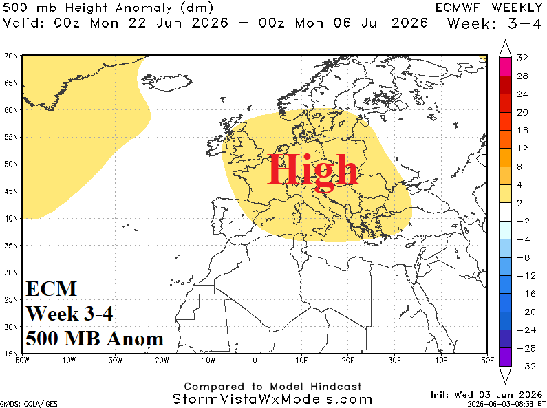
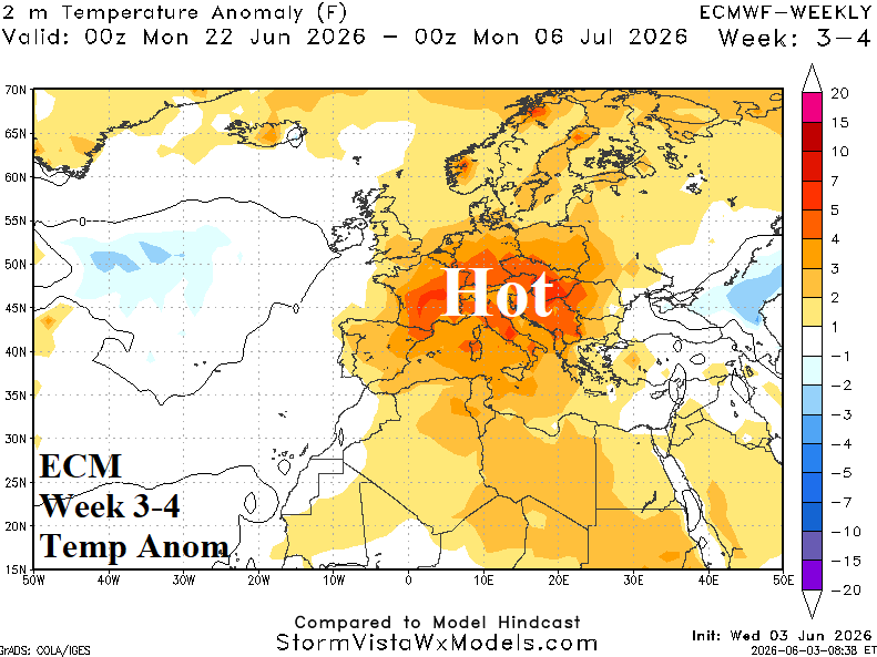
Fig. 5-6: ECM “weeklies” week 3-4 500 MB and temperature anomalies forecast across Europe.
Daily U.S. soil moisture anomalies analysis reveals the ongoing widespread drought affecting much of the U.S. (Fig. 7). However, an intense Madden Julian oscillation episode is shifting eastward across the equatorial Pacific and fuels an increasingly wet pattern for the U.S. into the middle third of June. The GFS is overstated, but makes the point, significant heavy rain is ahead (Fig. 8). The MJO intensity is defined by the presence of super intense negative southern oscillation index which has lowered to nearly -4 today. Clearly, El Nino climate is developing rapidly!
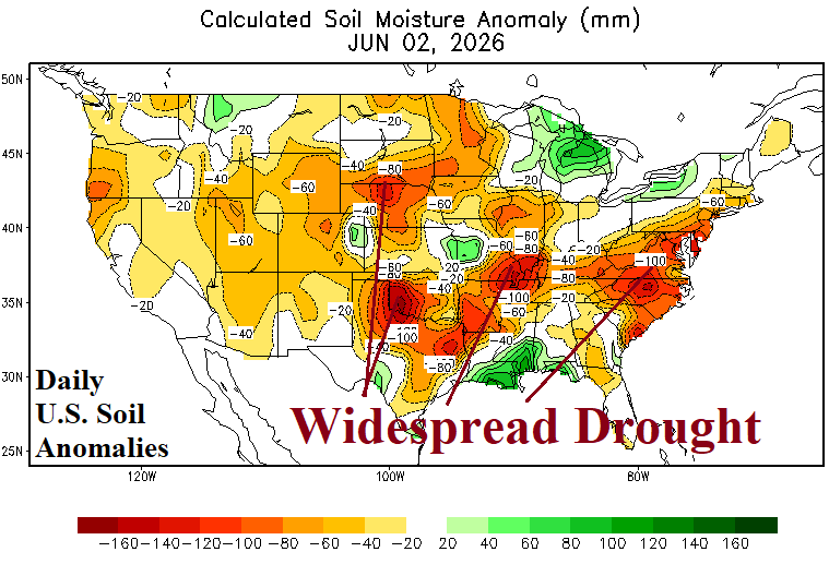
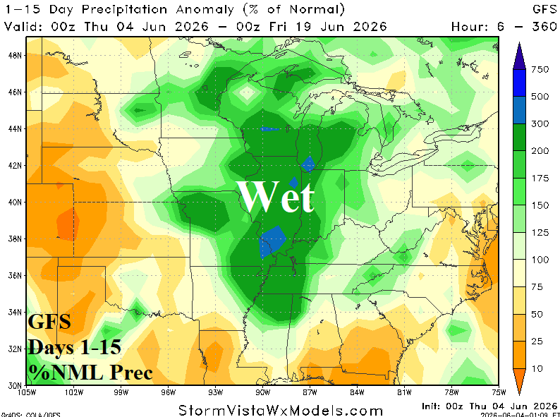
Fig. 7-8: The daily U.S. soil moisture anomalies analysis and the GFS 15-day percent of normal rainfall outlook for the U.S. AG Belt.
The 11-15-day temperature-anomaly forecast across South America remains cold. Yesterday, ECM was most aggressive and today the GFS has the strongest cold forecast (Fig. 9). Indicated is risk of a freeze to the southern coffee growing areas in Brazil.
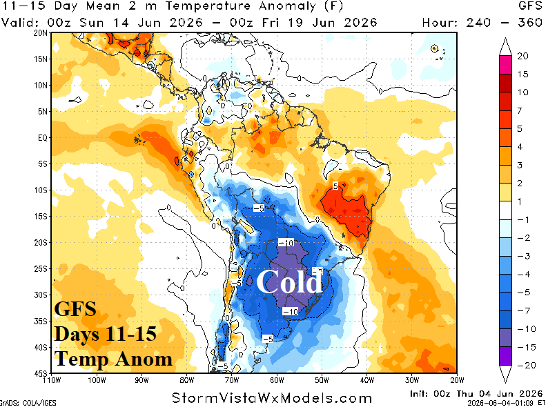
Fig. 9: GFS 11-15-day temperature anomaly forecast across South America.