
Strong -GLAAM Stalls Weather Patterns, Continues in July
06/28/2025, 3:52 pm EDT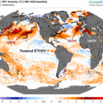
Marine Heatwaves and the June 2025 Northern Hemisphere Climate
07/02/2025, 5:51 am EDT
Climate Impact Company Week 2-4 Outlook
Australia
Issued: Tuesday, July 1, 2025
Highlight: Comparing ECM and AI temperature forecasts; AI indicates potential developing important chill after mid-July.
Charts of the day: The June 2025 Australia climate.
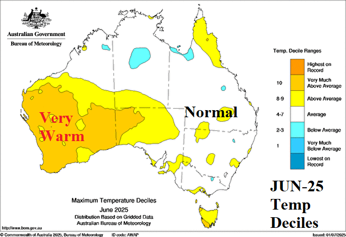

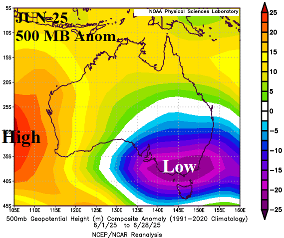
Discussion: Despite the presence of a deep upper trough during June across Southeast Australia, the month of June averaged near normal temperature across eastern continent while an upper-level high pressure ridge located over a marine heatwave west of Australia spawned a warm and dry early winter in the West.
Week-2 Ahead Forecast valid July 6-12, 2025: Prefer cooler AI forecast for each coast.


Discussion: Both the ECM “weeklies” and AI GFS ENS agree that the first full week of July brings a deep upper-level low-pressure trough to south of Australia. North of the trough, a dry/warm subtropical ridge rests on the northern continent. The AI forecast favorably indicates high er risk of cool weather in East (and West) Australia on air masses emitted from the upper trough.
Week-3 Ahead Forecast valid July 13-19, 2025: Cooler AI solution selected.

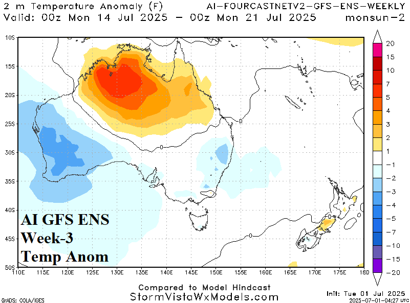
Discussion: Once again, both forecast processes render an impressive upper trough near the Australia South Coast which puts Australia at risk of some colder temperatures. The cooler AI forecast is preferred indicating greatest risk of cool anomalies across Western Australia.
Week-4 Ahead Forecast valid July 20-26, 2025: Monitoring for important cold risk.

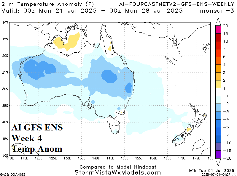
Discussion: Forecast models maintain the trough and if so increasing risk of chilly weather for mid-winter is possible as indicated by the AI GFS ENS.