Deep Tropics Not Likely to Activate Until Around August 1st
06/24/2025, 5:58 am EDT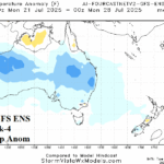
Australia Week 2-4 Outlook: Comparing ECM and AI Temperature Forecasts
07/01/2025, 5:27 am EDT

Climate Impact Company Climate Research
Issued: Saturday June 28, 2025
Strong -GLAAM Stalls Weather Patterns, Continues in July
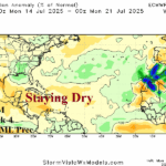
Discussion: Global atmospheric angular momentum (GLAAM) is currently sharply negative. Negative GLAAM patterns are frequently represented by a slower jet stream, tendency for semi-permanent trough and ridge patterns (caused by the slow down), and responsible for persistent and sometimes harsh weather patterns. The 15-day forecast by all operational models indicates -GLAAM eases but does not end (Fig. 1) while the CFS V2 6-week forecast carries -GLAAM through July (Fig. 2). The catalyst to the -GLAAM pattern is an area of persistent convection located either side of the Dateline in the tropical Pacific (Fig. 3). The latent heat release of the convection poleward is causing the jet stream to slow and buckle. The stagnation of the convection pattern suggests limited relationship to the Madden Julian oscillation (MJO) often associated with large equatorial convection patterns. Examples of how the -GLAAM is affecting climate is the vigorous stagnant heat across West and South Europe (Fig. 4) plus intense Southeast Europe dryness and widespread wetter than normal early meteorological climate across much of the U.S. (Fig. 5).
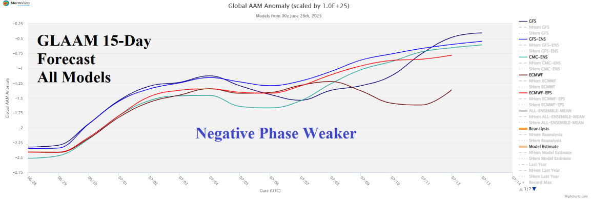
Fig. 1: The 15-day GLAAM forecast utilizing all models.
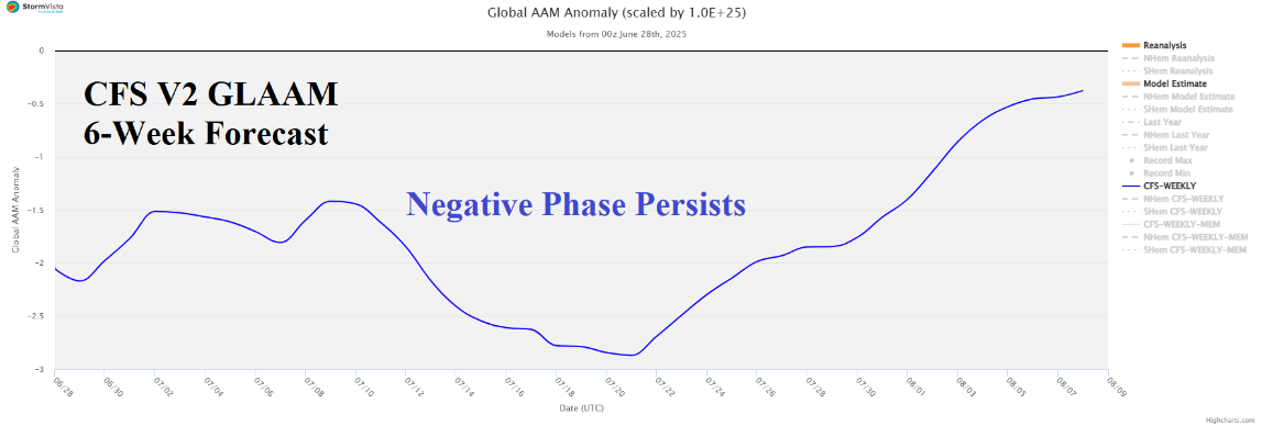
Fig. 2: The NCEP CFS V2 6-week GLAAM forecast.
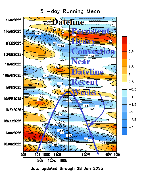
Fig. 3: The outgoing longwave radiation anomalies to identify heavy convection (blue) near the Dateline.
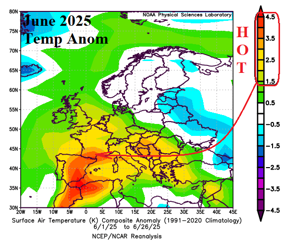
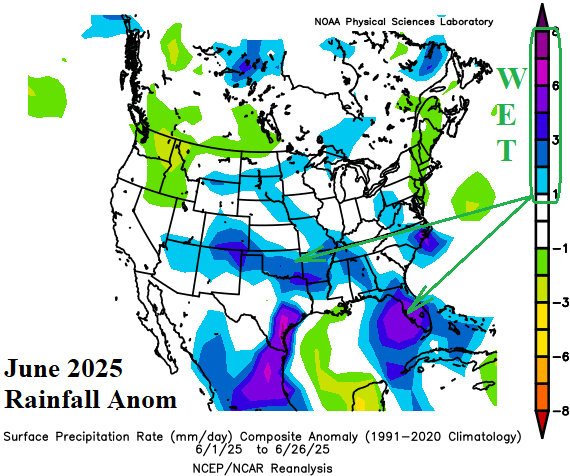
Fig. 4-5: The Europe temperature anomalies and U.S. rainfall anomalies for June 2025 so far.