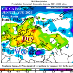
Major Drought for Europe During Summer 2026
04/15/2026, 12:54 pm EDT
Cold Start to Week Midwest/Northeast U.S.; More Chill on the Way Late April/Early May
04/20/2026, 8:38 am EDT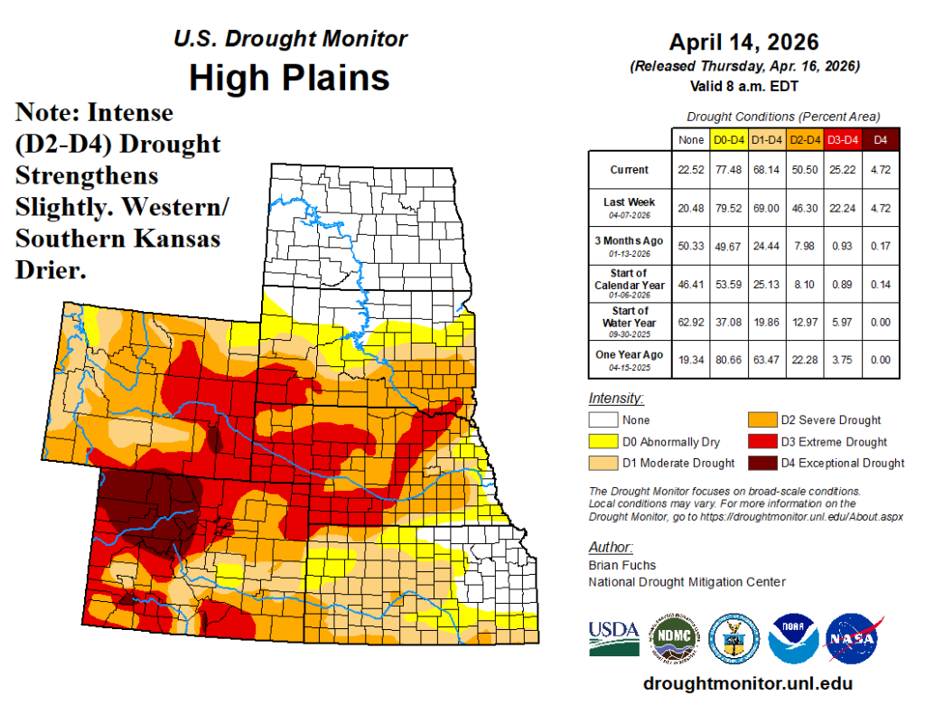

Climate Impact Company AG Hot Spot
Issued: Friday April 17, 2026
Highlight: Central and South Great Plains soil conditions and 3-week rainfall outlook.

Fig. 1: U.S. Drought Monitor for the High Plains for the week ending April 14, 2026.
Discussion: Close eye on Central and South Great Plains drought conditions as mid-meteorological spring arrives. In the High Plains, D0-D4 aerial coverage lowered slightly, but (more) intense drought (D2-D4) increased by 4% (Fig. 1). In Kansas, soil conditions are steadily shifting drier (except in the northeast). The South U.S. drought is impressive with sharpest declining conditions in Arkansas (Fig. 2). Similar with the High Plains, D2-D4 drought increased slightly in mid-April.
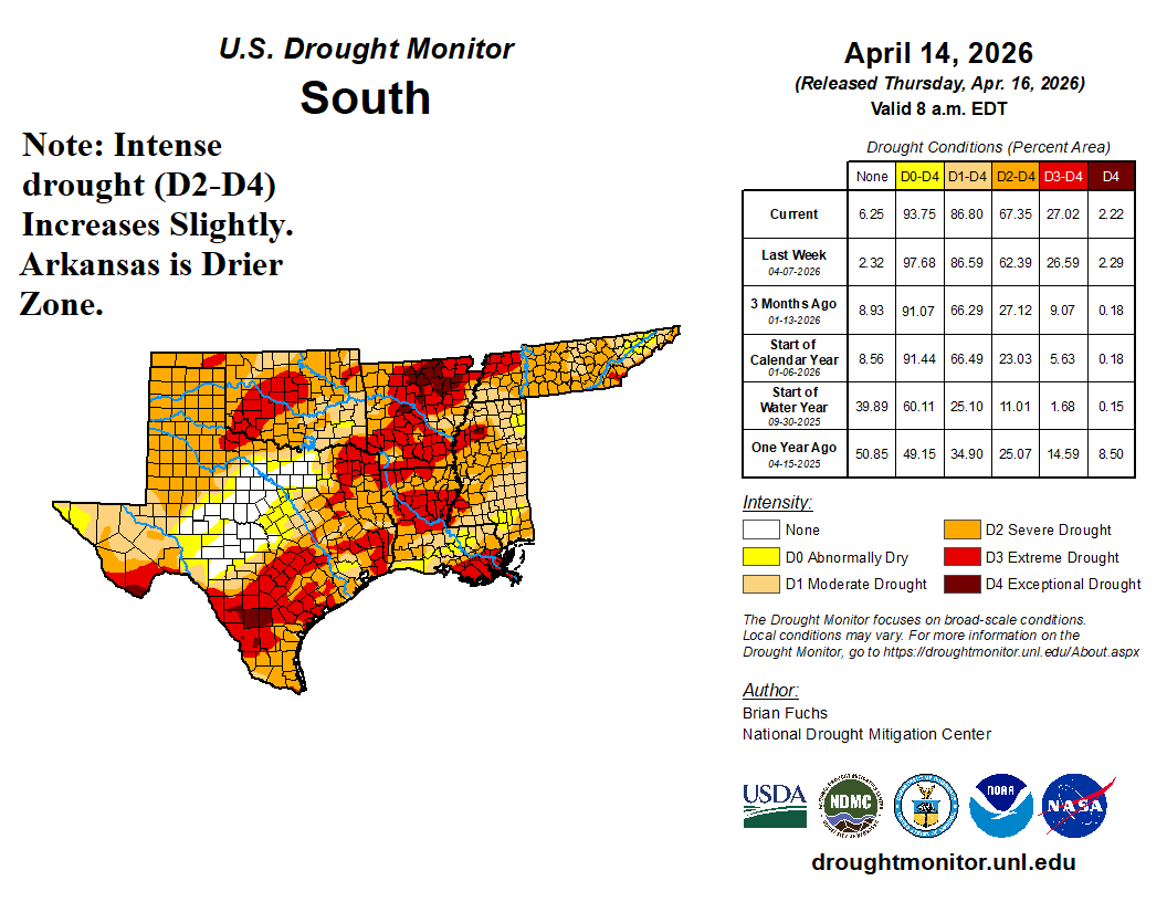
Fig. 2: U.S. Drought Monitor for the South U.S. for the week ending April 14, 2026.
For farmers, traders and analysists, there is importance of awareness of precipitation forecast bias by all dynamic and AI forecast models during this critical time. The GFS has the wettest bias of dynamic models across Canada and the Southeast States during April (Fig. 3). Other operational models, such as ECM, are not quite as wet biased. A leading AI model, the AIFS ENS, has shown a wet bias in the Southeast U.S. although not as wet as GFS in Canada (Fig. 4) during April.
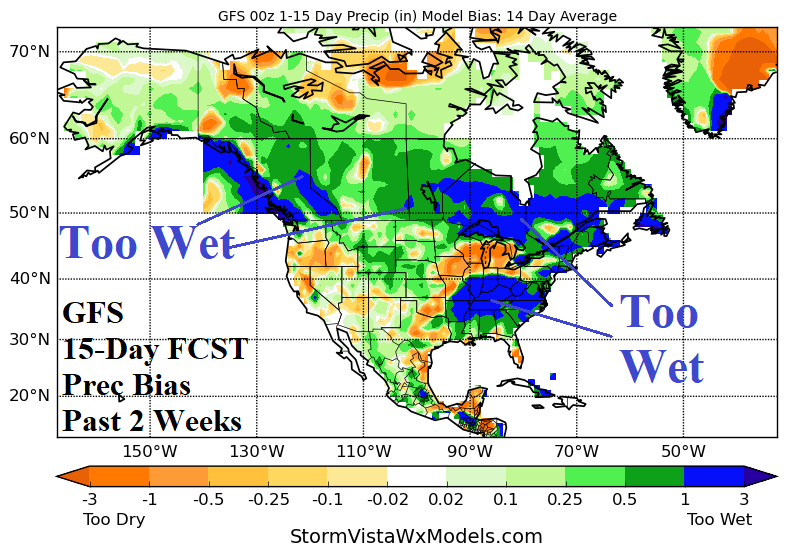
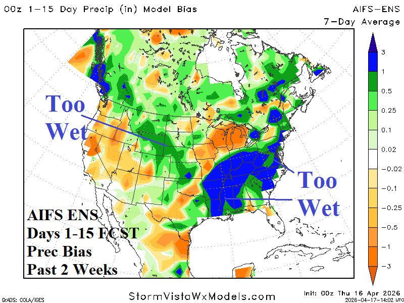
Fig. 3-4: U.S. Drought Monitor for the South U.S. for the week ending April 14, 2026.
The National Blend of Models (NBM) is utilized to project 7-day rainfall across the U.S. AG Belt. The forecast emphasizes dryness for the western Great Plains and under-achieving rainfall amounts in the heaviest rainfall areas centered on the Missouri Valley (Fig. 5). In the 8-14-day period, AI models are preferred. GFS and ECM are back-and-forth on excessive rain threats. But, with rainfall forecast bias showing that forecasts are generally too wet, and lack of tropical forcing from the MJO, the less wet outlooks are preferred. AIFS ENS indicates a heavy rain risk in the Mid-south U.S. with some marginal rainfall possible in the western Great Plains (Fig. 6).
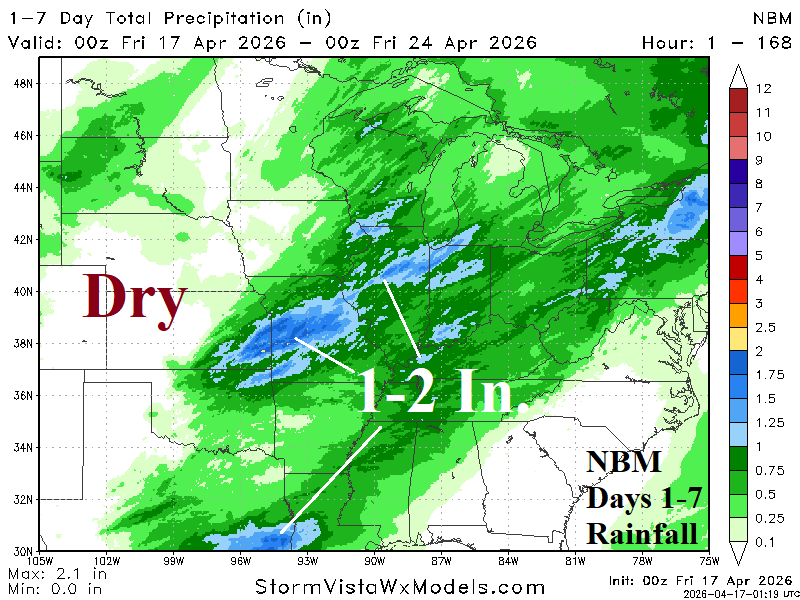
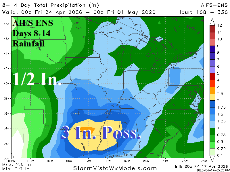
Fig. 5-6: The NBM 1-7-day rainfall amount forecast and the AIFS ENS 8-14-day rainfall amount outlook.
In the extended range (days 16-20), the evolution of a negative phase arctic oscillation/North Atlantic oscillation the last third of April ignites a sprawling upper trough that stretches westward across the U.S. in early May. In the Great Plains, anomalous warmth is suppressed. However, the position of the upper trough limits Gulf moisture from extending north of the immediate Gulf States. Consequently, any rainfall in the Great Plains is likely near or below normal and not beneficial to eroding drought. Texas rain may be more plentiful in early May.