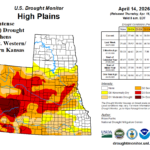
Central/South Great Plains Drought Receive Helpful Rainfall East, Not Much Rain West
04/17/2026, 1:47 pm EDT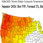
Latest Summer Outlook for U.S. Implicates Northwest with Possible Record Heat/Drought Expansion
04/21/2026, 5:43 am EDT

Climate Impact Company U.S. Medium Range Report
Issued: Monday April 20, 2026
Highlight: Big chill starts the week, warming trend follows. But! Another cool surge late April lasting into May.
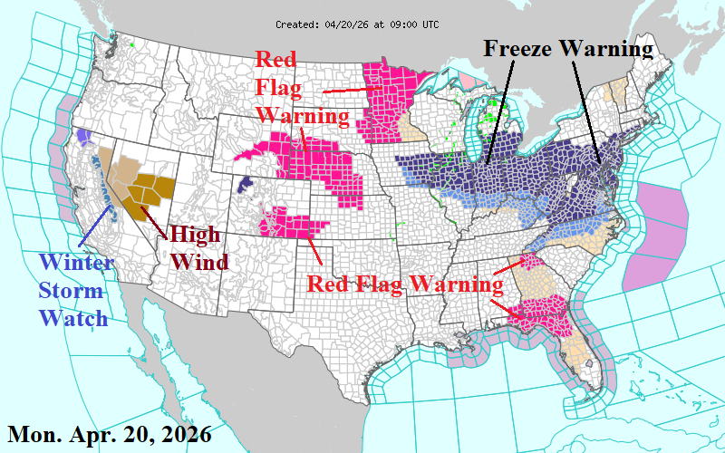
Charts of the day: Latest HDD forecast and NWS weather warnings.
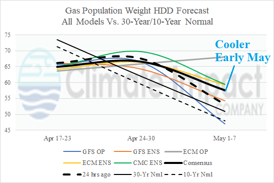
Discussion: The U.S. gas population weight HDD forecast reveals late season heating demand for the U.S. rending higher for early May. This morning, a Freeze Warning extends from the Midwest to the northern Mid-Atlantic States.
Medium-range 6-10 Day Forecast Valid April 25-29, 2026 (ECM ENS and 24-hour change)
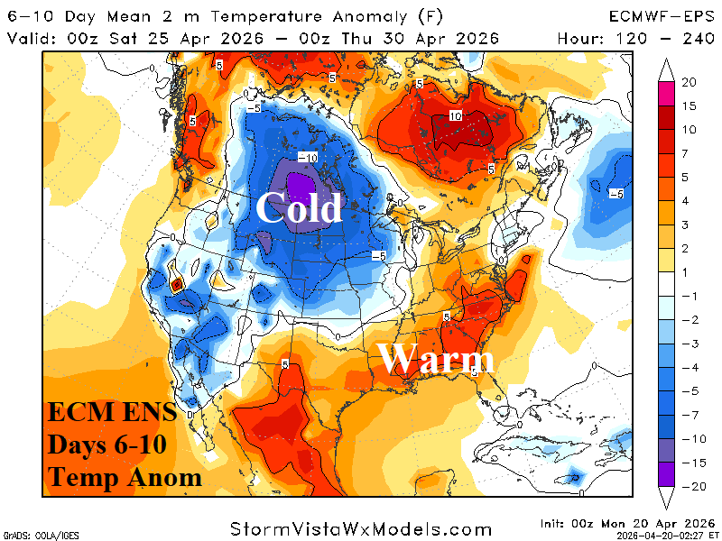
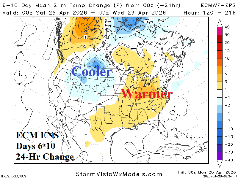
Discussion: ECM ENS is warmer in the East during the 6-10-day forecast although New England misses the warm-up. An incoming cold air mass is made colder by new snow cover.
Medium-range 11-15 Day Forecast Valid April 30-May 4, 2026 (ECM ENS and 24-hour change)
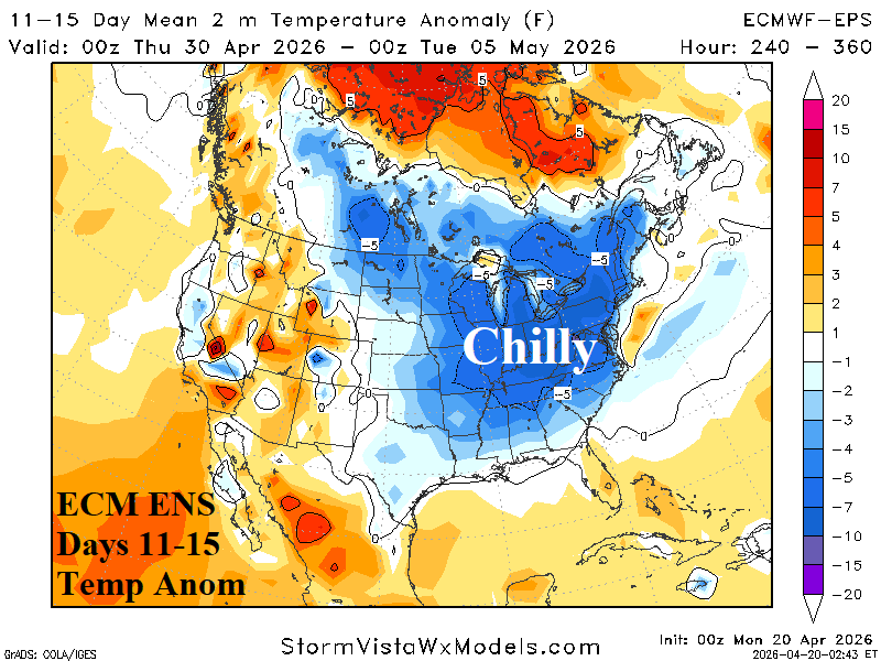
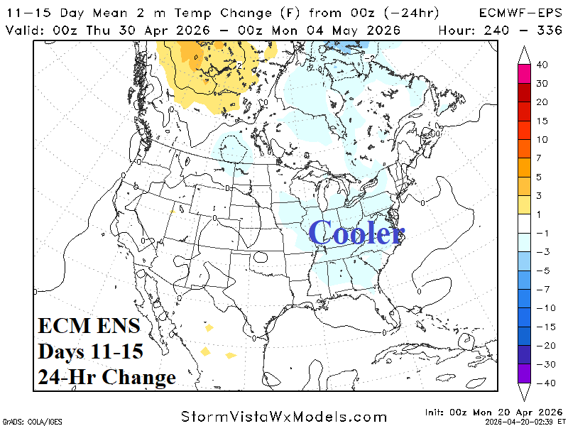
Discussion: Chilly weather sweeps into the East in the 11-15-day period. The <32F threshold forecast indicates risk of a freeze is located across the Northern Plains and Great Lakes region.
U.S. Medium-range Precipitation Forecast
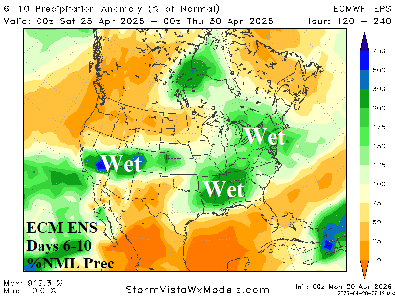
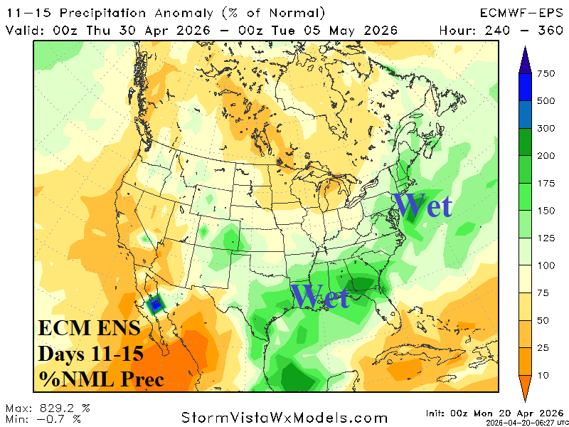
Discussion: Wet weather driven by severe thunderstorms is likely in the Mid-south region in the 6-10-day period. At that time, wet weather with mountain snow stretches from California to Colorado. In the 11-15-day period, wet weather shifts to the Gulf States and Atlantic Seaboard.
Days 16-20 Extended range Temperature Forecast valid May 5-9, 2026
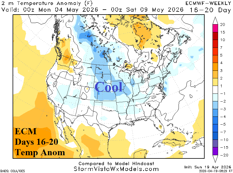
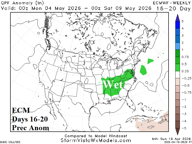
Discussion: ECM is conservatively cool in the extended range. CFS V2 and AI models are much cooler. Wet weather risk is centered on the Tennessee Valley and vicinity.