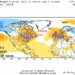
NAWH Pattern Strongest Since 2018, Fuels Mid-summer East N.A./Europe Heat (and Dryness)
06/22/2025, 9:40 am EDT
Strong -GLAAM Stalls Weather Patterns, Continues in July
06/28/2025, 3:52 pm EDT
Climate Impact Company Week 2-to-5 Tropical Outlook
Issued: Tuesday June 24, 2025
Headline: Deep tropics not likely to activate until around August 1st.
Table of the day: Current North Atlantic SSTA vs. 1 year ago.


Discussion: The daily North Atlantic basin SSTA analysis reveals two patterns: Very warm in the Northeast Gulf, Western basin, and off the West Coast of Europe and temperate (near normal) in the subtropics and tropics. Note that most of the North Atlantic, with exception of Gulf of Mexico and western North Atlantic is much cooler than 1 year ago.
Week-2 Valid June 29-July 5, 2025: Deep tropics are dry.

Discussion: The tropics are dry with very limited risk of any important tropical convection in early July (which is not unusual). Subtropical thunderstorms in the northeast Gulf and near the Bahamas are monitored for possible development.
Week 3 Valid July 6-12, 2025: Possible issue northeastern Gulf of Mexico.
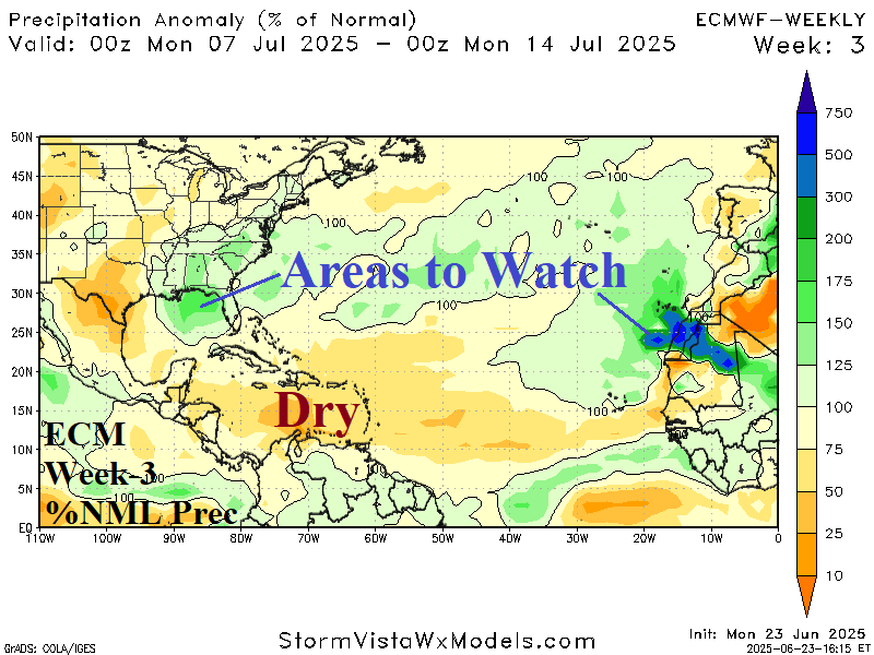
Discussion: Areas to watch are in the subtropics, primarily the northeastern Gulf of Mexico, for any possible development. The deep tropics are extremely dry.
Week 4 Valid July 13-19, 2025: Tropics stay dry; Tropical waves trying to emerge in the eastern tropics.
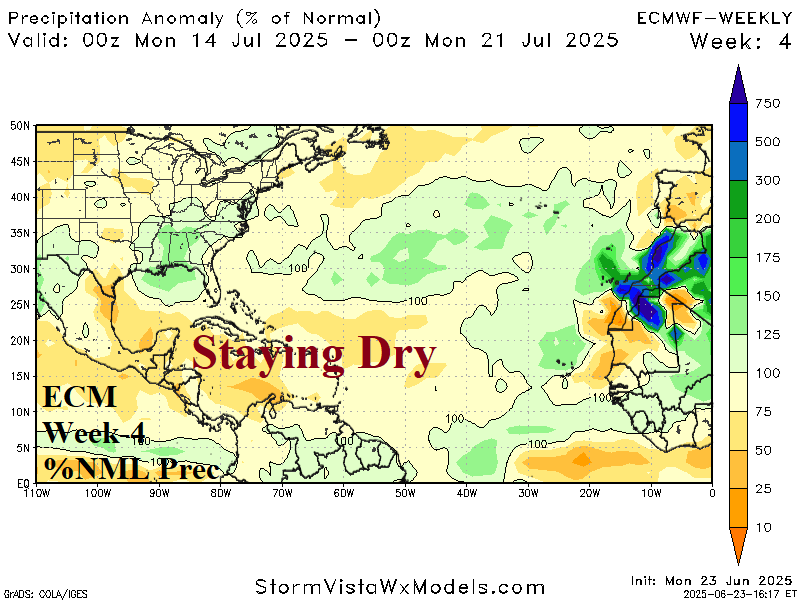
Discussion: The deep tropics dryness continues although tropical waves are trying to organize of the Northwest Africa Coast.
Week 5 Valid July 20-26, 2025: Still quiet into late July.

Discussion: The dryness in the tropics appears to be starting to break down.