
Wet Pattern Ahead in Brazil Abates Early May
04/10/2026, 4:11 pm EDT
Unusual Early Season West Pacific Major Typhoon Sinlaku Indicates Potential for Busiest North Pacific TC Season on Record
04/14/2026, 9:39 am EDT
Climate Impact Company Week 2-4 Outlook
North America
Issued: Monday, April 13, 2026
Highlight: The national pattern cools off and turns wetter.
Charts of the day: MJO is active, a climate influencer!

Discussion: The Madden Julian oscillation shifts from phase_8 (American longitudes) this week to phase_1 (Africa) next week. P8 supports strong warming in the East; P1 favors a cooler shift into the East. P8 favors wet weather in the Central U.S. shifting to the East Coast in P1. The MJO is forecast to lose intensity while in the Indian Ocean in the 16-30-day period.
Week-2 Ahead Forecast valid April 19-26, 2026: Lingering warmth will fade.
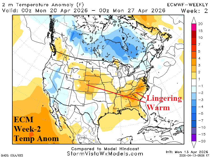
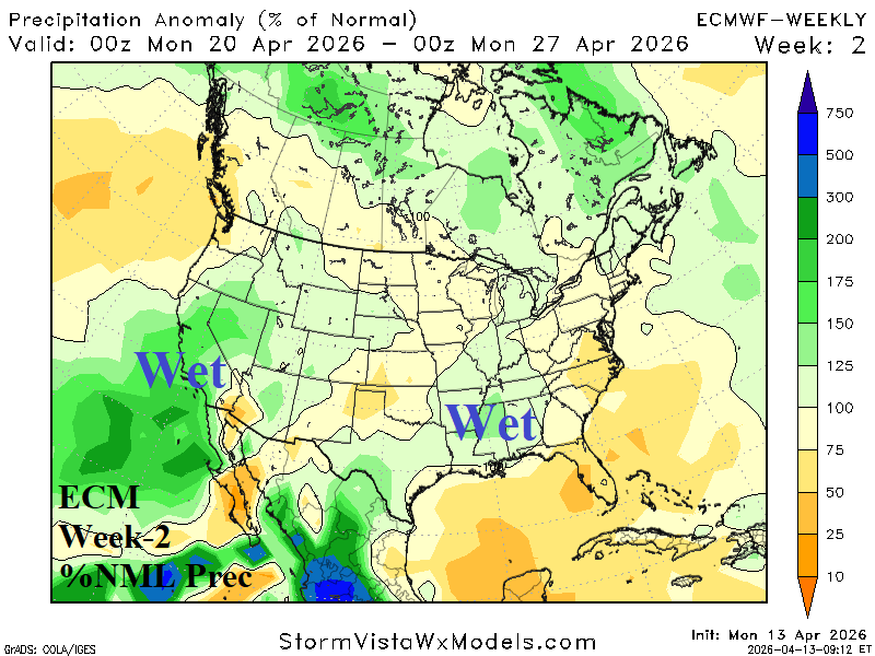
Discussion: ECM confirms a blocking high pressure near Greenland forcing a cooler regime in Canada shifting into the U.S. gradually defeating lingering warmth in the Mid-Atlantic/Southeast U.S. Wet weather shifts to the Mid-south; the southwestern Great Plains are dry. Upper trough delivers wet weather to California.
Week-3 Ahead Forecast valid April 26-May 3, 2026: Cooler/wetter.
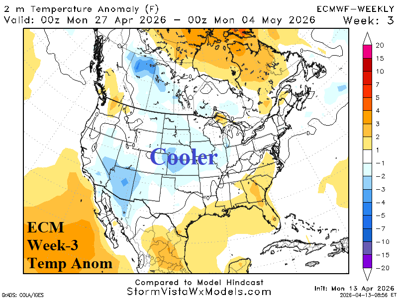
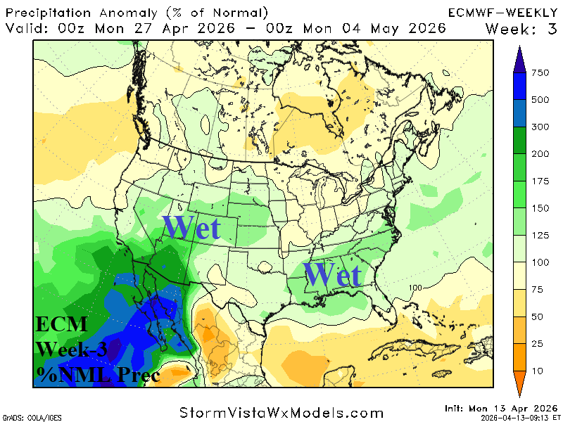
Discussion: Elongated upper trough cools the U.S. while supporting wet weather in the Southwest U.S. to the Great Basin and across the Southeast States. Wet weather reaches the parched western Great Plains.
Week-4 Ahead Forecast valid May 3-10, 2026: Nationally, drier pattern.
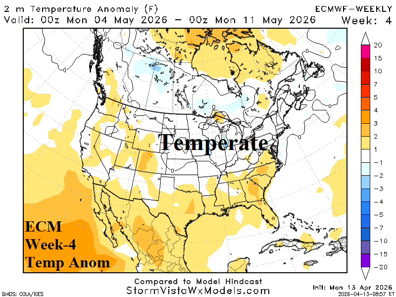
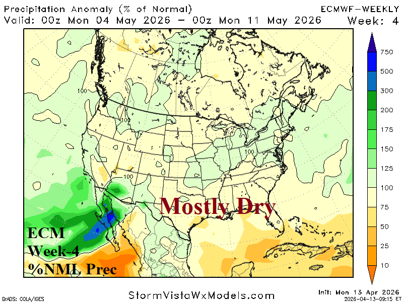
Discussion: Upper trough settles in the East. Anomalous warmth across the South otherwise near normal temperature. The national pattern is drier.