
Another Marine Heatwave Induced Excessive Hot Weather Regime: East China/Japan
07/05/2025, 11:15 am EDT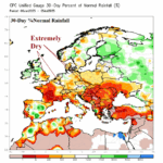
Hot and Dry Climate Expands Europe Drought, but Thunderstorms Are Ahead for Europe
07/07/2025, 9:30 am EDT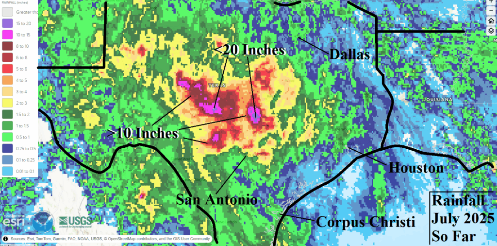
Climate Impact Company U.S. Sunday Report
Issued: Sunday, July 6, 2025
Highlight: Ongoing Texas flooding, Chantal soaks Mid-Atlantic. West and North U.S. anomalous heat in medium range. East Texas heat.
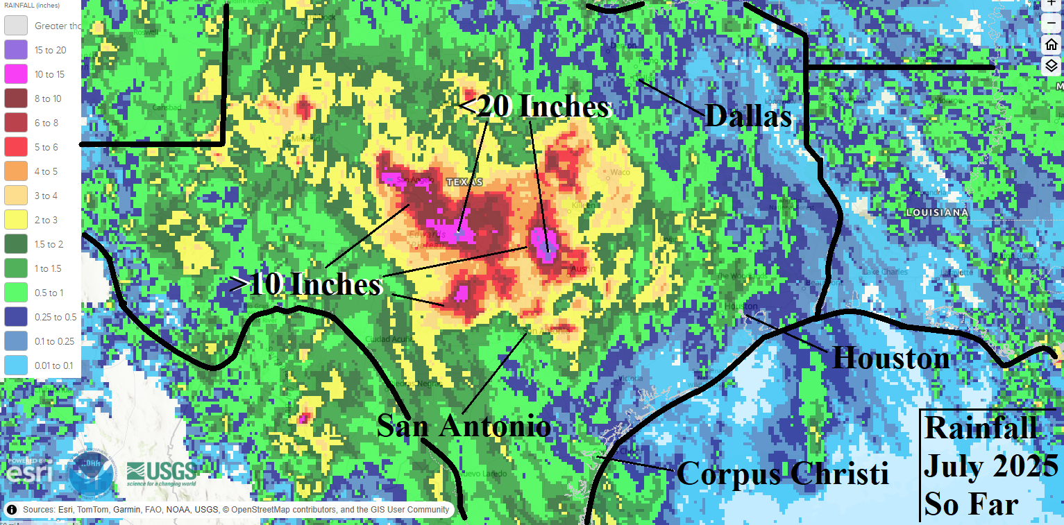
Fig. 1: The Texas rainfall amounts observations for July 2025 so far.
Discussion: A semi-permanent upper-level low-pressure trough located over southeast New Mexico during early July entrained tropical moisture off the East Pacific Ocean and western Gulf of Mexico creating the perfect set-up for persistent heavy rains. The development of the semi-permanent low-pressure area was potentially related to the unusually wet monsoon pattern of early summer. The early July rainfall observations across Central Texas indicate widespread >10-inch regions with high spots exceeding 20 inches (Fig. 1). Catastrophic flooding has occurred; fatalities have reached 51 as of Sunday morning and many are still missing. The excessive rainfall and additional flooding risk continues today (Fig. 2). By midweek, a much-needed stretch of dry weather emerges in Central Texas while heavy rainfall focus will shift to the Mid-Atlantic States during the next 2 days due to the remains of Chantal (Fig. 3), much of the East and particularly the Mid-Atlantic Region due to a stalled front midweek (Fig. 4), and lingering rains East late in the week (Fig. 5). The U.S. medium-range forecast is hot in the West and Central/East Canada to the Ohio Valley while areas to the south observe suppressed heat risk due to a showery and thundery regime (Fig. 6-7). The U.S. population weight CDD forecast indicates ongoing much hotter than normal conditions nationally until a potential cooling to near normal regime develops late in July (Fig. 8).
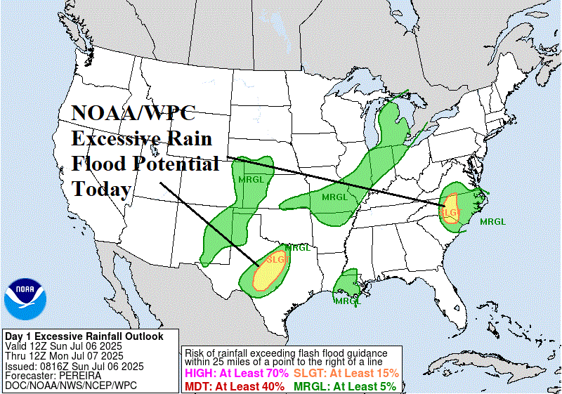

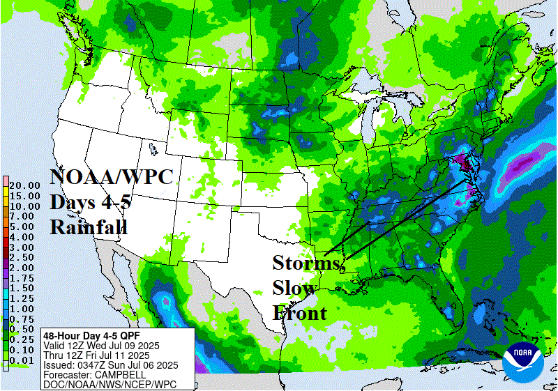

Fig. 2-5: Today’s excessive rainfall/flood risk areas and the NOAA/WPC 1-3-day, 4-5-day, and 6-7-day quantitative precipitation forecast.

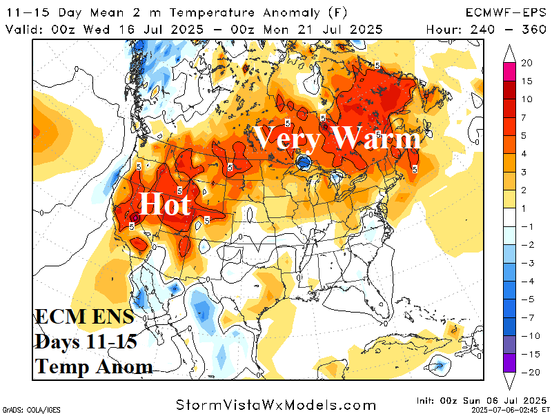
Fig. 6-7: ECM ENS U.S. medium-range temperature anomaly forecast.
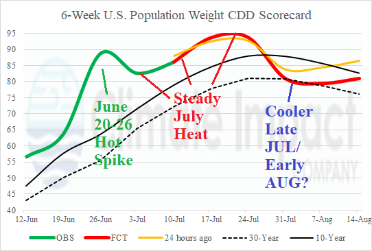
Fig. 8: U.S. 6-week population weight CDD forecast utilizing all models, their consensus, and comparing with 24 hours ago and 10-year/30-year climatology.