
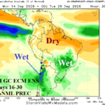
Widening Brazil Rains Ahead
08/30/2026, 12:19 pm EDT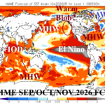
Record-strength El Nino Ahead and Climate Influences of Other Strong Regional SSTA Patterns
09/01/2026, 4:40 am EDT
Climate Impact Company Early U.S. Report
Issued: Monday August 31, 2026
Highlight: Derecho-style severe storms possible Eastern Ohio Valley to Mid-Atlantic TUE/WED. Tropical system brings heavy rain to Houston area.
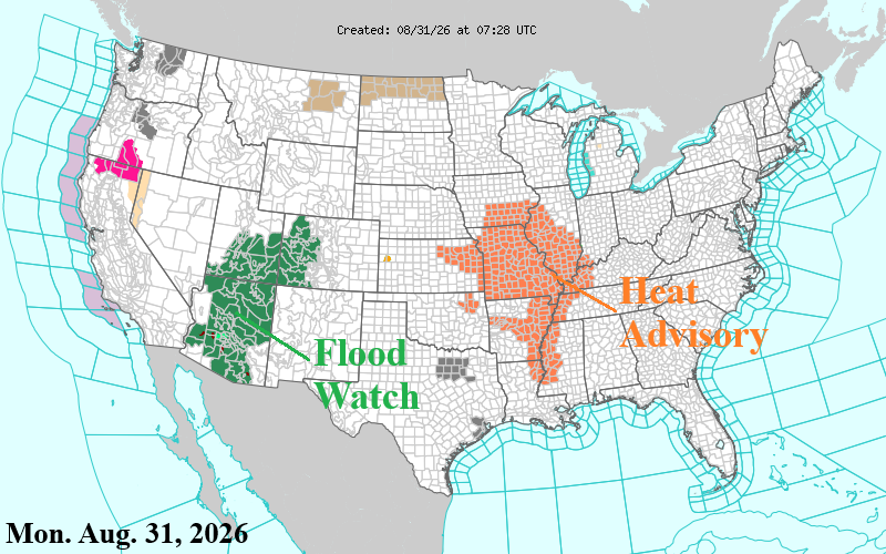
Fig. 1: NOAA/NWS weather watch, warning, and advisory areas.
Discussion: Excessive rainfall causing flooding associated with the Southwest U.S. wet monsoon is indicated for the first half of this week. Flood Watch areas extend from Southern Arizona to Western Colorado (Fig. 1).
The next Mid-South U.S. heatwave is underway with Heat Advisories posted for Missouri/Illinois to Louisiana/Mississippi. St. Louis to Little Rock is near 100F with heat index 105F into midweek. The heat extends to the Mid-Atlantic States beginning today roaring to 96F-99F Tuesday through Thursday for Washington, DC/Richmond, VA with heat index well over 100F.
“Ring of fire” severe thunderstorms, possibly derecho-style fold through the eastern Ohio Valley and Mid-Atlantic States tomorrow and Wednesday (Fig. 2-3). The clash of hot weather with the jet stream not far to the north is the recipe for fast-moving big wind-producing severe storms.
Tropical Disturbance 97L located south of Southeast Louisiana is expected to drift west to west-northwest and inland the Upper Texas Coast near or just north of Galveston Bay Tuesday afternoon. NOAA/NHC indicates 70% chance of a minimal tropical storm. The primary issue will be flooding rain into the Houston area beginning tomorrow and lingering into late week (Fig. 4). Coastal flooding from rising seas is likely along the northern coast of Texas and western coast of Louisiana.
The U.S. population weight CDD projections into mid-September are similar with yesterday’s forecast maintaining above normal cooling demand for the U.S. (Fig. 5).
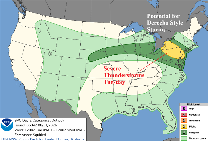
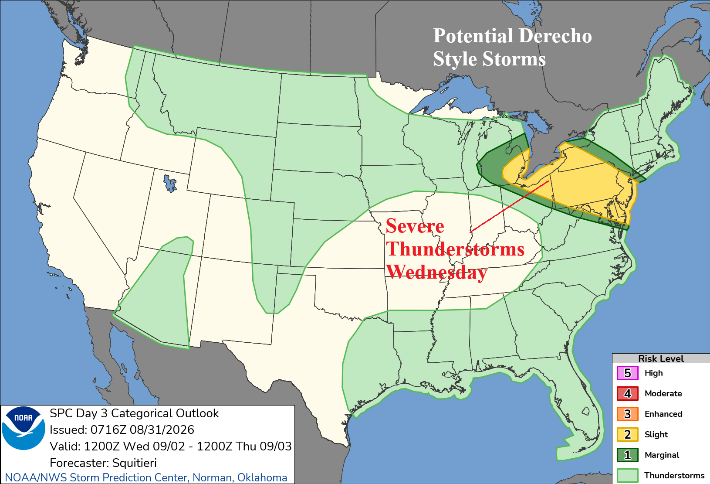
Fig. 2-3: NOAA/SPC severe weather outlook for TUE/WED.
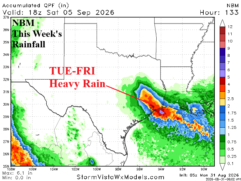
Fig. 4: NBM projects heavy rain in Southeast Texas this week associated with a potential tropical cyclone.
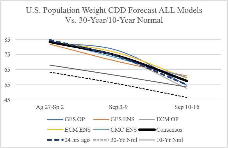
Fig. 5: Utilizing all models, the latest U.S. population weight CDD forecast.